WASHINGTON — The Weather Watch Team is tracking blustery and potentially damaging winds to start the workweek
Key Points:
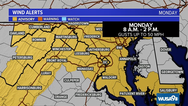
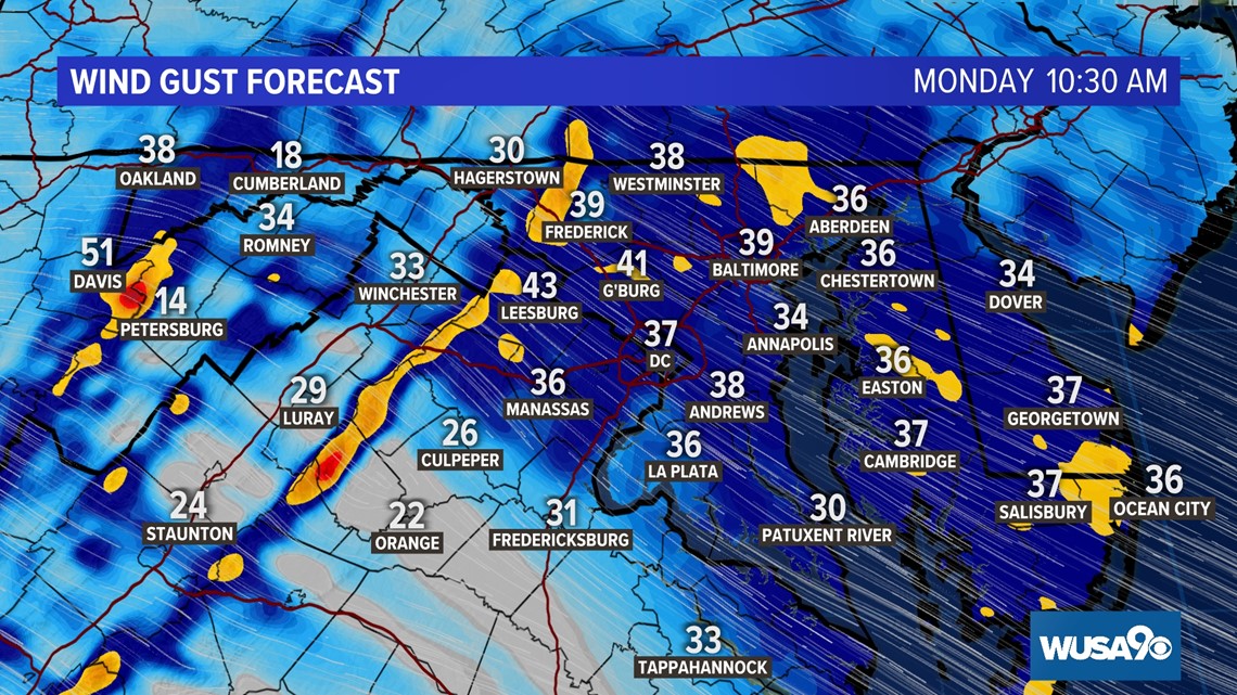
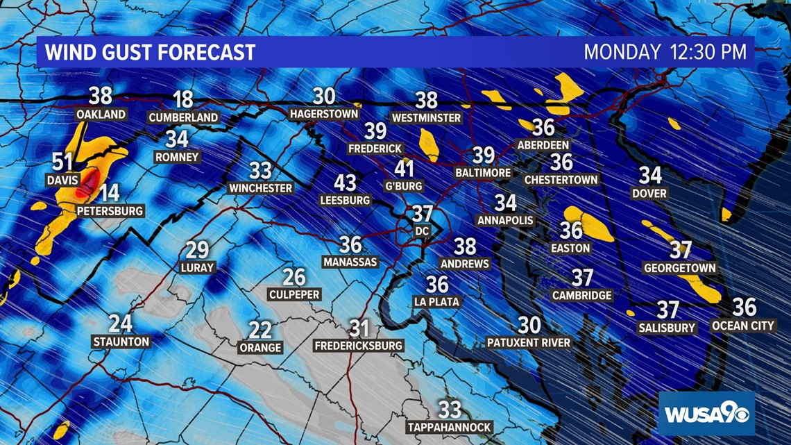
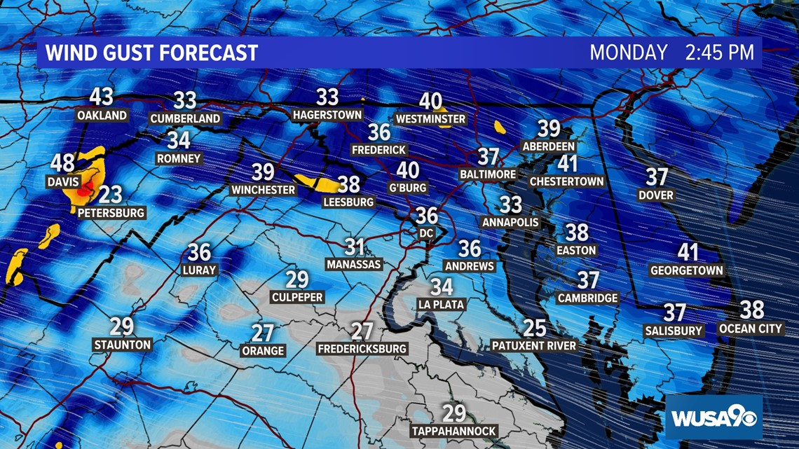
- Windy conditions will build on Monday with the strongest winds through 2 p.m. Monday with gusts of up to 50 mph possible.
- A Wind Advisory has been issued for much of the DMV on Monday until 2 p.m.
- Significant mountain snow will impact areas west of I-81 on the back side of the storm.
Be sure to:
- Secure outdoor decorations.
- Bring trash cans and recycle bins indoors on Monday.
- Bring patio furniture inside.
- Keep an eye on package deliveries late Sunday and Monday that could blow away or get wet from rain if left outside.
Wind:
Winds will become more gusty on Monday as the storm pulls away. The National Weather Service has also issued a WIND ADVISORY for much of the DMV from 8 a.m. to 2 p.m. on Monday. Wind gusts of up to 50 mph are possible. That means it's essential loose objects are secured (e.g., holiday decorations, trash cans and recycle bins, etc.) or they will be at risk of being blown down or blown over. Isolated power outages are also possible so be sure to keep you electronic devices charged.


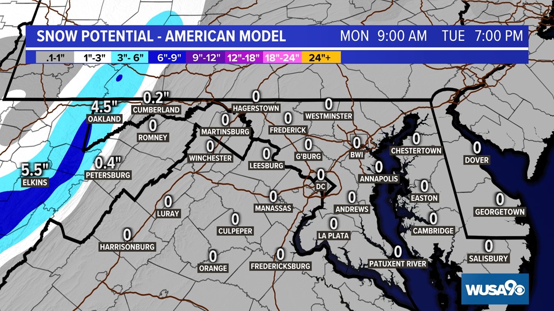
Snow:
While we may see a few flakes in western Maryland and Northern Virginia Monday night into Tuesday morning, the more substantial snow will remain well off to our west. That's great news for our local ski resorts, but if you're traveling in far western Maryland or West Virginia, prepare for slick roads and significant snow accumulations in areas.