WASHINGTON — The Weather Watch Team is tracking the heavy rain from Sunday that has turned into gusty winds Monday morning. Unlike last weekend, the storm won't end as snow Monday morning.
Key Points:
- Heaviest rain has passed (it fell between will fall between 8 p.m. Sunday and 4 a.m. Monday)
- One to three inches of rain was forecasted
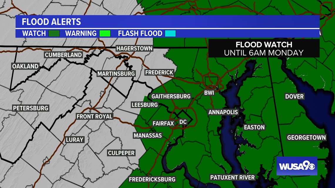
- A Flood Watch was issued for parts of the DMV.
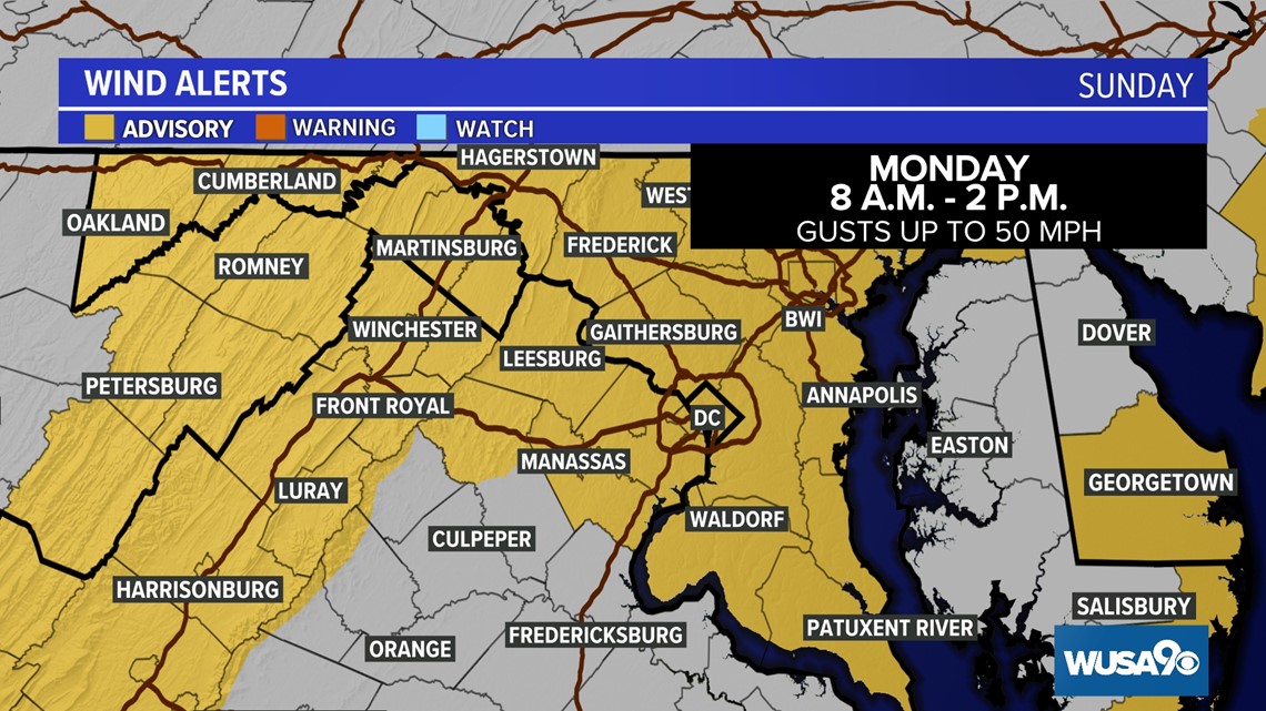
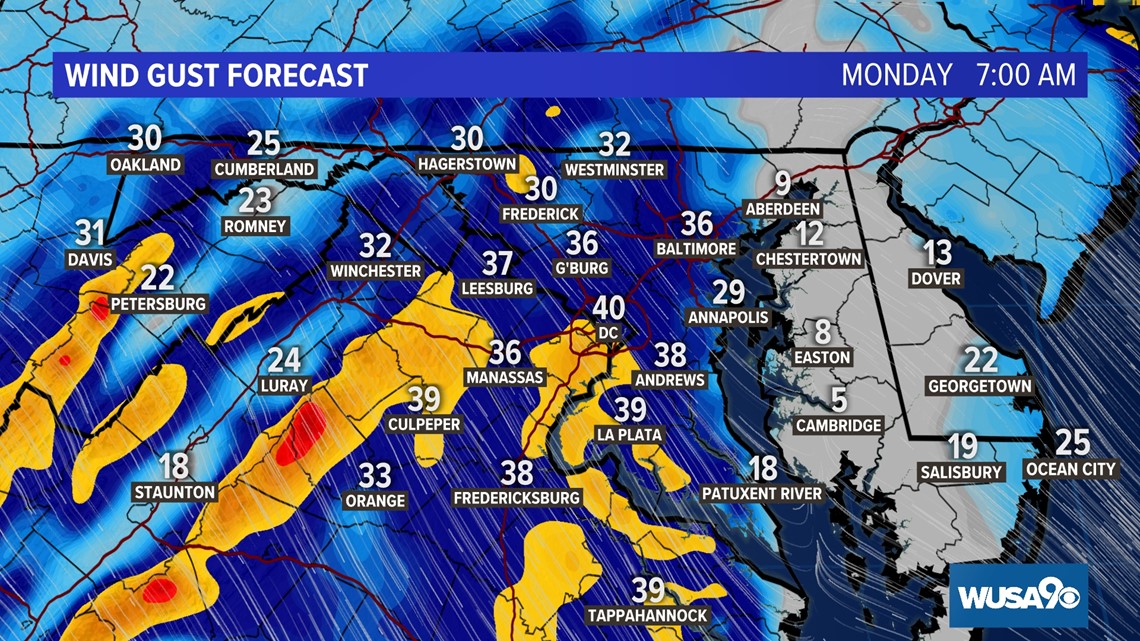
- The strongest winds will blow from 8 a.m. Monday to 2 p.m. Monday with gusts of up to 50 mph possible.
- A Wind Advisory has been issued for much of the DMV until 2 p.m. Monday
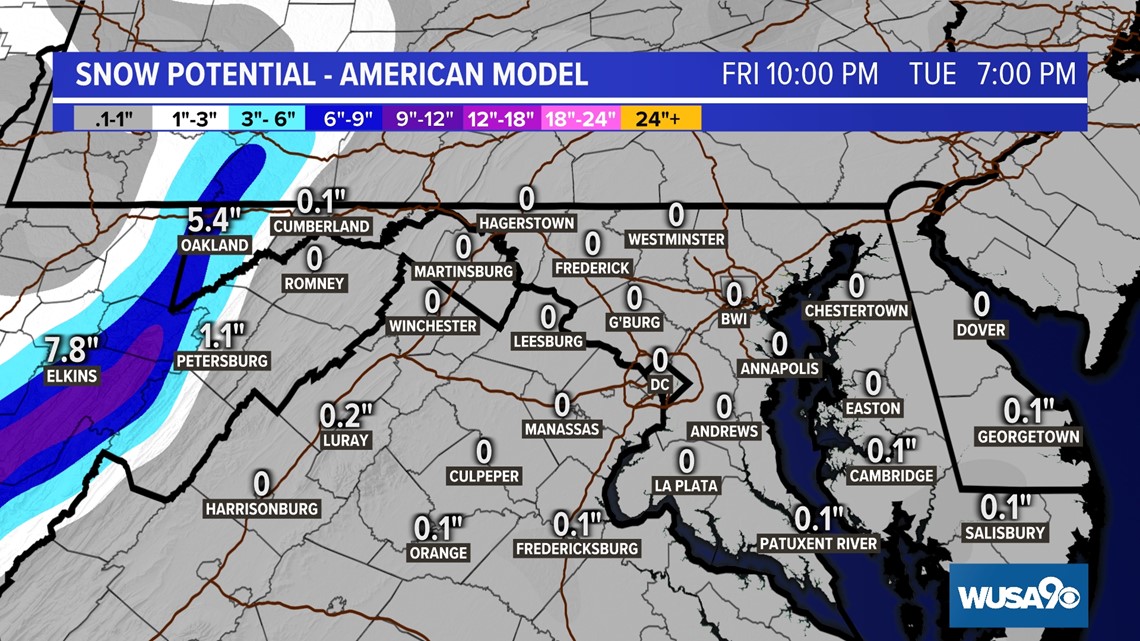
- Significant mountain snow will impact areas west of I-81 on the back side of the storm.
How to prepare:
- Secure outdoor decorations.
- Bring trash cans and recycle bins indoors quickly on Monday.
- Bring patio furniture inside.
- Keep an eye on package deliveries late Sunday and Monday that could blow away or get wet from rain if left outside.
Timeline:
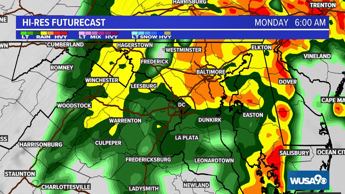
Monday at 6:00 a.m.
The heaviest and steadiest rain should clear out by the time most people hit the road for the Monday morning commute. Roads will still be very wet, with plenty of ponding, so you'll want to leave a few extra minutes for your Monday morning drive. Rain and showers will ease as Monday morning wears on.

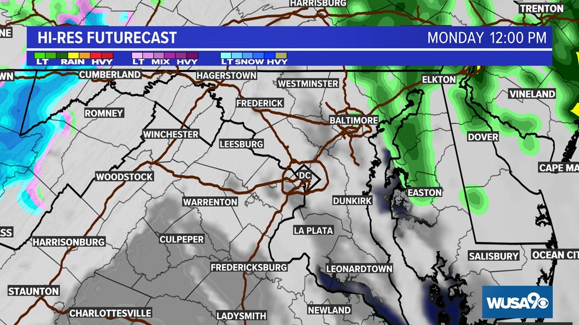
Monday at 12:00 p.m.
By lunch time Monday, showers should have moved to our north and east but we'll still be watching mountain snow west of I-81. A few flurries might cross into Northern Virginia on Monday night into Tuesday.

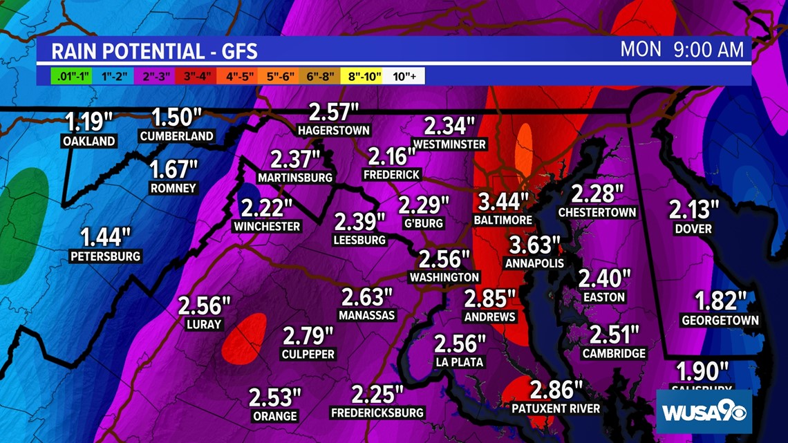
Rain:
The National Weather Service has issued a flood watch for parts of the DMV. It will remain in effect until early Monday morning.

Both the European Model and the American Model are on board with a widespread 2" - 3" of rain.
The European Model has slightly less rain than the American Model (GFS) but still a very beneficial 1.5" - 2.5" of rain.

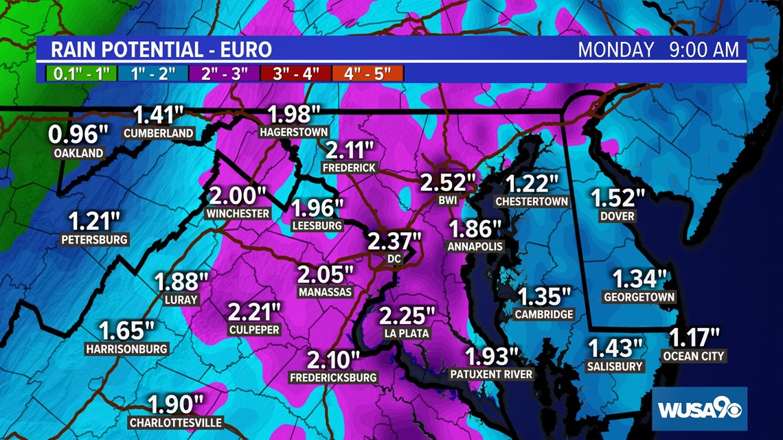
The American Model (GFS) brings the heaviest axis of rain between Baltimore and D.C., resulting in slightly higher rainfall totals.
With the rain falling over a prolonged period of time, flooding is not a big concern at this time. However, some urban street flooding is possible as the heaviest rain moves through late Sunday into Monday.

Wind:
Winds will become more gusty on Monday as the storm pulls away. The National Weather Service has also issued a WIND ADVISORY for much of the DMV from 8 a.m. to 2 p.m. on Monday. Wind gusts of up to 50 mph are possible. That means it's essential loose objects are secured (e.g., holiday decorations, trash cans and recycle bins, etc.) or they will be at risk of being blown down or blown over. Isolated power outages are also possible so be sure to keep you electronic devices charged.


Snow:
While we may see a few flakes in western Maryland and Northern Virginia Monday night into Tuesday morning, the more substantial snow will remain well off to our west. That's great news for our local ski resorts, but if you're traveling in far western Maryland or West Virginia, prepare for slick roads and significant snow accumulations in areas.

WATCH NEXT: