WASHINGTON — The D.C., Maryland and Virginia region were all under a Winter Weather Advisory through 10 a.m. Thursday due to snow, sleet and rain that hit the region starting Wednesday evening.
The wintry mix continued through Thursday morning impacting some areas with up to five inches of snow. Other areas like the District and surrounding Maryland neighborhoods were only graced with a trace of light snow, sleet and rain. The issued Winter Weather Advisory ended early for the D.C. region.
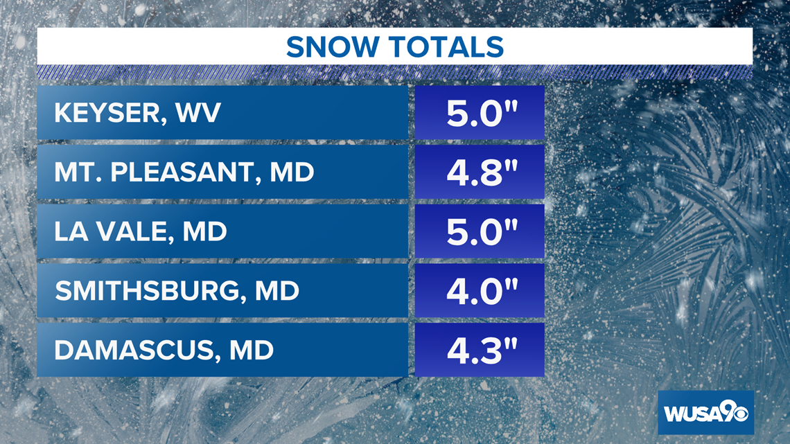
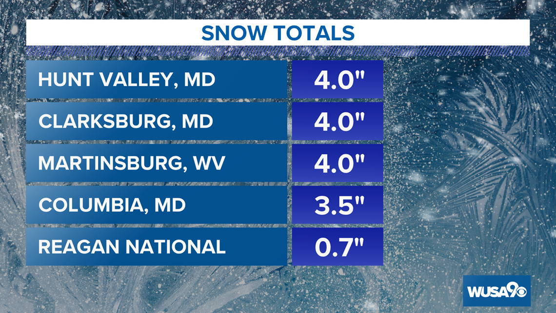
Areas hit the hardest during the Wednesday night into Thursday morning winter weather were areas north of D.C. such as Frederick County, Md., Hagerstown, Md., Clarksburg, Md. and some areas near Baltimore County.
Residents in those areas reported seeing between 3 to 5 inches of snow accumulation.
Snow totals released around 7:30 a.m. Thursday morning showed that Reagan National Airport got less than an inch of now compared to the Mt. Pleasant, Md. area in Frederick County that reported up to 5 inches of snow.
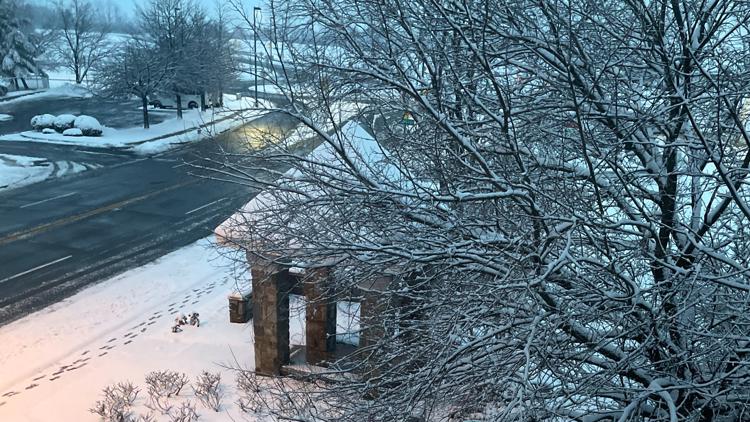
Slick spots were a concern for areas hit hard with snow Thursday morning because of the big flakes hitting the ground.


WUSA9 Reporter Nicole DiAntonio was in Frederick County, Md. Thursday morning and said there was heavy and wet snow around downtown Frederick. She also said a city spokesperson said they had a team of over 100 snowplow drivers out salting and pretreating the roads.
The weather event prompted several school closures including Loudoun County, Prince William County and Frederick County Schools, just to name a few.
We're still expecting another round of weather to hit the region Thursday night that could last into Friday morning.
Here's what we know so far:
- More snow is on the way Thursday night
- There will be a let-up or lull in the precipitation most of the day Thursday
- The second storm is tracking south of the immediate Metro Area Thursday night into Friday morning
- Most of the snow will fall south of DC
Timeline
5 p.m. Thursday - Midnight Friday: The second storm passes well to our south bringing snow between Fredericksburg and Richmond. We will see some flurries and a little light snow in the Metro but with no accumulation.
Midnight - 7 a.m. Friday: Light snow or flurries with moderate south of D.C. Accumulating snow moves into southern Maryland where 1" - 2" of snow could fall.
7 a.m. Friday - Noon: Cloudy and cold in the Metro with some flurries. The snow winds down in Southern Maryland and the Northern Neck early with any additional accumulations very light
Click here for more information on upcoming weather.


