WASHINGTON — We have another threat for wintry weather across the DMV Thursday night that could last into Friday morning. It will come ahead of more winter weather that will impact the region on Saturday.
Here's what we know so far:
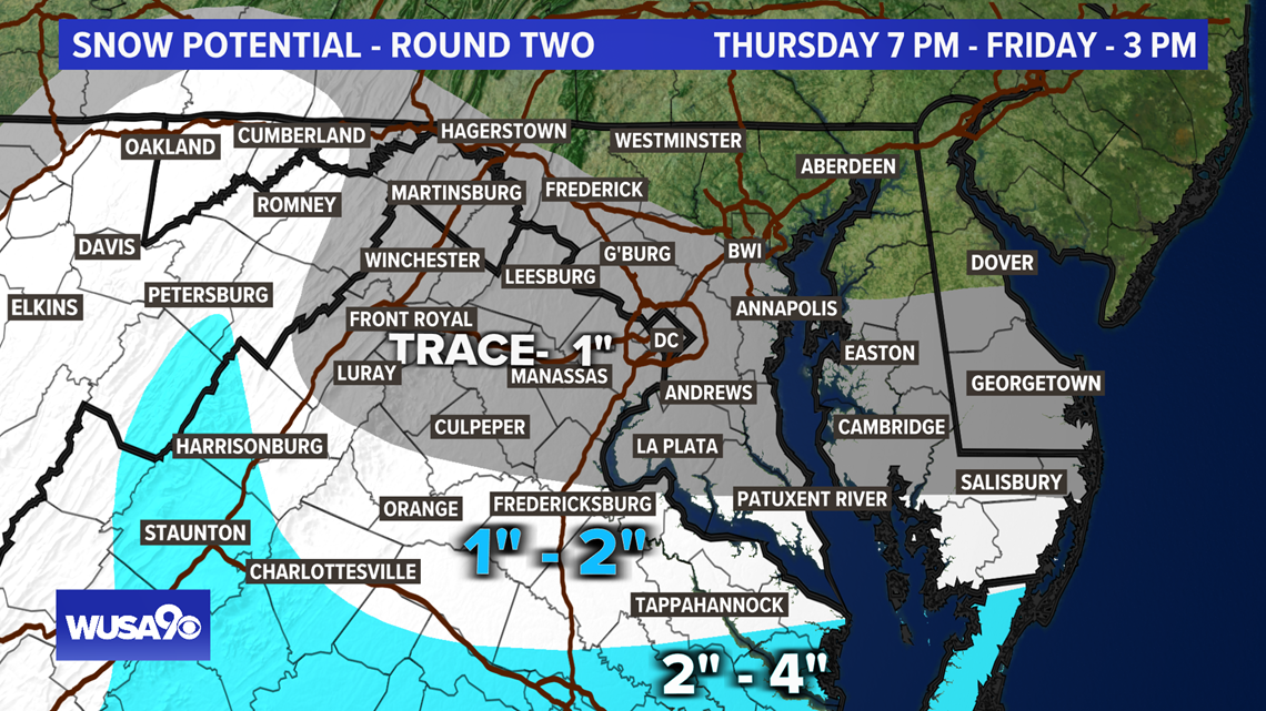
- The second storm is tracking south of the immediate Metro Area Thursday night into Friday morning
- Most of the snow will fall south of DC
Another Winter Weather Advisory goes into effect south of D.C. Thursday night into Friday for another trace to an inch of snow and a wintry mix. These areas include Fredericksburg.
Timeline For Winter Weather
Now - Noon: Cloudy and cold in the Metro with some flurries. The snow winds down in Southern Maryland and the Northern Neck early with any additional accumulations very light.
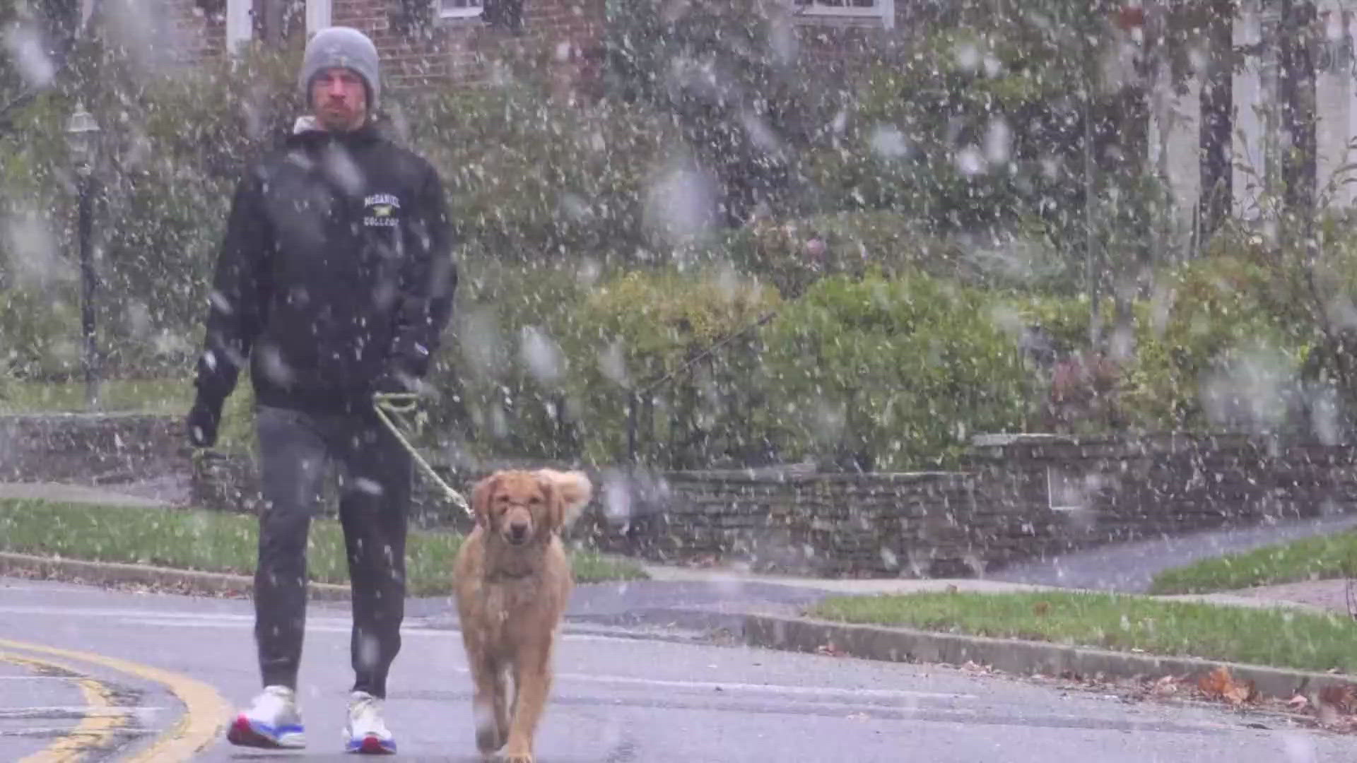
Here's a look at the snow we've seen from Wednesday night through Thursday morning. Some areas north and west of DC got up to 5 inches of snow.


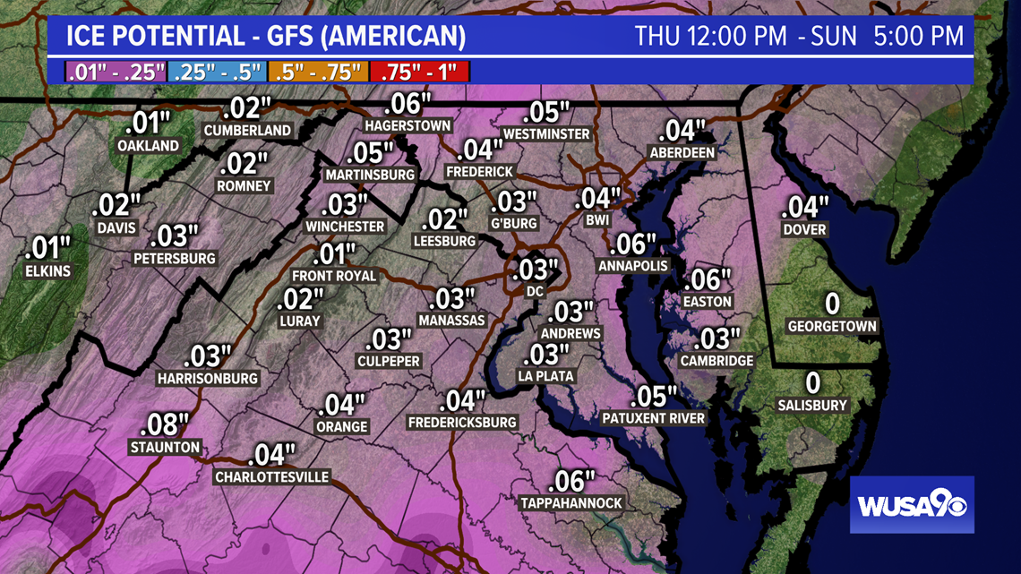
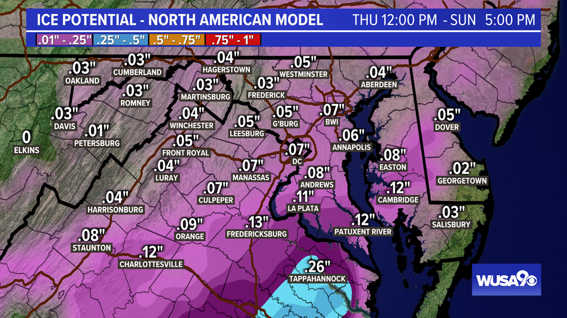
We're bracing for yet another round of winter weather this weekend, but this time, ice will be the main threat.
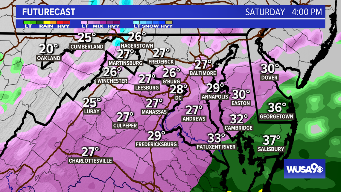
As low pressure moves toward the area Saturday, we'll see a wintry mix with mostly sleet and freezing rain.
Freezing rain could lead to ice forming on power lines, trees, cars, street signs and other objects. There will be slick spots on driveways, sidewalks and untreated roads. Depending on how much ice we get, there could also be power outages.
Higher up in the atmosphere temperatures will be relatively warmer, so most of the precipitation will fall as sleet or freezing rain.
Freezing rain falls as regular rain but freezes on surfaces that are at and below freezing.
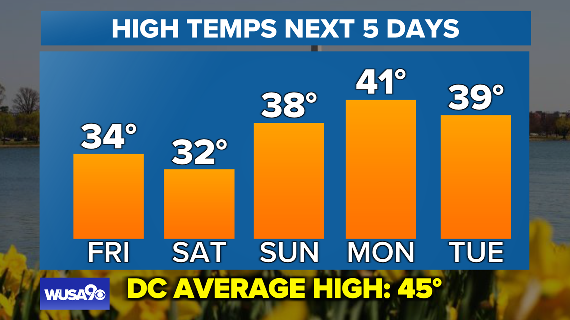
Valentine's Day is this weekend and the winter weather will move out by then, with a wintry mix early Sunday morning and clear by late morning. Highs Sunday will top out near 40.
The winter weather will start Saturday afternoon, so Saturday morning is clear for breakfast, brunch and running errands.

