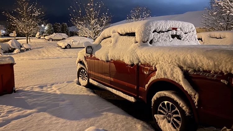
WASHINGTON — The second snow of the week was over before most of the DMV had even woken up to start the day, but early snowfall totals are showing a solid accumulation. Maryland counties are reporting the highest totals so far, with some neighborhoods seeing more than 6 inches of fresh powder.
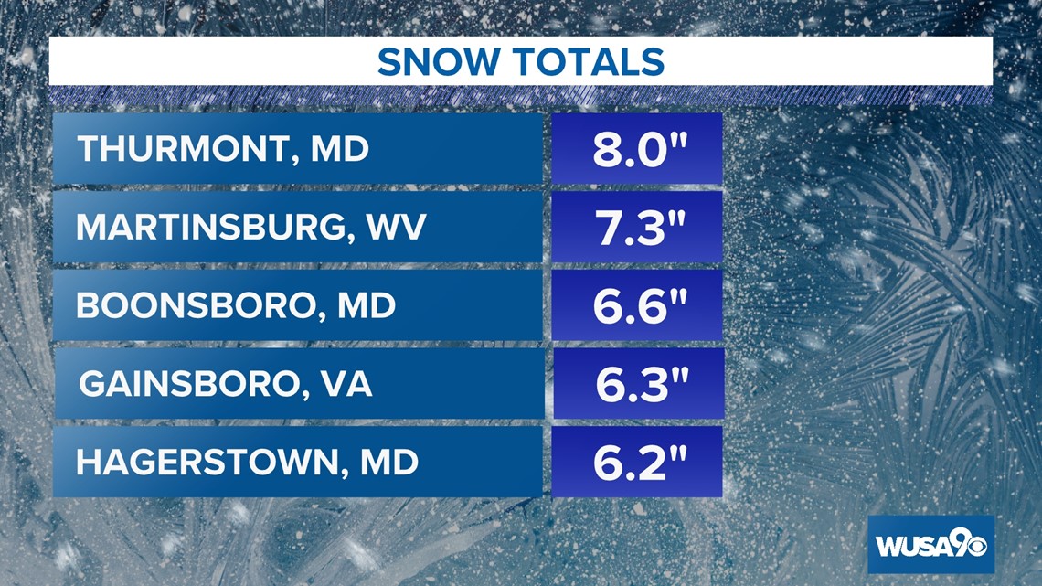
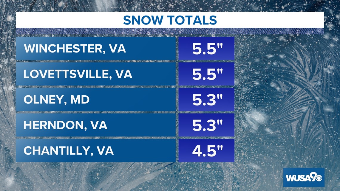
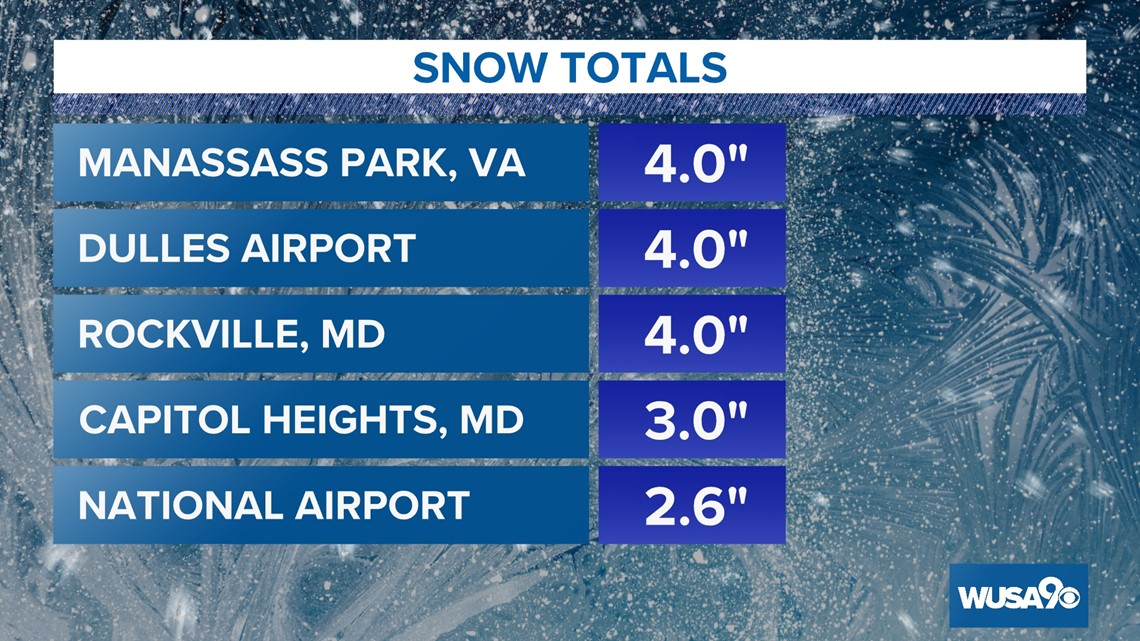
As of 10 a.m. Thurmont reported the biggest total, with 8 inches. Hagerstown residents reported approximately 6.2 inches, Olney had 5.3 inches and Rockville had about 4 inches.
In Virginia, Herndon saw 5.3 inches and Manassas Park recorded 4 inches. Reagan National Airport, with 2.6 inches, tweeted that their team worked all night to clear the main runways, but advised checking on flight status before heading to the airport, as many flights were still canceled Friday morning.
While the snow had moved out by 6 a.m., it left enough behind to mess with morning commutes. I-270 in Frederick, in particular, saw multiple crashes slowing traffic, including a jack-knifed Amazon truck blocking the northbound lanes near Buckeystown Pike for almost an hour.
Authorities are asking anyone who does not need to be on the roads to stay in and allow plow crews to do their jobs.


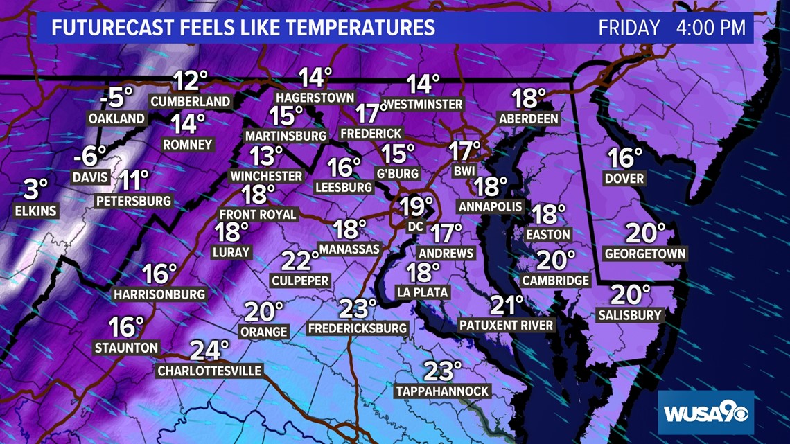
The rest of Friday should be dry and sunny, but it will still feel bone-chillingly cold. High temperatures will stay in the upper 20s to around 30, with wind chills in the teens and 20s through the day.

The weekend looks bright to start with sunshine and cold temperatures in the 30s on Saturday before the next storm system arrives Sunday. While it does look like mostly rainy starting Sunday afternoon, it is possible that we could see some mixing with sleet or snow well north and west of D.C. Temperatures will be mild Sunday afternoon in the low to mid-40s.
The coldest air of the season arrives next week with high temperatures in the low 30s Monday and upper 20s Tuesday.
RELATED: Full forecast
Thousands of families in Northern Virginia have been without power the entire week, including more than 6,500 homes in Stafford County that still haven't had their heat or electricity restored. Dominion Energy estimates that the impacted customers should have power back by the end of Friday.
Some residential roads off the I-95 corridor in Northern Virginia are also still coated with snow. VDOT crews are working to get plows to all neighborhoods affected.
Several Maryland school districts reconsidered opening their doors Friday morning after seeing road conditions, including Montgomery County Public Schools, which moved from a 2-hour delay status to closing fully.