WASHINGTON — A cold front and strong thunderstorms will break the heat over the D.C. region Thursday afternoon.
Summer heat and near-record-high temperatures on Tuesday and Wednesday will be followed by a stormy afternoon on Thursday. A cold front will cross the mid-Atlantic, bringing humidity and a high chance for severe thunderstorms to the area.
The Storm Prediction Center, part of the National Weather Service, has most of the DMV under a 'slight' risk for severe weather. The Thursday risk includes the possibility of damaging winds and large hail. Isolated tornadoes cannot be ruled out either.

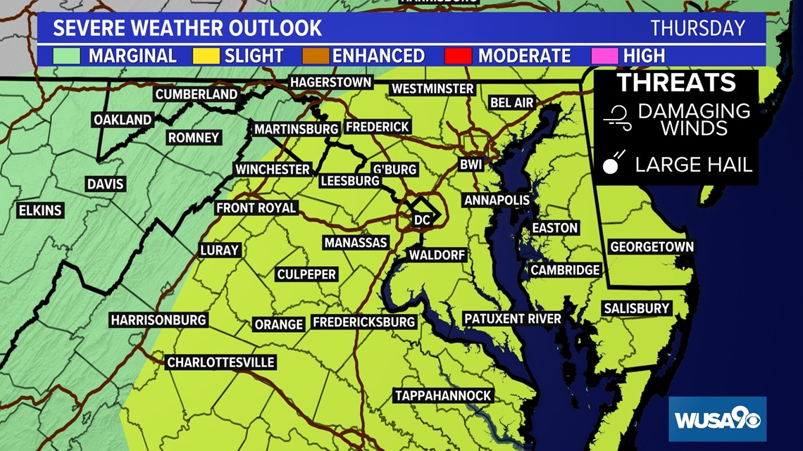
Possible impacts for Thursday include downed trees and limbs, power outages, isolated flooding, and travel slowdowns on the roads and at local airports.
It's important to know your severe weather plan and where to shelter ahead of Thursday's storm chances.


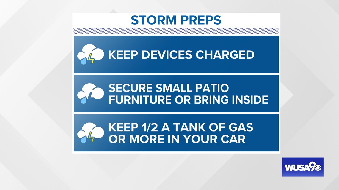
Time to prepare:

Storms Timeline
Thursday morning through noon: Storms west of the the metro. An isolated shower may make it as far east as the I-81 corridor.
Noon to 2 pm: Scattered storms will develop along and east of the Blue Ridge Mountains. Some may be strong.

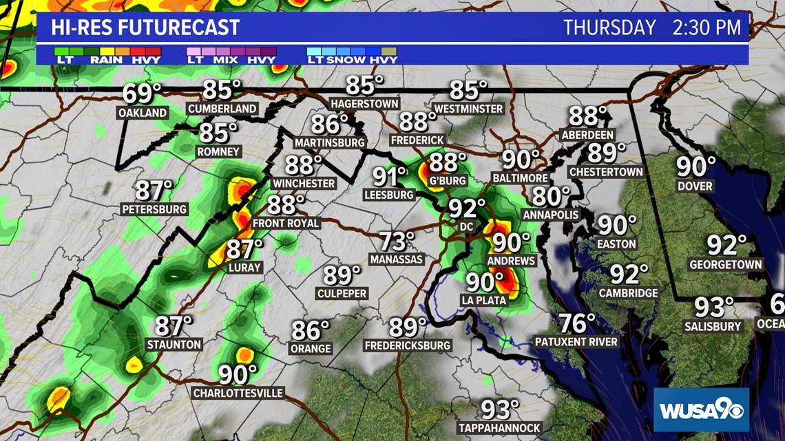
2 pm to 8 pm: Thunderstorms become more widespread, including in metro Washington. Storms may produce damaging winds and hail. Downpours are likely. An isolated tornado cannot be ruled out, but remains unlikely.

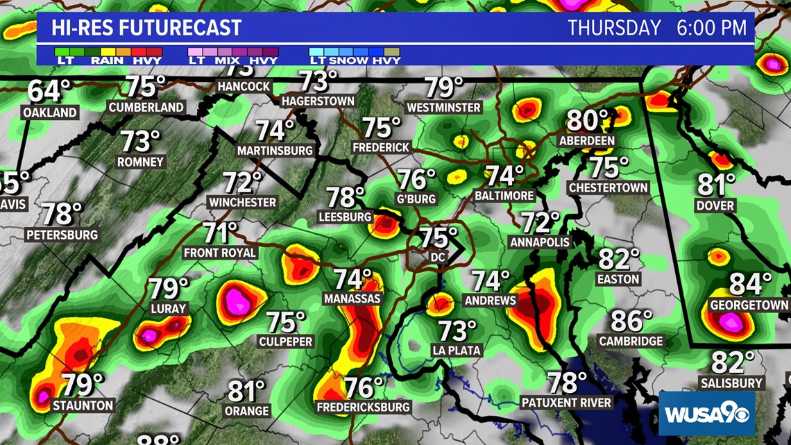
8 pm to midnight: Storms will move out of metro D.C. and across the Bay, with the severe threat moving east and diminishing. Cooler, less humid air arrives overnight.
Cold Front
Thursday's front is being driven by an area of low pressure that will sit over eastern Canada. Additionally, another area of low pressure will develop on the east side of the Blue Ridge mountains.
With a soupy air mass in place on Thursday, along with strong heat, there will be sufficient energy to power thunderstorms over the region.
This comes less than a week after two tornadoes ripped through parts of the Maryland suburbs of D.C. Severe weather the previous Friday also brought down numerous trees and limbs across the region.
Thunderstorms will clear overnight Thursday, leaving D.C. with cooler and less humid weather on Friday.
RELATED: Has a tornado hit your area? Or ever get a tornado warning? Share your story in Tornado Tales study
RELATED: A tad cooler for June in the DMV? Here’s why temperatures may be below normal for a few days

