WASHINGTON — The atmosphere is pumping the breaks on the summertime sizzle in June, at least for a few days.
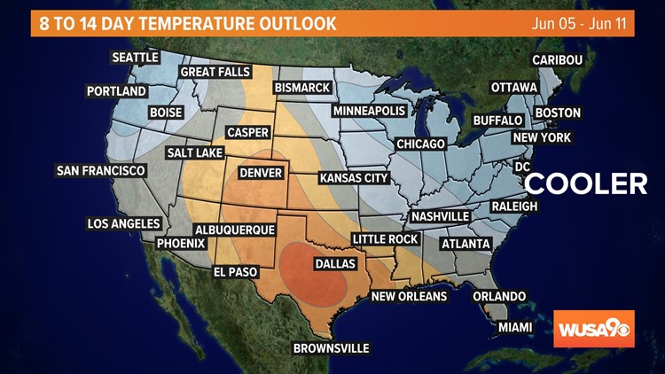
The Climate Prediction Center's 8 to 14-day temperature outlook shows that below-normal temperatures are likely to occur across D.C., Maryland, and Virginia between June 5-11.
Don't go breaking out the winter coats! Temperatures may only end up 1 or 2 degrees cooler than the normal high temperature of the day. For example, if the average high is 80, we could see a high of 79. This is technically cooler, but not by much.
On the first day of June, the forecast calls for 90-degree weather, but soon after that temperatures will cool again to the low 80s and upper 70s.
Why the Cool Off?
After reviewing the data from several models, it doesn't look like we'll get any major bursts of cold air. The cooler than average temperature outlook is likely attributed to cloudy skies and wet weather patterns that could shave off a few degrees from our average high temperatures.
What About the Rest of The Summer?
The summer heat is still on. The Climate Prediction Center's 3 Month Outlook shows that above-average temperatures are likely during the better half of June, July, and August in the Northeast.
July is typically the hottest month for D.C. In January and March, temperatures were below average in the D.C. region. In February and April, monthly temperatures in D.C. were above average.


