WASHINGTON — What are the chances of a white Christmas in Washington? In 2021, not great.
With Christmas less than two weeks away, early weather forecast data points to a mild holiday. While the weather pattern looks active during the early part of Christmas week, the a pattern also looks warm by December standards (sound familiar?).
The average high temperature on Christmas Day in Washington is 47 degrees. Temperatures are forecast to be in the 40s on Christmas, at or just a hair above that average.
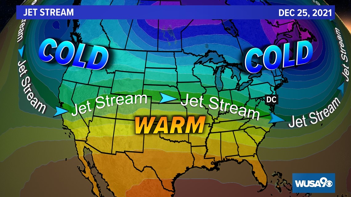
The forecast weather set up for days leading up to the Christmas holiday has the jet stream, the fast ribbon of air about 30,000 feet up and controls large scale weather patterns, set up to our north.


High pressure will be placed over the Gulf of Mexico and much of the south. This is likely to bring settled weather to our region. There is still an outside chance that a cold front or two may push across our region at the edge of that high pressure. However, at this time there is no strong signal for a cold front nor precipitation around the holiday. This means brand new sleds or other gifted snow gear may not get much use when opened Christmas morning.
A white Christmas in D.C. is rare
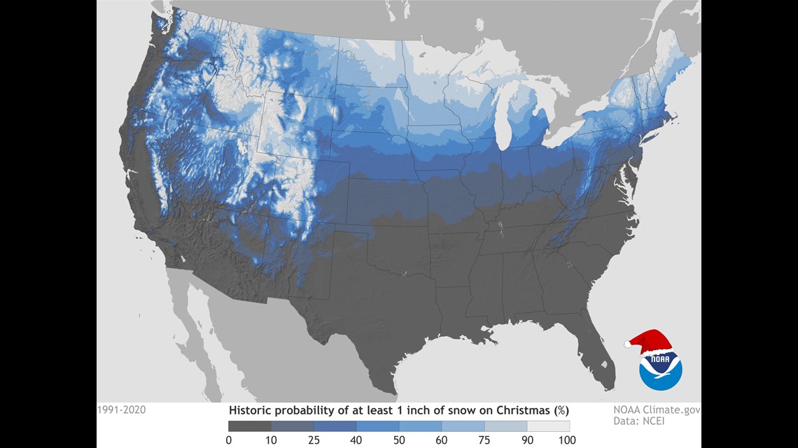
Historically speaking, there is less than a 10% chance of snow (1 inch or more) on the ground for Christmas Day in metro Washington, according to NOAA’s climate.gov. In fact, you can check out their story about snow on Christmas Day for the entire country here.


Looking at climate data from the 1991 to 2020 period showed a grand total of one day where Christmas Day had snow on the ground in Washington, D.C. That day was back on December 25, 2009, when seven inches was measured at National Airport. That seven inches was leftover snow from the blizzard of December 19, 2009, better known as Snowpocalypse. On Christmas Day 2009 temperatures rose into the 40s with rain, melting most of the snow by December 26.

