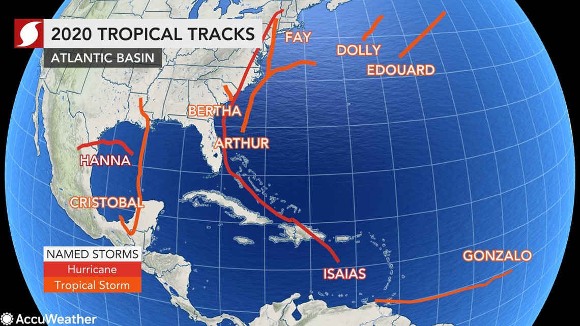
Isaias, the first tropical system of its name, made an unforgettable run at the end of July and into early August of the 2020 Atlantic hurricane season.
The ninth tropical system of the season, the second to strengthen to hurricane intensity and also the second of the year to make U.S. landfall, Isaias was not particularly notable in power or the distance it traveled but in the circumstances that characterized the storm.
When Isaias claimed its name on July 29, it instantly entered the record books, becoming the earliest-forming "I"-named storm since Irene formed on Aug. 7, 2005. It was the fifth consecutive storm this season to be the earliest-forming storm of its respective letter, the pattern beginning with Edouard, which formed on July 6. Cristobal had also become the earliest-named "C"-storm, forming on June 2.
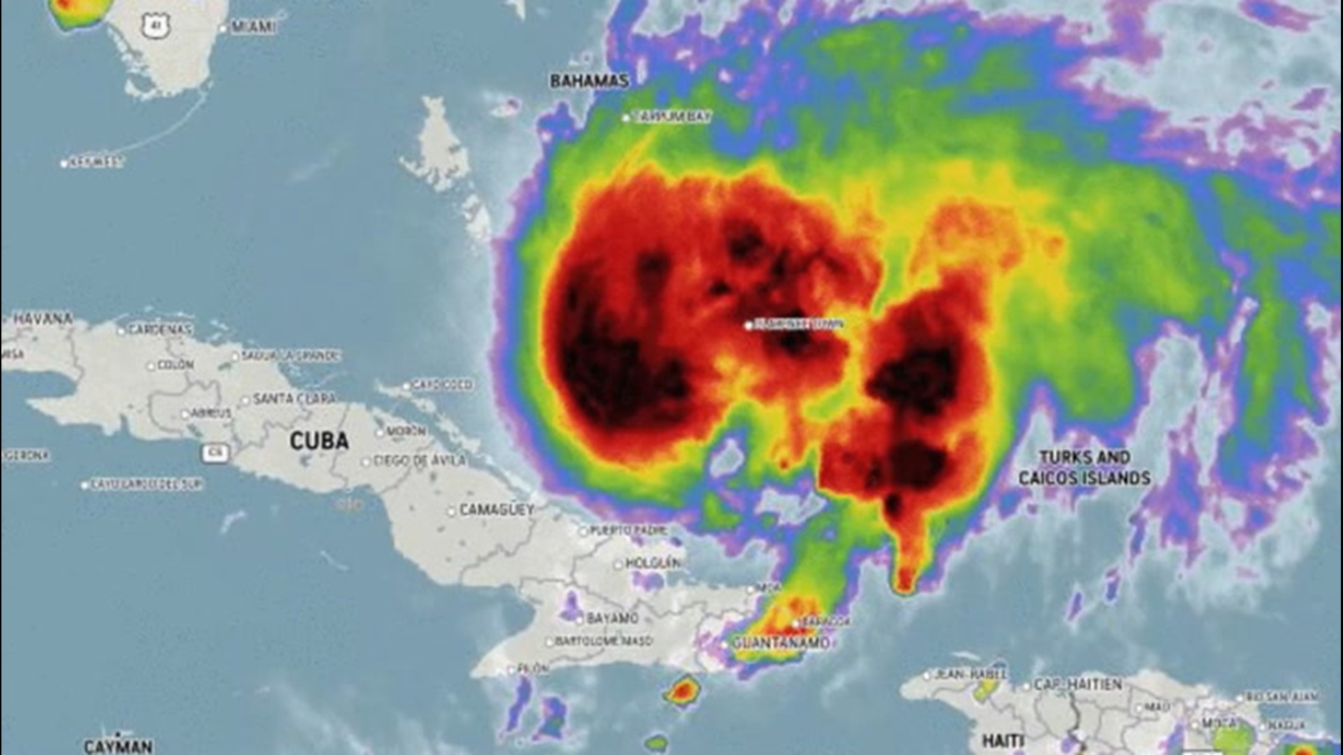
After forming west of the Lesser Antilles, it trekked through the Dominican Republic, the Turks and Caicos Islands and the Bahamas, then it narrowly missed the coast of Florida before slamming into Ocean Isle Beach, North Carolina, on Aug. 3, and racing up through the Northeast.
"Isaias will go down in the record books as a storm that brought heavy rain, tornadoes and damaging winds along and east of its path from the Carolinas into the Northeast," said AccuWeather Meteorologist Bill Deger. "Widespread rainfall amounts of 4 to 8 inches, with the heaviest totals over Philadelphia's northwestern suburbs, led to record river flooding."
At least nine people lost their lives to Isaias. Five of these deaths were in the United States as a result of tornadoes and falling branches or trees from wind damage associated with the storm.
"There were also multiple confirmed tornadoes from North Carolina to Pennsylvania and New Jersey, one of which produced a wind gust to 109 mph at Ship Bottom, New Jersey," Deger said.
The Mount Washington Weather Discovery Center in New Hampshire recorded a peak wind gust of 147 mph on Tuesday as Isaias passed through, marking the highest reported wind gust there in the month of August.
Impacts from the storm reached from North Carolina to New Hampshire, powerful winds knocking out the power to over 3 million customers along the East Coast by Tuesday, Aug. 4.
The speed at which the storm traveled was one of the characteristics that particularly stood out to meteorologists.
Although Isaias lacked power, frequently teetering on the edge of a tropical storm and a hurricane, its speed was far from lacking.
"When Isaias made landfall on Monday night in North Carolina, it was moving north at 22 mph, already a fairly brisk pace for a tropical system," Deger said. "By the time it was moving through eastern Pennsylvania, a little over 12 hours later, it was traveling at nearly twice the pace: 40 mph."
This speed would carry it from the Carolinas to Canada, as its impacts spread across 16 states.
"Isaias made it 150 miles inland before transitioning from a hurricane to a tropical storm then traveled nearly another 700 miles to the north as a tropical storm, before becoming a tropical rainstorm just outside of Montreal," Deger said.
However, there was a moment in the Isaias' journey when there was a chance the storm could have unraveled before reaching the U.S. coast.
Isaias hit Hispaniola -- the island consisting of Haiti and the Dominican Republic -- as a newly-formed tropical storm on July 30. At that time, AccuWeather forecasters had warned that the island's mountainous terrain had killed many storms before while other storms had persevered, even becoming hurricanes upon re-entering warmer waters to the north of the island.
"The eastern Caribbean Sea up through Hispaniola is known by some as 'the graveyard of tropical systems,'" Deger said. "Typically harsh conditions in the Caribbean Sea and mountainous terrain in Hispaniola have caused numerous storms to lose strength and become disorganized beyond survival."
Isaias emerged from Hispaniola the same night, seemingly unhindered by the challenge of the mountains that had deterred other storms.
"Isaias overcame both obstacles, since its center of circulation reformed multiple times and it was fed by very warm ocean water temperatures along its path," Deger said.
In the same evening, having entered the warmer waters, Isaias strengthened into a Category 1 hurricane.
Isaias would falter into a tropical storm to sideswipe Florida before strengthening back into a Category 1 hurricane on Aug. 3, a little over three hours before making landfall near Ocean Isle Beach, North Carolina.
Veiled by the storm clouds, August's full moon hung in the sky. Although the celestial body wasn't visible, its impacts on the tide was evident.
The storm surge from Isaias plagued the North Carolina shoreline, flooding beach towns and devastating the nearby Oak Island. A lunar tide had caused an already high tide to surge even higher, and winds perpendicular to the beach at Oak Island were adding to the overwhelming floodwaters, according to AccuWeather reporter Jonathan Petramala.
"A lunar tide, which is the unwelcome combination of a high tide coinciding with the increased gravitational pull of the moon during a full moon, will lead to a higher-than-normal tide even before factoring in a surge of water from a tropical system," Deger said. "The combination of all three will lead to more coastal flooding and beach erosion."
After racing up the East Coast, Isaias weakened to a rainstorm on Aug. 4 as it moved into southeastern Canada, a day after making landfall in the U.S. With the storm gone, the Atlantic basin fell quiet, but it's only a matter of time before the season ramps up once more as the peak of the hurricane season approaches.


