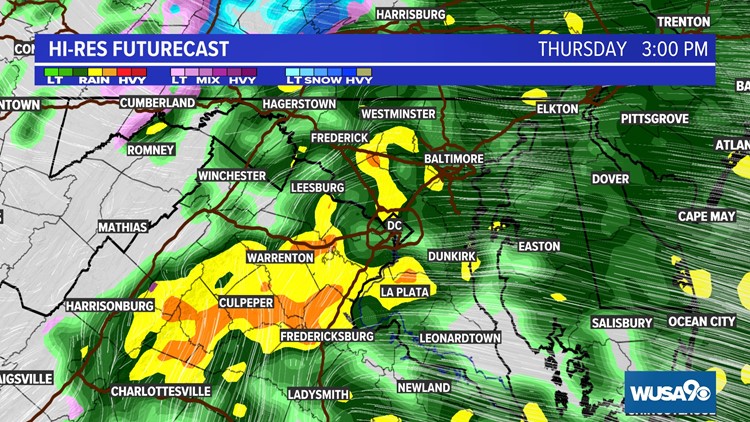
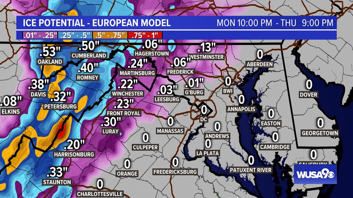
WASHINGTON — Heavy rain will continue to move through parts of the DMV while areas west of I81 transition from ice to rain.
The Ice Storm Warning continues until 10 p. m. along and west of I 81 and Frederick County, Md.

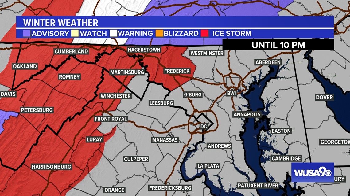
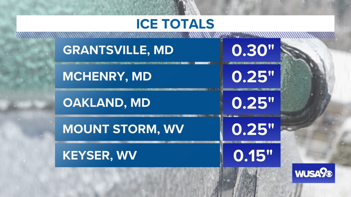
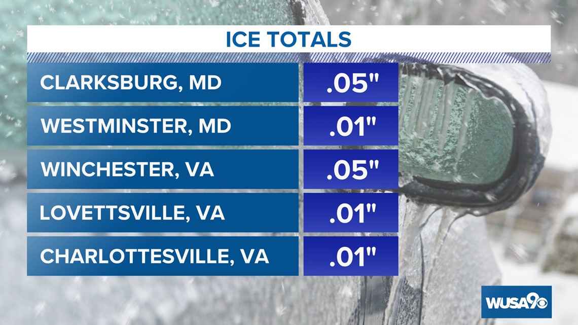
We have already seen significant ice accumulation in parts of the western DMV.


Timing
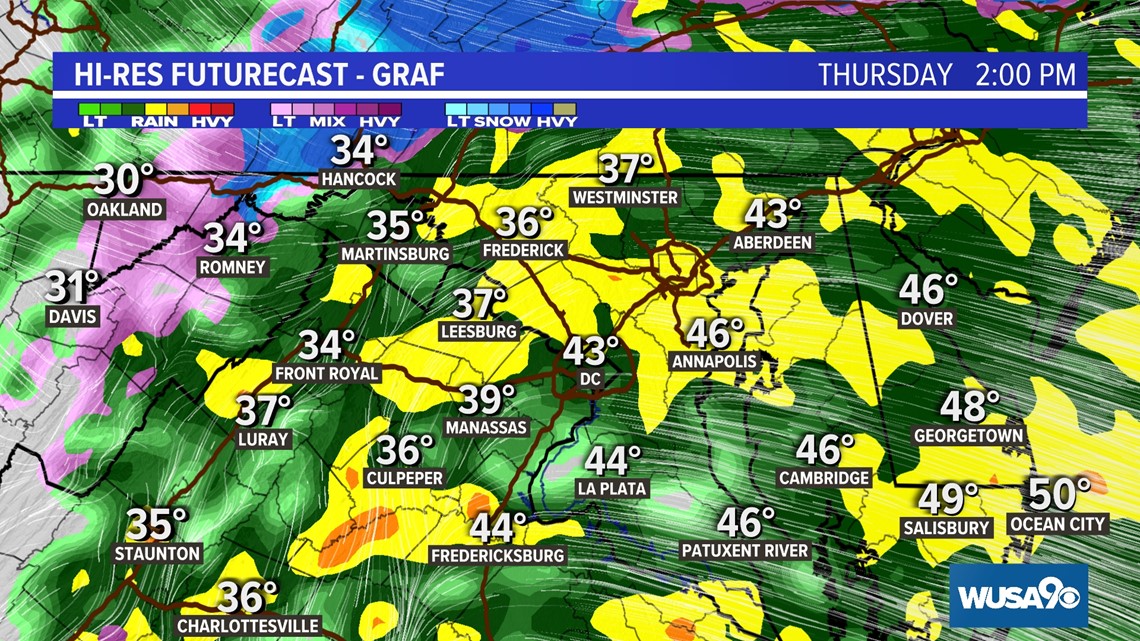
Thursday now to 5 pm:
The rain/ice dividing line will move farther west as warmer temperatures push into the region. Metro Washington will see temperatures warm into the 40s. Cold air will remain in the Shenandoah Valley and across much of western Maryland and West Virginia. This will lead to additional light ice accumulation. With some snow possible, too, especially in mountain areas. Meanwhile, some downpours will be possible in metro Washington and surrounding parts of Maryland and Virginia.

Thursday 5 pm until Friday 1 am:

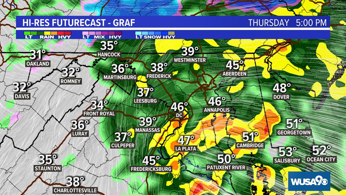
Most of the DMV will see rain with, light ice accretion still possible across the Shenandoah Valley and west of the Divide in Garrett County and south through the Canaan Valley. The bulk of the area will see temperatures rise well above freezing.

Friday morning:
All rain and ice will be over well before dawn. Dry skies take over on Friday, with temperatures starting above freezing in all locations.
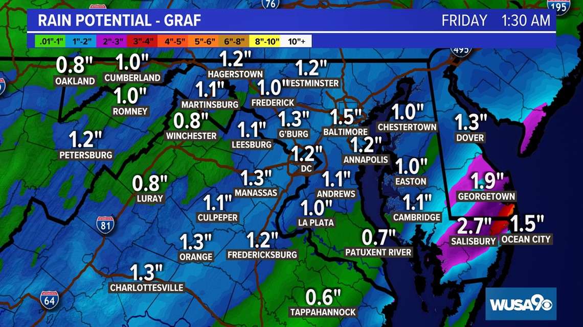
Rain totals for the DC region will be on the heavy side, with 1 to 2-inches of rain falling between early Thursday morning and early Friday morning.

