WASHINGTON — From snow last week to rain this week. It will feel - and look - far from winter over the next several days. Rain has spread across the region Thursday morning, with wet roads as you head out.
The rain will generally be light to moderate at times. With snow continuing to melt, plan on very wet roads and lots of road spray.
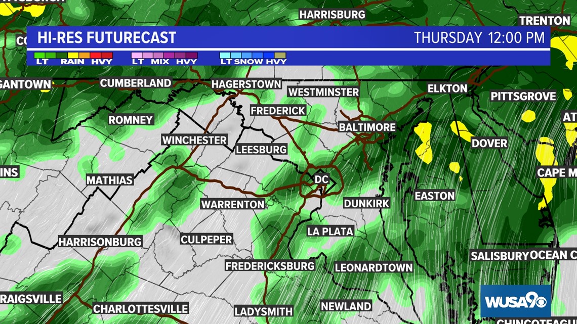
By lunch time, rain will start to become more scattered with breaks in the wet weather throughout the afternoon.
THURSDAY 12:00 PM

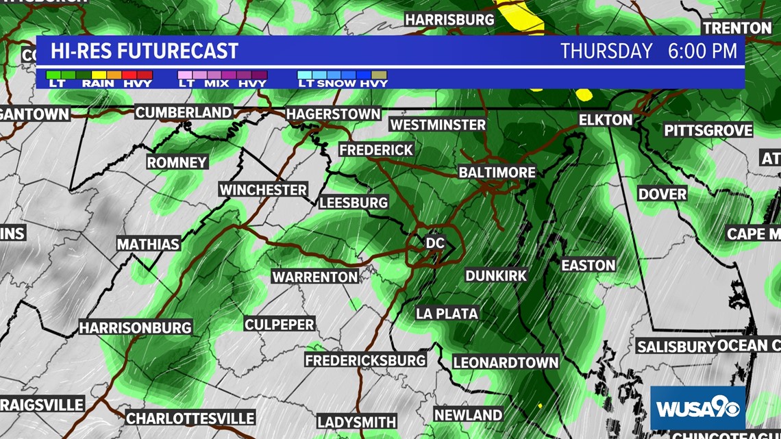
Scattered showers will persist through the evening drive. While it might not be actively raining everywhere during your evening commute, roads will still be very wet.
THURSDAY 6:00 PM

A few showers may linger into early Friday morning, but some computer models clear out the rain overnight.
FRIDAY 6:00 AM

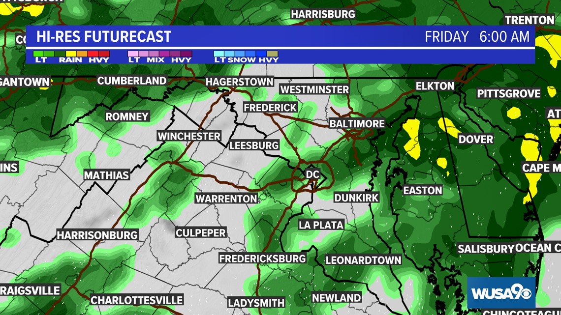
When all is said and done, a widespread 0.50" to .75" of rain looks likely Wednesday night into Friday morning.
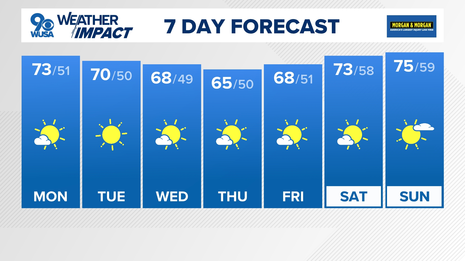
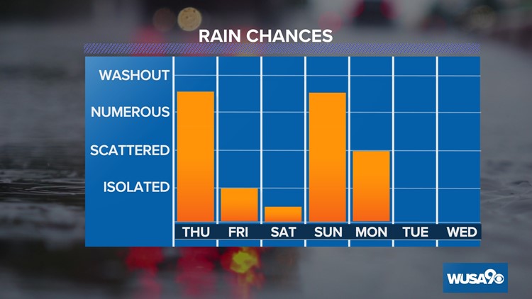
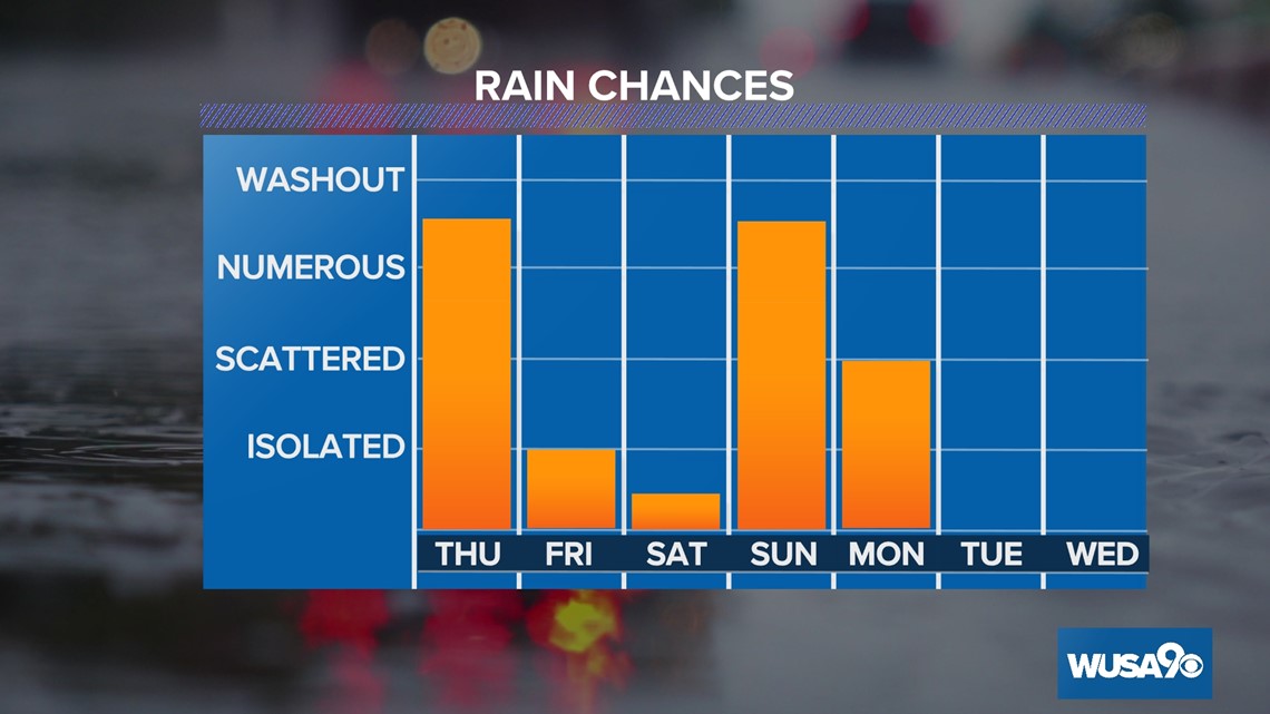
Saturday will be the pick of the weekend with sunshine to start before clouds increase throughout the afternoon. There is still some uncertainty around a storm that could bring another round of rain Saturday night into Sunday. Right now, the forecast looks to remain dry until around dinner time Saturday with showers expected off-and-on throughout the day Sunday.
Check back in over the next several days and we'll detail how this may impact the Baltimore Ravens game for the AFC Championship on Sunday at 3 P.M. against the Kansas City Chiefs.

RELATED: A big winter warm up this week
RELATED: FORECAST: Seasonably cold Tuesday