WASHINGTON — The WUSA9 Weather Impact team has issued a Weather Impact Alert for record heat and potential strong storms on Wednesday afternoon and evening. Here's what you need to know to stay safe.
Weather Impact Alert Details:
What:
- Isolated strong to severe thunderstorms this evening
When:
- Now until 11 p.m.
Impact:
- Outdoor plans may be impacted
The WUSA9 Weather Team issued a Weather Impact Alert first for record heat earlier today and now a chance for showers and storms through this evening.
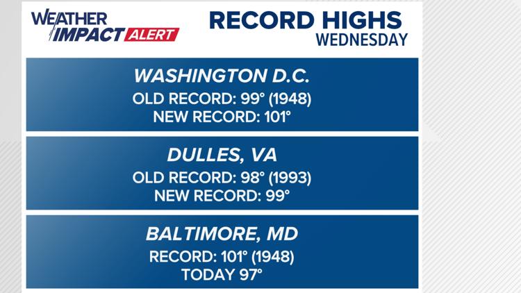
Wednesday Records:
- Reagan National Airport
Old record - 99° (1948)
New record - 101° - Dulles International Airport
Old record - 98° (1993)
New record - 99° - Baltimore/Washington International Airport
Record - 101° (1948)
Today - 96°
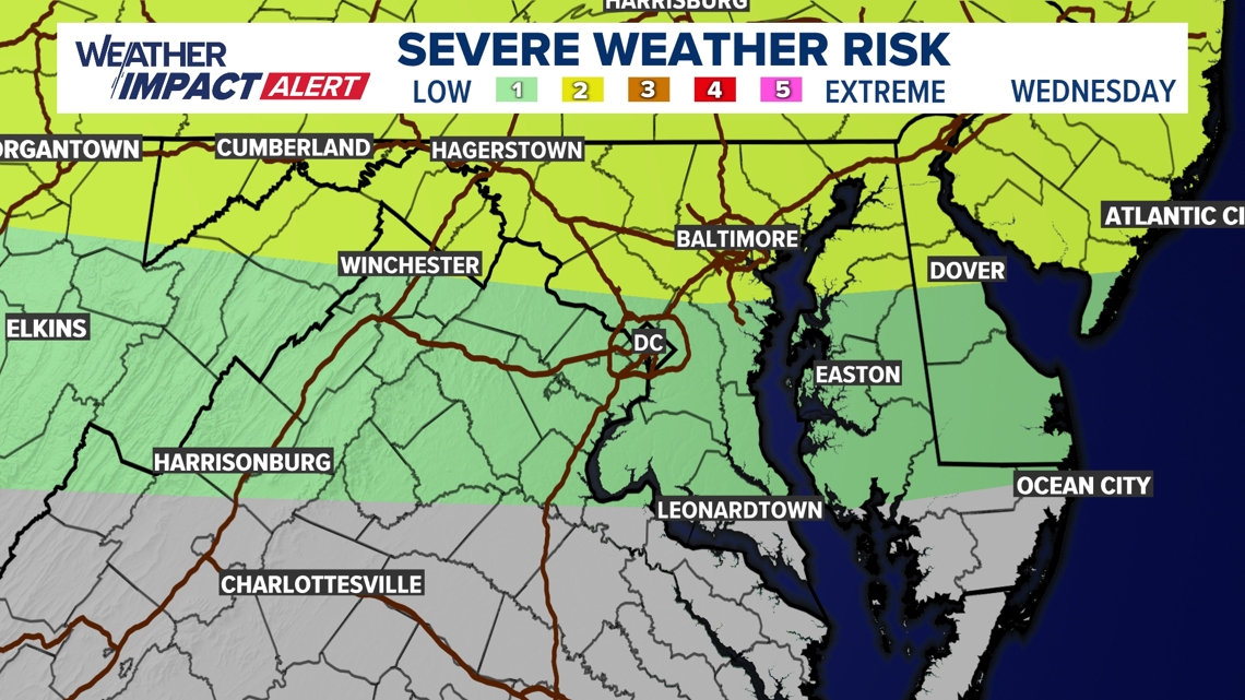
After a record hot day, there is a chance for showers and storms, anytime between now and 11 p.m. There is a small chance for one or two of the storms to become strong to severe, producing strong gusty winds.
Some storms may also produce heavy rain, which could make it difficult to see while driving or lead to water ponding on the roads. Storms will be spaced out, so not everyone will see a storm.
A 2 of 5 risk of severe weather is in place north of DC, with a 1 of 5 risk of severe weather elsewhere.

WUSA9 issues Weather Impact alert for dangerous or deadly weather, or even non-severe weather that may cause you to change your plans. It's our commitment to keeping our community safe.