WASHINGTON — If you have outdoor grilling or pool plans into Saturday evening of Labor Day weekend, you may want to reschedule or have some alternate indoor plans. WUSA9 has issued a Weather Impact Alert for Saturday evening due to scattered showers and storms.
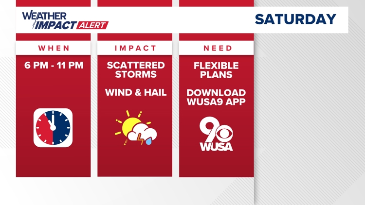
What: Weather Impact Alert for showers and storms. Storms may produce heavy rain, strong gusty winds, and even hail.
When: Saturday 6 p.m. to 11 p.m.
Impact: Heavy rain may reduce visibility for drivers. Roads may also become flooded. Weak or unstable trees and branches could fall. Isolated power outages are possible. Outdoor plans may have to move indoors.
Need To Know: Keep devices charged. Have a plan to get indoors when storms arrive. Avoid driving on flooded roads. Six inches of fast moving water is enough to knock an adult off of their feet. One foot or 12 inches of water is enough to float a car or small SUV, while 18 inches of water is enough to carry away most vehicles.
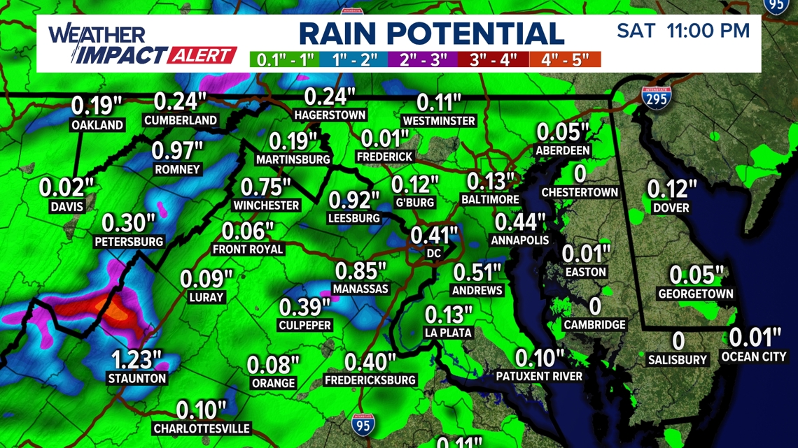
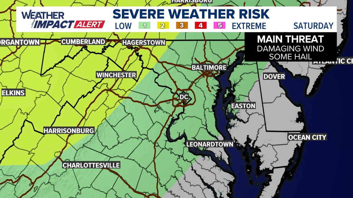
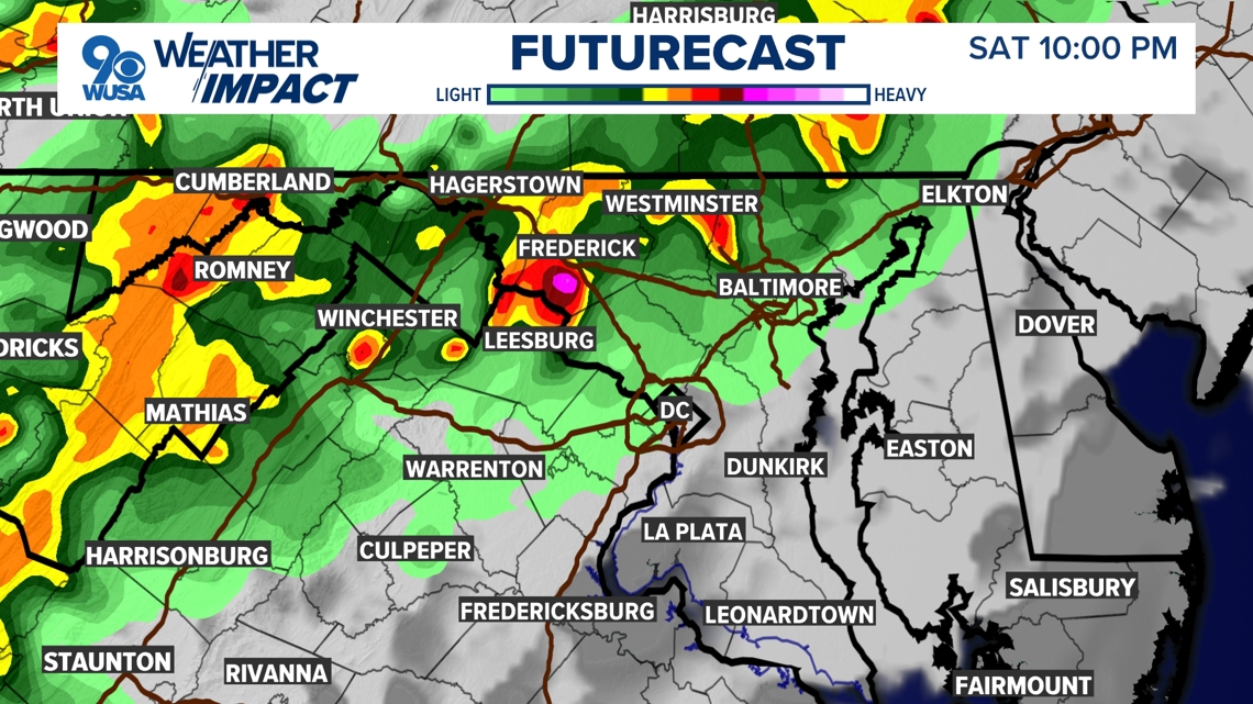
Showers and storms will become most numerous from northwest to southeast Saturday evening. Some storms may become severe so be sure you have a way to get weather information. Expect heavy rain that could cause flooding, with frequent lightning, damaging winds, and hail. The Storm Prediction Center has placed parts of the DMV in a "Slight" risk for severe weather on Saturday. This is a level 2 out of 5.

Timeline
Saturday 10 p.m.
The thunderstorms will then drop through Loudoun, Fauquier and Montgomery County as evening plans are in full swing.

Storms will begin to taper off around midnight.
Some areas will pick up an inch or more of rain, so there could be not only wet roads but some isolated flooding as well.