WASHINGTON — WHEN:
- Friday now - midnight Saturday
IMPACT:
- Off and on showers and storms
NEED:
- Keep outdoor plans flexible
- Leave extra time for the a.m. and p.m. commute
- Have a umbrella handy
- Get the dog towels out
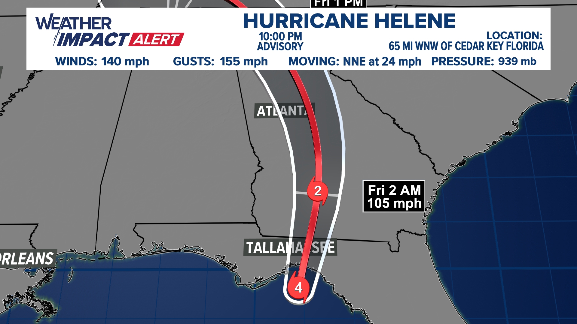
As Helene weakens and drifts off the northwest into the midwest, moisture associated with the outer bands of the large storm will bring showers and even a few thunderstorms to the DMV Friday. The day won't be a total washout with breaks in between showers, but it will still be a very damp, dreary and overcast end to the week.
Showers will be possible at anytime during the day. Winds will become breezy with gusts at more than 20 mph starting around noon. Thunderstorms are most likely to mix in after 3 p.m.
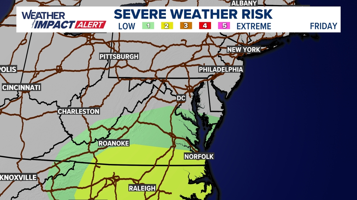
Most of the storms around the DC Metro area will be below severe criteria. However a there is a low tornado risk south of DC in areas such as Richmond, VA and Roanoke, VA.
Some showers will stick around into Saturday morning, but most of the day will be dry. Another round of rain is possible later Saturday night. We are holding out hope for a bit of mid-day sunshine.
TIMELINE:
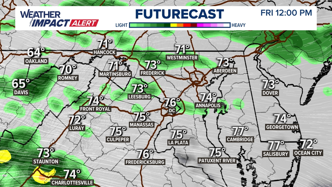
Friday 12:00 p.m.
Off and on showers will continue through the middle part of the day. When it's not raining, it will still be cloudy and drizzly at times.

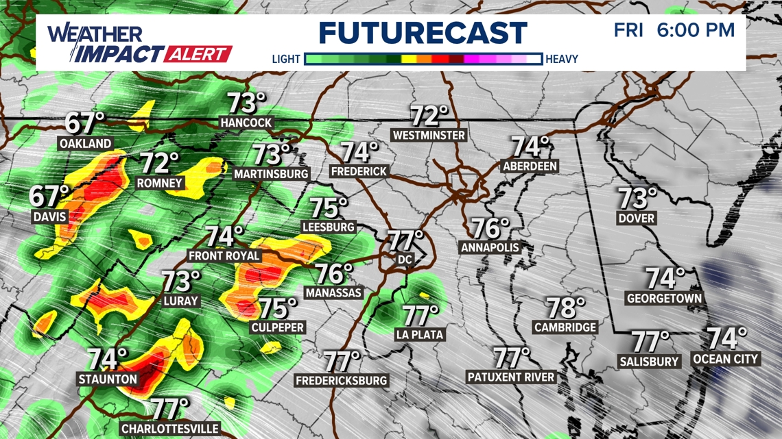
Friday 6:00 p.m.
More showers and even some storms will impact the Friday evening commute and outdoor plans later at night. Any storms look to remain sub-severe, but some locally heavy rain, gusty winds and lightning is all possible.

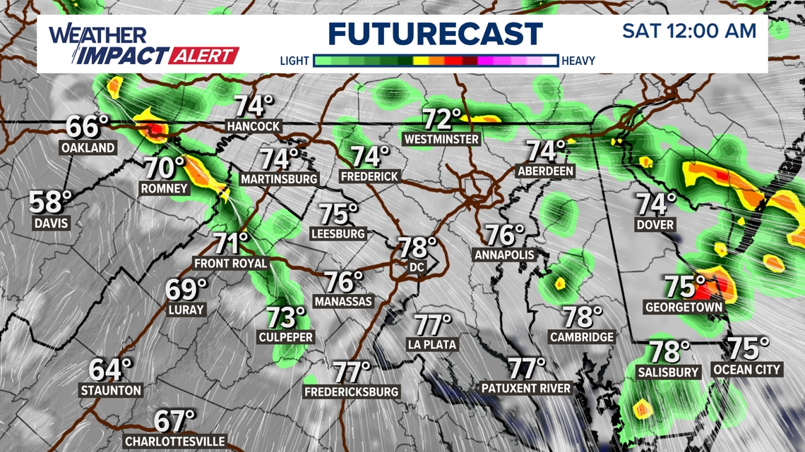
Saturday 12:00 a.m.
Most of the shower and storm activity will wind down overnight, but some showers are possible through Saturday morning.

Given the track of the storm, the greatest severe weather risk will remain well to our south. There is a low chance for a strong or severe thunderstorm south of I-66.