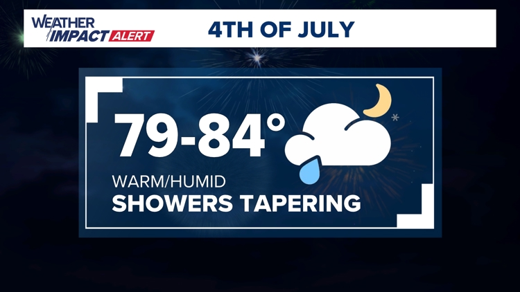
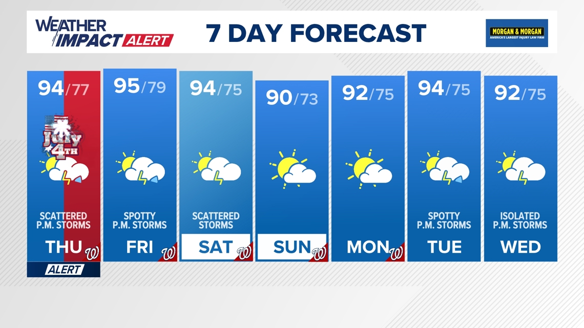
WASHINGTON — Heat, humidity and storm chances ramp up today, for the July 4th holiday, leading our weather team to issue a Weather Impact Alert for Thursday afternoon and evening.
When:
- Thursday: 12 p.m. until 9 p.m.
Impact:
- Thursday: Scattered storms for the entire DMV, with heavy rain, lightning, and perhaps some gusty winds.
Need to Know:
- Don't cancel plans, but have alternate indoor plans in case a thunderstorm strikes.
- Have a place to seek shelter as storms develop.
- In addition to the storm threat, it will be hot and humid on Thursday.
- Stay hydrated.
- Take breaks from the heat.
- Check on the elderly, children and pets
Timeline
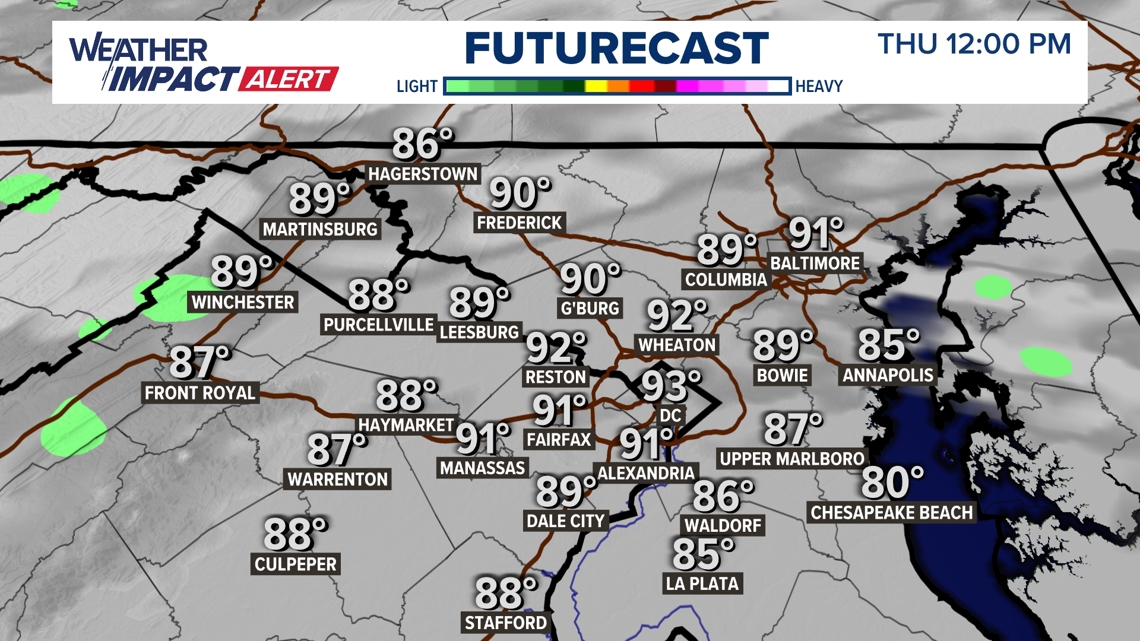
Thursday 12 p.m.
Plan on partly cloudy to mostly cloudy skies through lunchtime on Thursday with hotter temperatures and higher humidity for cookouts. There could be a stray shower developing here or there.

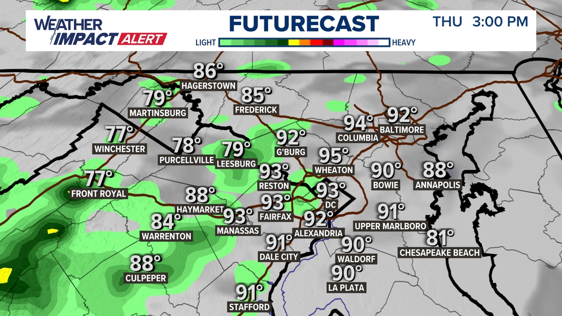
Thursday 3 p.m.
Storms remain very scattered through the early afternoon hours as parades wrap-up. Don't cancel or change any plans, but have a place to seek shelter if a storm rumbles through.

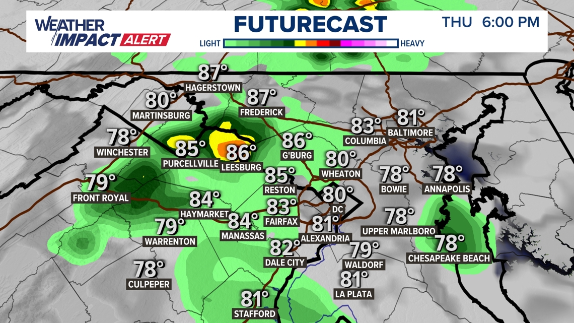
Thursday 6 p.m.
More scattered showers and storms will remain into the early evening hours.

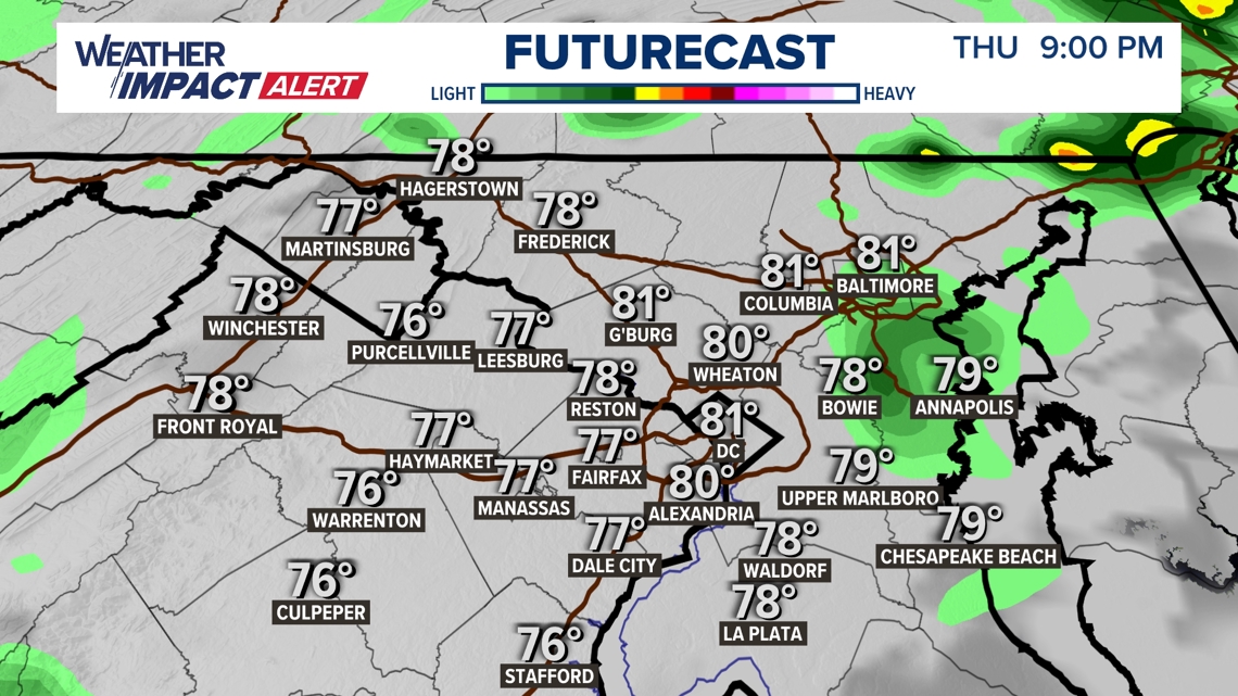
Thursday 9 p.m.
By fireworks time around 9 p.m., thunderstorm coverage will start to decrease, but there will likely still be some showers that could threaten some shows, so stay with WUSA9 and also download the WUSA9 App to stay on top of changing and evolving weather.

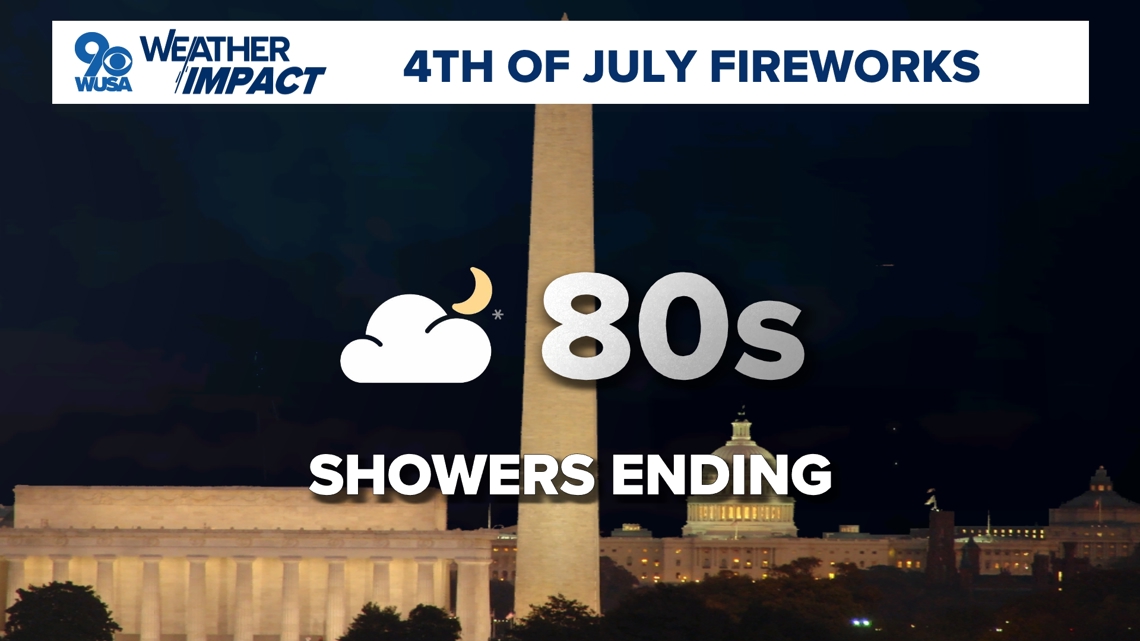
Fireworks Forecast
Most fireworks shows should get off OK, including the National Fireworks Show on the National Mall, but there may still be a lingering shower or two with temperatures still in the sticky 80s.

Another Heat Wave
In addition to the storm threat, it will also be hot and humid for the holiday. Actual temperatures will climb back into the low-mid 90s, but feel more like around 100 degrees once you factor in the humidity.
A Heat Advisory has been issued along the I-95 corridor from DC to Baltimore. We will actually stay below Heat Advisory criteria which is heat index values between 105° - 109°, but given how many people will be spending a prolonged period of time outdoors, the National Weather Service has issued the advisory as a precaution.

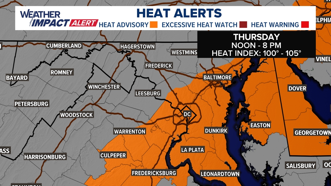
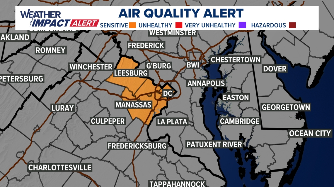
Meanwhile, a Code Orange Air Quality Alert has also been issued for poor air quality for sensitive groups for D.C., Fairfax, Loudon, and Prince William Counties.

The 90-degree temperatures will likely stick also around all the way through the weekend and into at least early next week, meaning yet another heat wave setting up.

MORE WAYS TO GET WUSA9
DOWNLOAD THE WUSA9 APP
Apple App Store: WUSA9 News on Apple
Google Play Store: WUSA9 News on Android
HOW TO ADD THE FREE WUSA9+ APP TO YOUR STREAMING DEVICE
ROKU: add the channel from the ROKU store or by searching for WUSA9.
For both Apple TV and Fire TV, search for "WUSA9" to find the free app to add to your account. Another option for Fire TV is to have the app delivered directly to your Fire TV through Amazon.