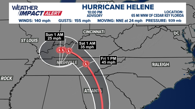
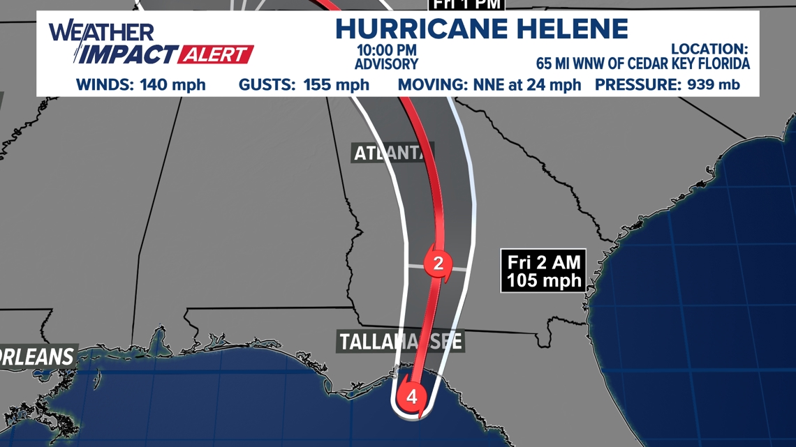
WASHINGTON — The eighth named storm of the Atlantic hurricane season formed Tuesday morning. Helene continues to strengthen in the Gulf of Mexico. As of 10 p.m. sustained winds are up to 140 mph.
The National Hurricane Center forecasts a Thursday night landfall in the Florida Panhandle as a Category 4. Landfall is expected near between Apalachicola and Cedar Key, Florida.
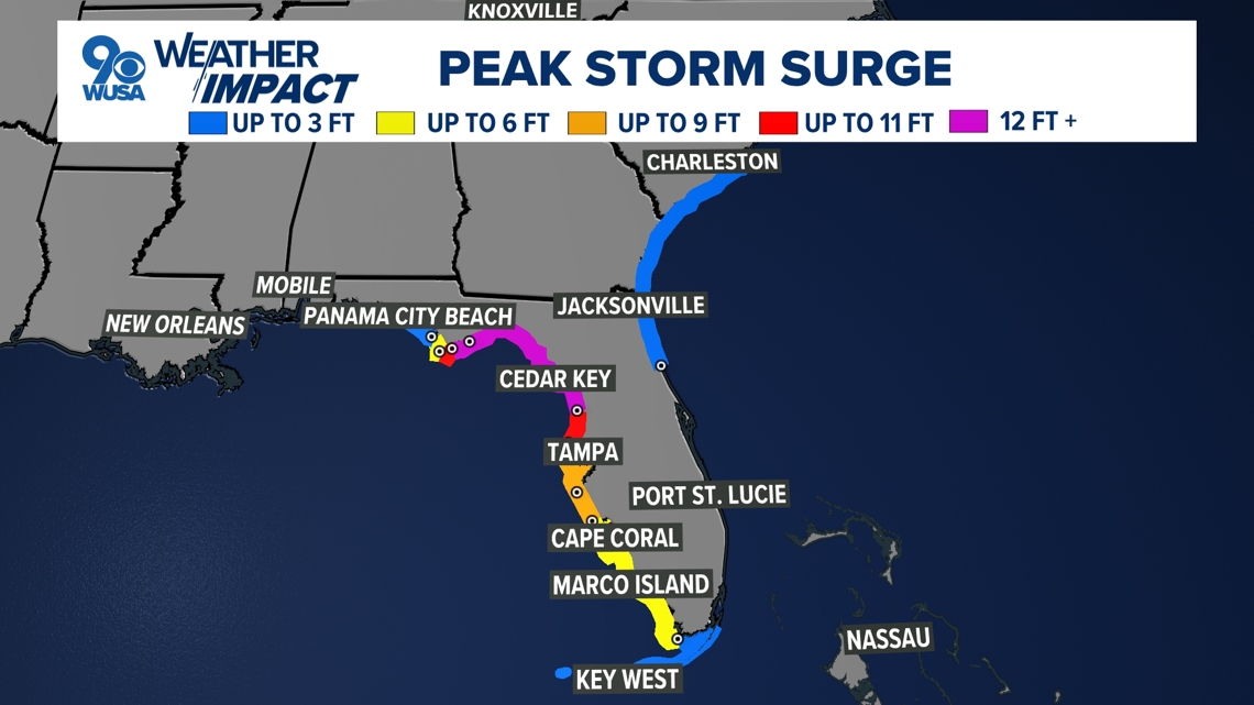
The storm will bring heavy rain and powerful winds to the entire state. Storm surge could approach 20 feet in the Big Bend area.
After making landfall, the storm will quickly move through Georgia overnight Thursday into Friday, potentially maintaining tropical storm intensity as far north as Atlanta.


This timing is concerning because in addition to heavy rain and tropical storm force winds overnight, there is also a significant severe weather threat on the right hand side of the storm track.
Off and on showers and a few thunderstorms associated with Helene's outer bands will impact the DMV Friday. The remnants of Helene will drift east near the region Sunday through Tuesday next week bringing in more rain for our region.
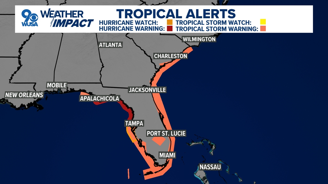
Hurricane Warnings are in effect for parts of the Big Bend of Florida into the panhandle.
Tropical Storm Warnings are in effect for most of the Florida Peninsula and Panhandle as well as the Georgia and the South Carolina coast.