WASHINGTON — The WUSA9 Weather Team has issued a Weather Impact Alert on Wednesday for high heat and humidity, giving way to strong storms. A cold front will pass through the region Wednesday afternoon and help trigger a line of organized thunderstorms during the afternoon and evening commute.
Alert Details
When:
- Wednesday now - midnight
Impact:
- Heavy rain, thunder and lightning, and strong winds
Need to Know:
- Afternoon plans need to be flexible
- Have a place to safely seek shelter
- Commutes home may be slower than normal
- Track storms on the WUSA9 app
Timeline
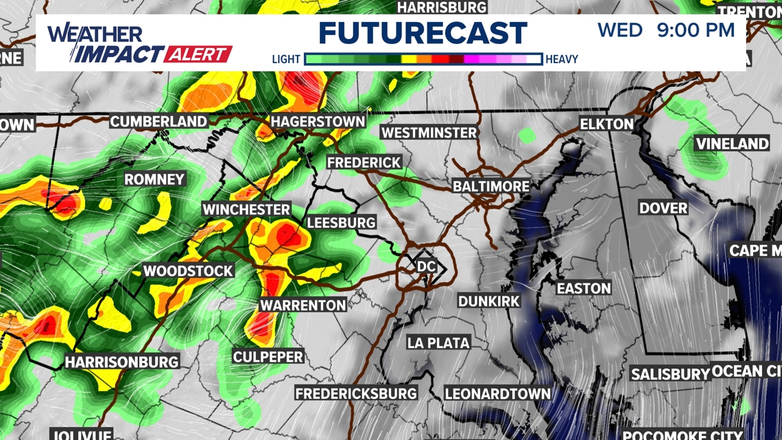
Wednesday 9 p.m.
By 9 p.m. showers and thunderstorms will intensify along the I-66/I-81/I-70 Corridors and points west... beginning to quickly move east.

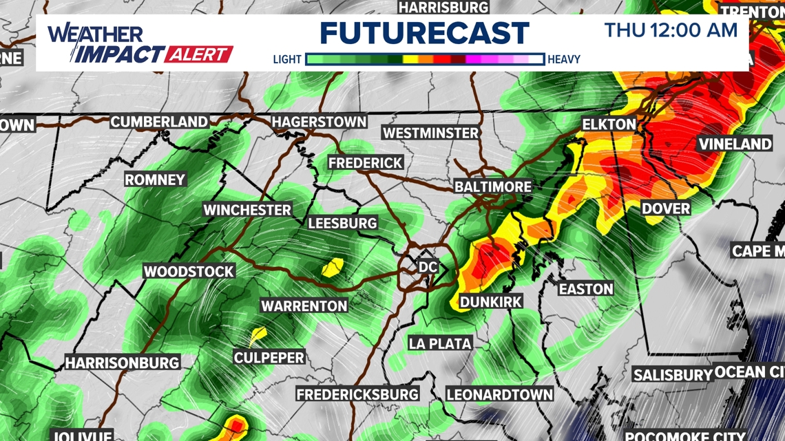
Thursday 12 a.m.
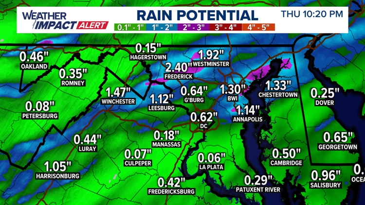
A more organized line of showers and thunderstorms race from west to east, first through Loudoun, Fauquier and Frederick County, then across the District, and eventually east of the Beltway by midnight. Shortly after midnight, storms will be east of the Bay.

Residual showers will linger into the overnight and pre-dawn hours of Thursday.

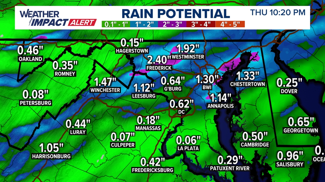
After a localized 1-3" of rain overnight, some folks may still have damp conditions for the Thursday morning commute but skies will clear quickly throughout the morning.
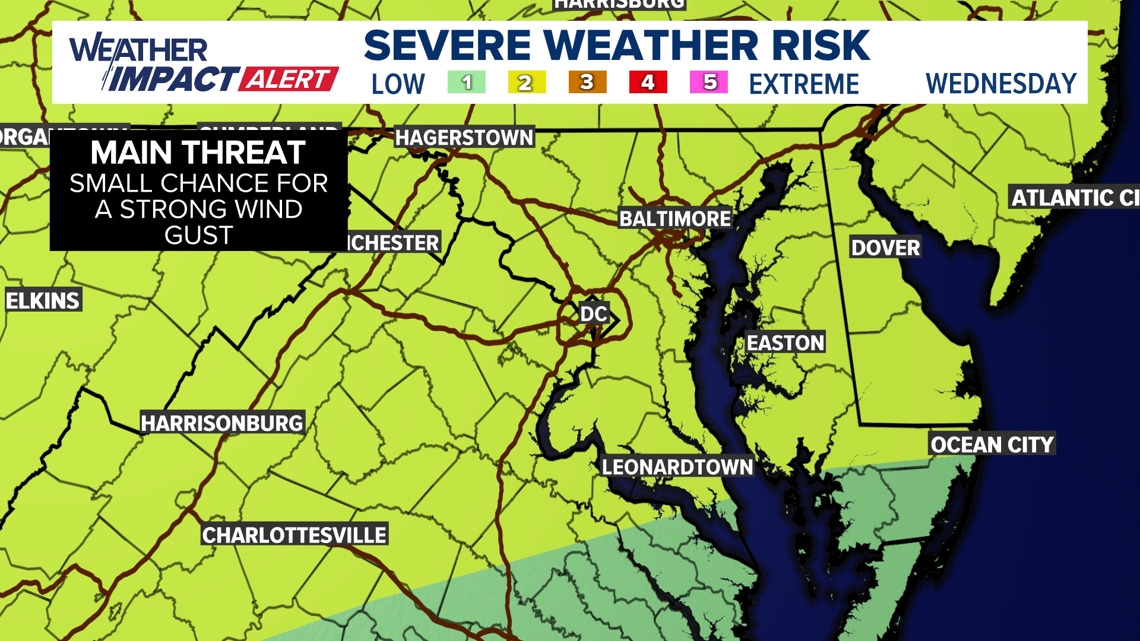
Severe Threat
The Storm Prediction Center has placed the DMV in a level 2 out of 5 risk for severe weather. However, with high heat and humidity helping to destabilize the atmosphere, scattered severe thunderstorms with damaging wind as the greatest threat seems to be most likely.

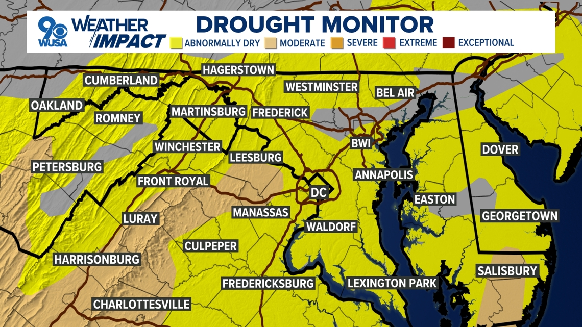
Drought
We could certainly use the rain after a long stretch of dry and very hot weather. Most of the region is currently experiencing abnormally dry conditions while parts of Loudoun, Fairfax, Fauquier and Rappahannock counties are under moderate drought conditions.

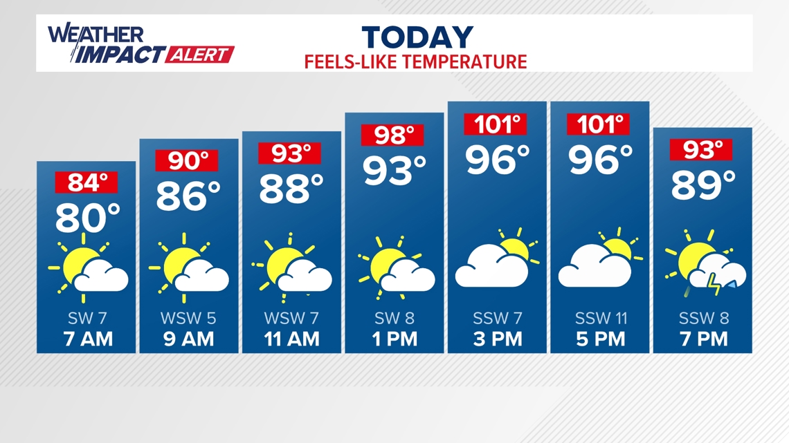
Heat
In addition to the storm threat, it will also be very hot and humid Wednesday. Actual temperatures will climb into the mid to upper 90s.

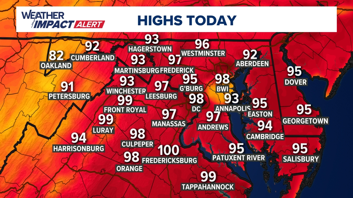
Heat index values, though, will feel more like the triple digits once you factor in the humidity.