WASHINGTON — Winter storms can a whole plethora of types of precipitation from snow, to sleet, freezing rain, and just plain rain. Although snow is what many get the most excited and fixated upon, freezing rain is a much more significant danger. It can lead to extremely dangerous driving conditions and power outages.
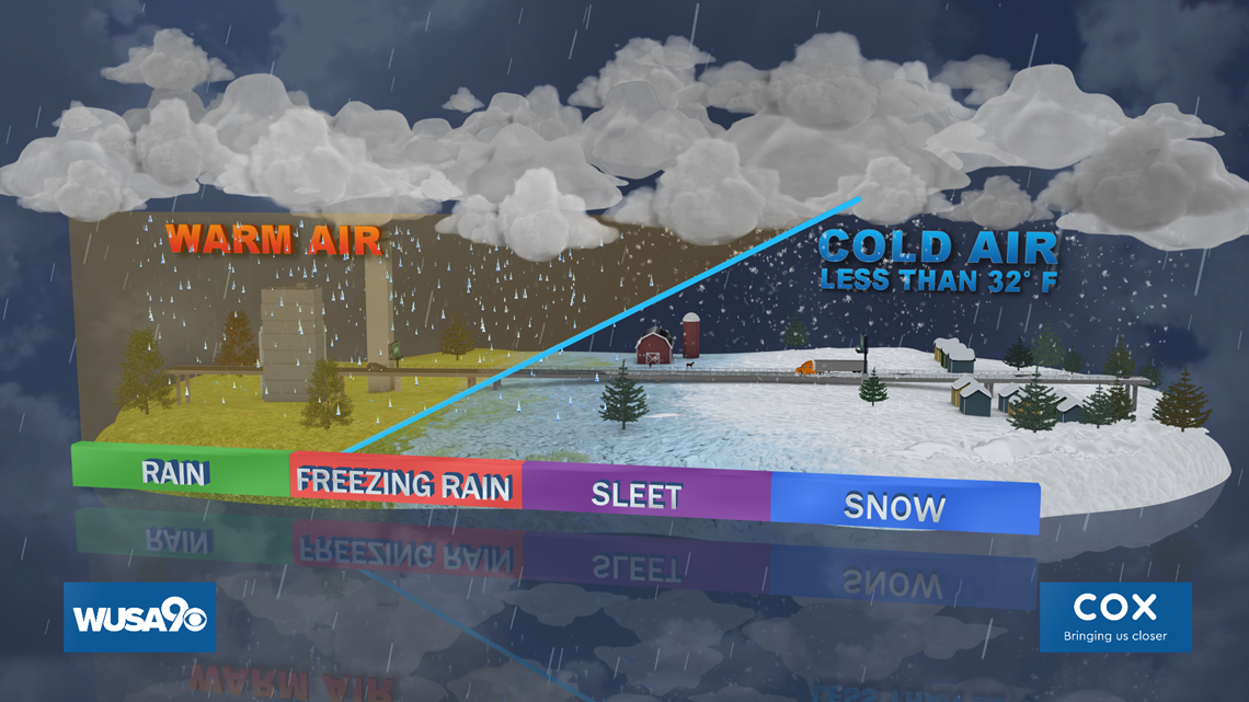
Below is a graphic which shows a section of the atmosphere with a cold air mass where the temps are below freezing and a warm air mass where the temperatures are above freezing. We'll call these 'cold air' and 'warm air', respectively.
When you have all 'cold air' from the top of the atmosphere to the bottom in which the temperatures are all below freezing, what reaches the ground is snow.
When you have a thin layer of 'warm air' stuck in between two layers of 'cold air', a falling snowflake melts, but then refreezes into a tiny ball or pellet of ice before reaching the ground. We call this 'sleet'. Many people confuse this with hail, but they form from completely different weather setups.


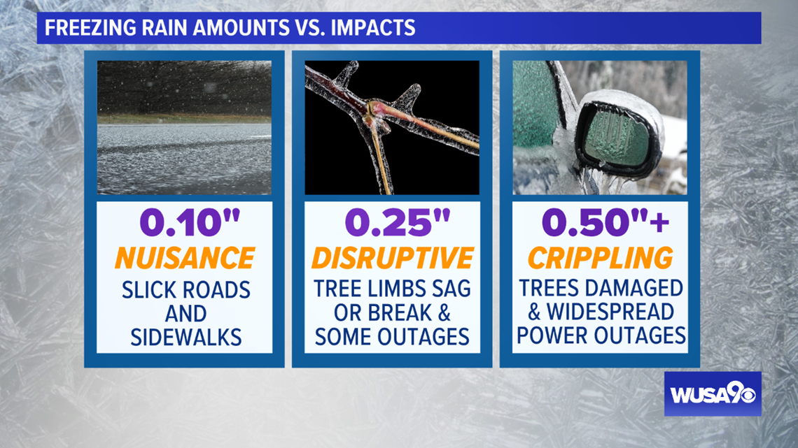
When that layer of 'warm air' is thicker and the bottom layer of 'cold air' is thin, the melted snowflake doesn't have time to refreeze into a sleet pellet. Instead, it falls to the ground as a liquid, but with a temperature below freezing. This is called freezing rain. This freezing rain then becomes a layer of ice that coats any object below freezing, including trees, power lines, bridges and overpasses.
The ice adds weight to tree limbs and power lines. It causes them to sag and weaken. And if enough ice is on tree limbs and power lines they can break or snap from the shear weight and stress of the ice.


This weekend, we're anticipating each of these types of winter weather: snow, sleet and freezing rain. Hope for more snow and less freezing rain!

