WASHINGTON — Summertime high pressure keeps the hot and humid weather going for Monday.
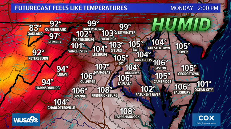
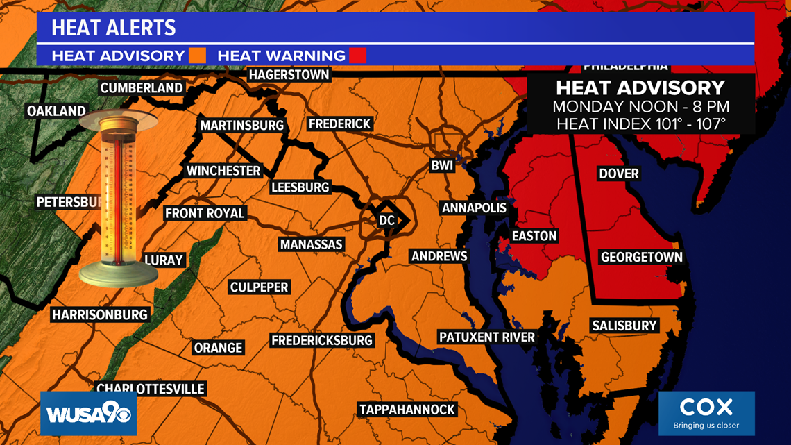
Expect high temperatures in the upper 90s to near 100 degrees, with a heat index temperature as hot as 108 degrees during the afternoon hours.
Sunday was the hottest day of the year so far in D.C. as National Airport reached 99 degrees. Additionally, Baltimore hit the century mark on Sunday.
Monday’s weather is expected to be similar to Sunday, with scorching heat and uncomfortable humidity levels.

On top of the heat, a weak weather system will bring isolated to scattered thunderstorms to the region. A couple of the storms may produce damaging winds, however widespread severe weather does not forecast.
Critical timing for thunderstorms will be 1 p.m. to 7 p.m.
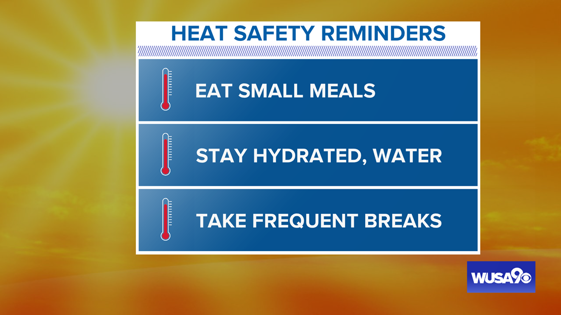
It’s important to take extra safety precautions if you have to be outside during the day, including staying hydrated, taking frequent breaks, and avoiding caffeine and alcohol.

We are currently in the hottest heat wave of the year and the hottest since July of 2019.
While some locations hit 100 on Sunday, D.C. has not hit the century mark yet in 2020. In fact, the last time we were at 100 degrees was August 15, 2016, almost 4 years ago.
The heat wave is expected to continue through midweek, with more 90s Tuesday through to Thursday. Heat index temperatures will stay near 100 degrees until Thursday, too.

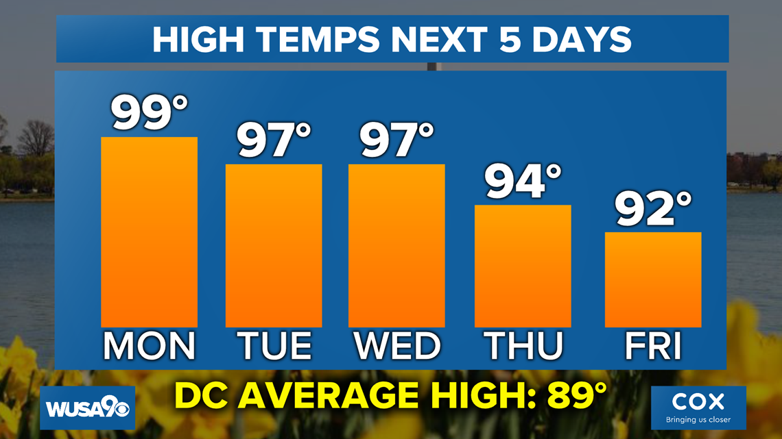
By Thursday evening a cold front will move across the region, bringing less humidity for Friday and slightly cooler temperatures.