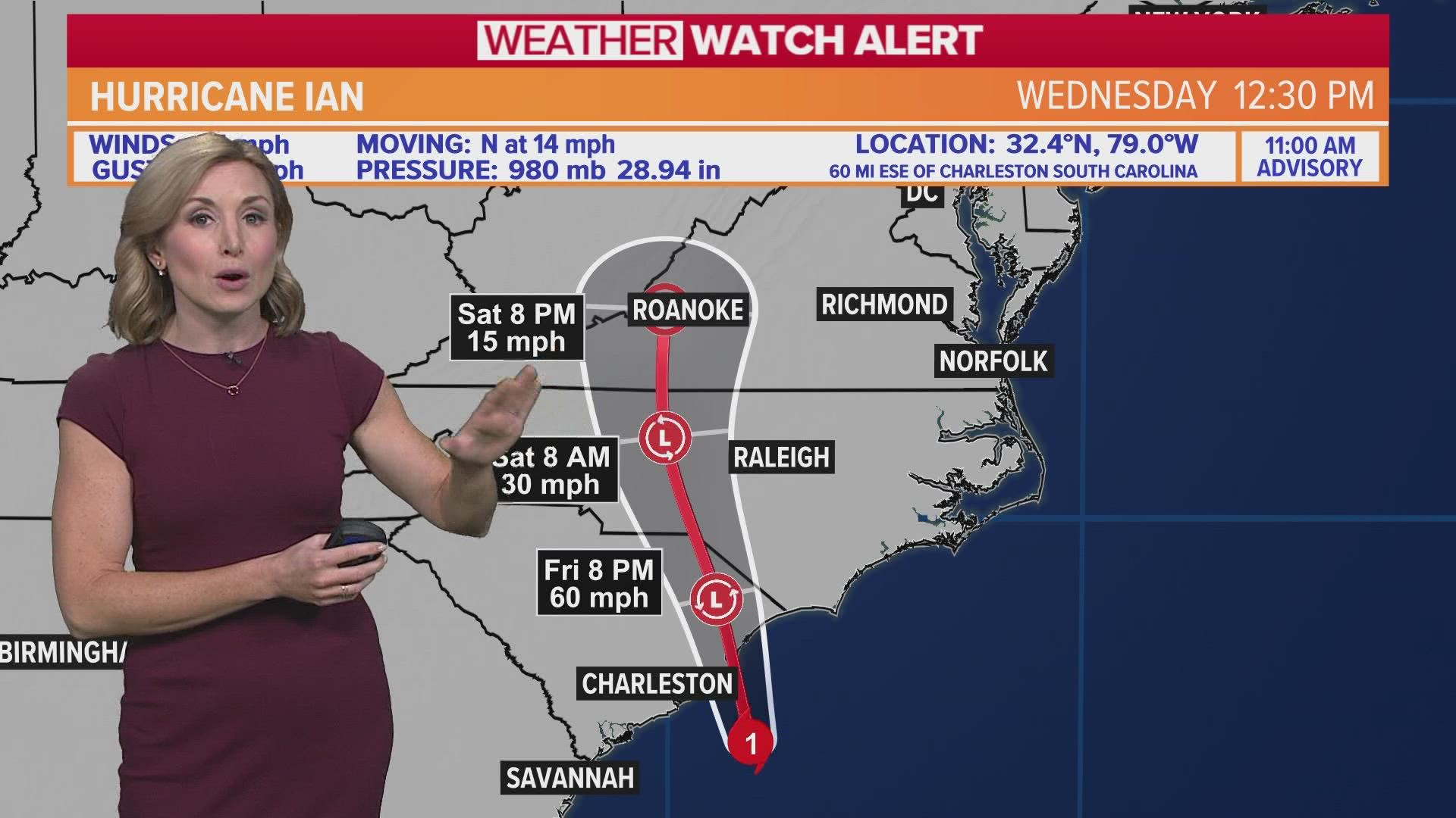
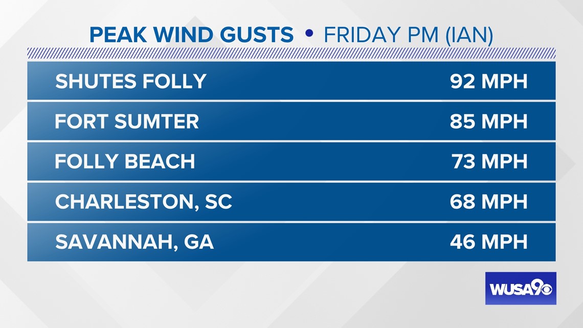
WASHINGTON — Hurricane Ian made landfall near Georgetown, South Carolina at 2:05 pm, which is just north of Charleston. Ian had 85 mph winds as it made landfall Friday afternoon. Ian is now post-tropical as it pushes north through South Carolina.
The storm is forecast to bring heavy rain, flooding, and some storm surge along the east coast, mainly along the Carolina coasts.
On Wednesday, Ian made landfall as a hurricane around 3:05 pm near Cayo Costa, Florida. The Category 4 storm had a maximum sustained winds of 150 mph at landfall.
Cuba Tuesday
Additionally, earlier this week on Tuesday, Hurricane Ian made its first landfall at 4:30 a.m. in Cuba as a Category 3. The storm knocked out most of the Cuba's power grid and destroyed homes and businesses.
We are continuing to learn more about the devastation that Ian caused as it made landfall and tore through central Florida.

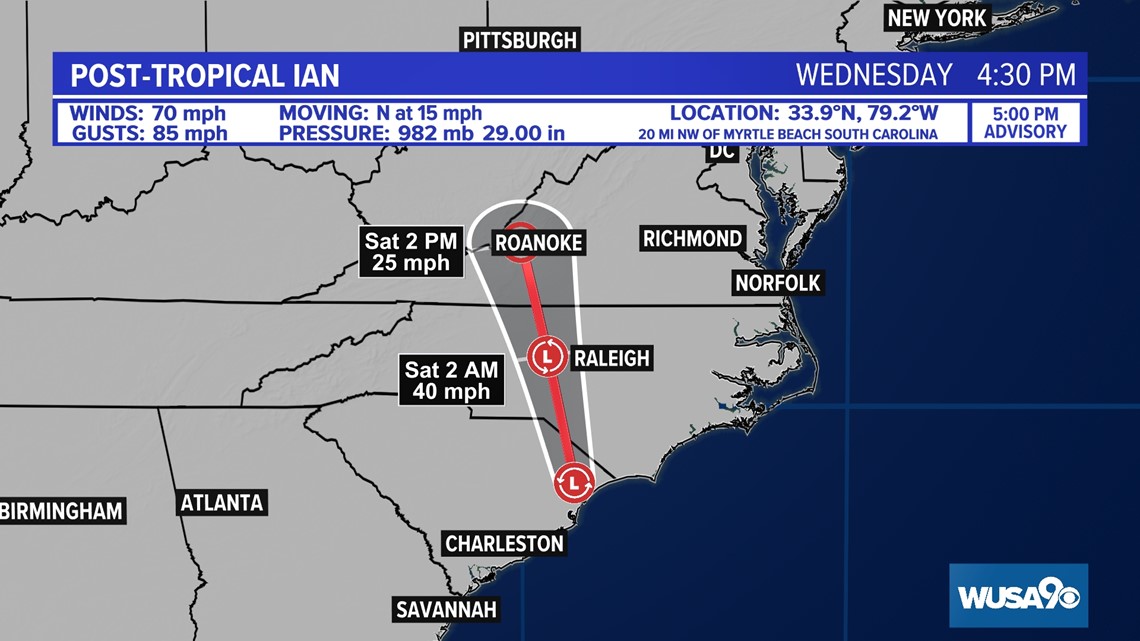
Tropical Storm Warnings remain in effect for South Carolina and North Carolina where tropical storm conditions could persist through tonight.

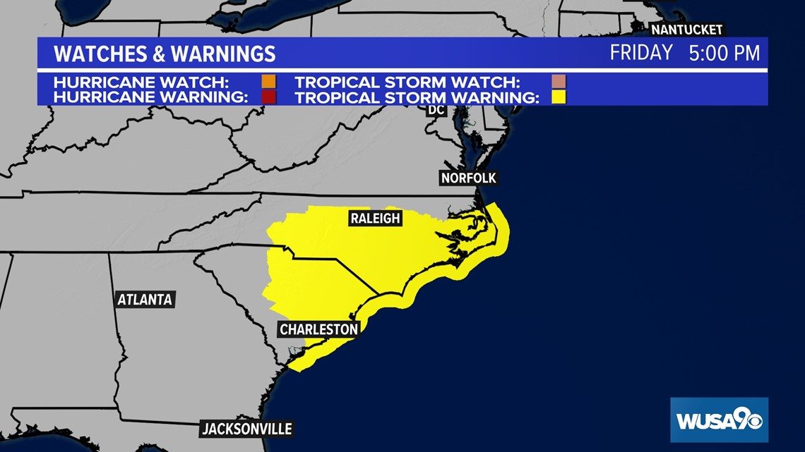
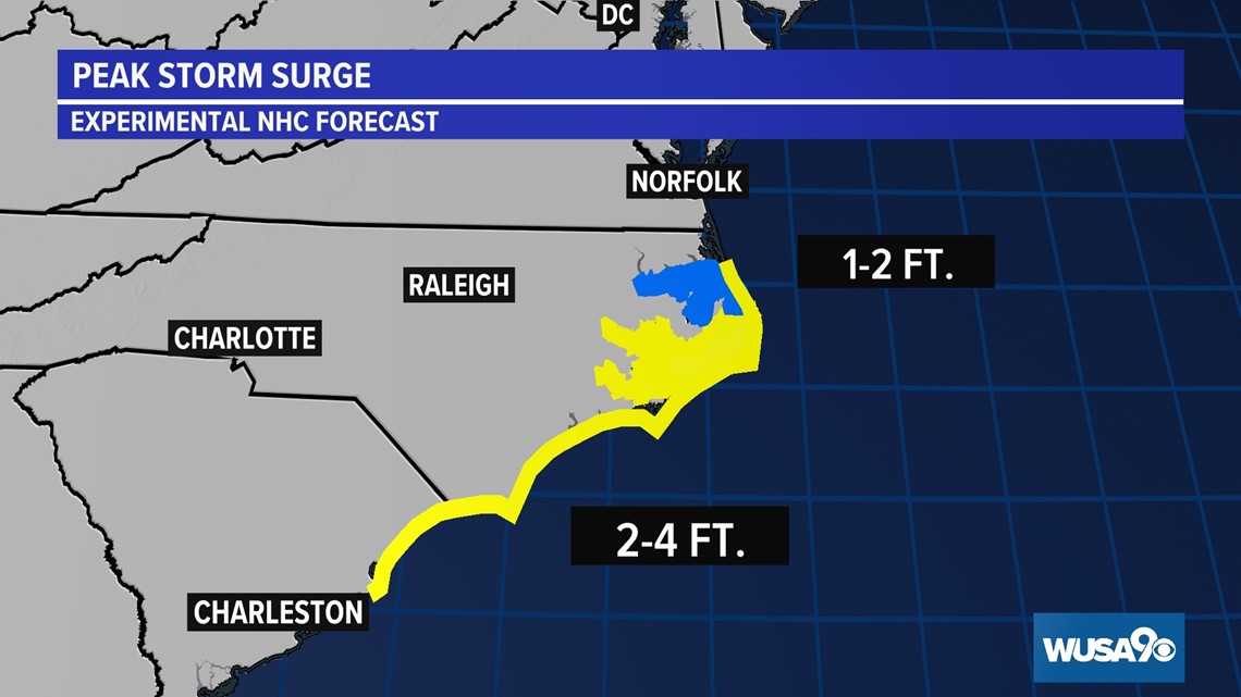
There is still a storm surge through through this evening as strong wind continues to blow onshore.

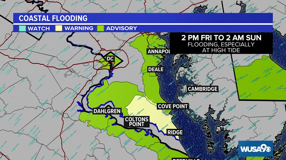
That same northeasterly wind will lead to minor coastal flooding in parts of the DMV. Where the Coastal Flood Warning is in effect for St. Mary's county inundation up to a foot is possible, especially around high tide. Our local beaches may also incur some temporary erosion.



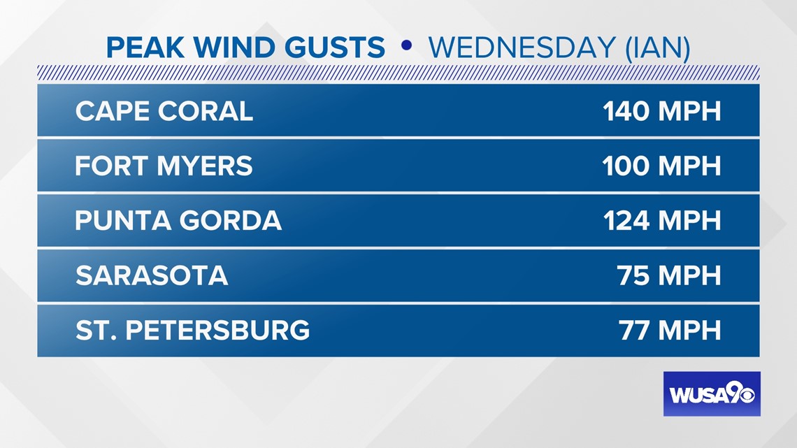
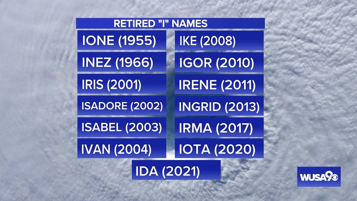
Storms that start with the letter "I" have a bad reputation...and rightfully so. There are more retired "I" names than any other letter.
Hurricane names are retired when a storm is particularly deadly or destructive.

DMV IMPACTS:
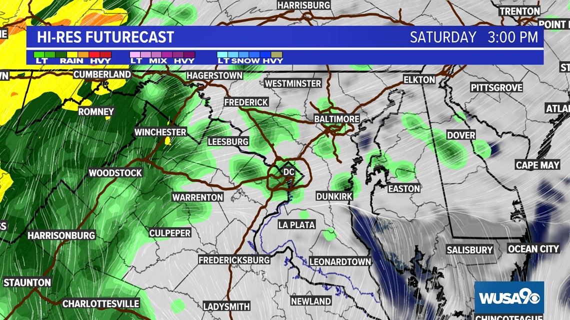
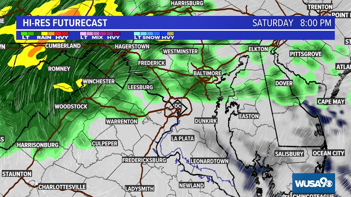
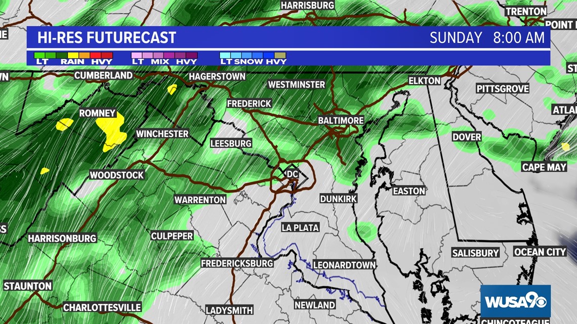
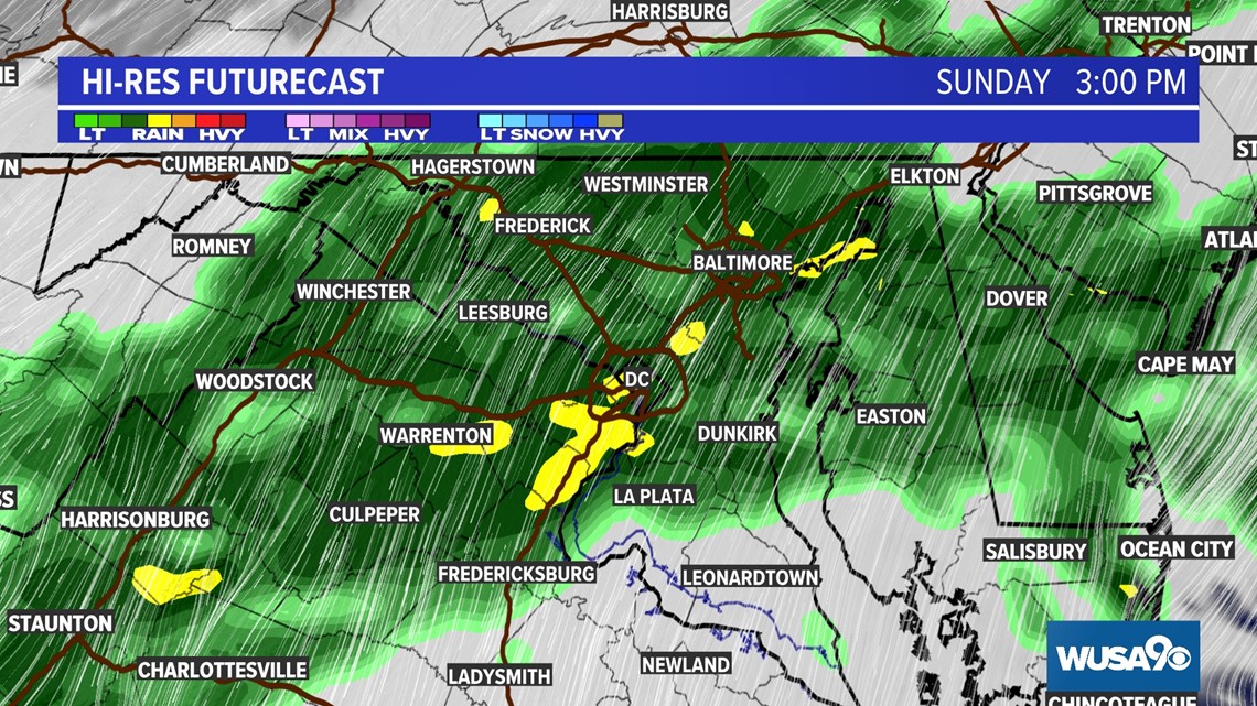
The storm will move over land and weaken, eventually losing tropical features. We will likely see off and on rain from the remnants of Ian late Friday, Saturday, Sunday, Monday and even Tuesday morning.
Our flood risk remains very low because we won't see a lot of rain in a short period of time, rather a lot of rain over several days. We won't see all day washouts either, rather periods of rain with otherwise cloudy skies and cool temperatures.
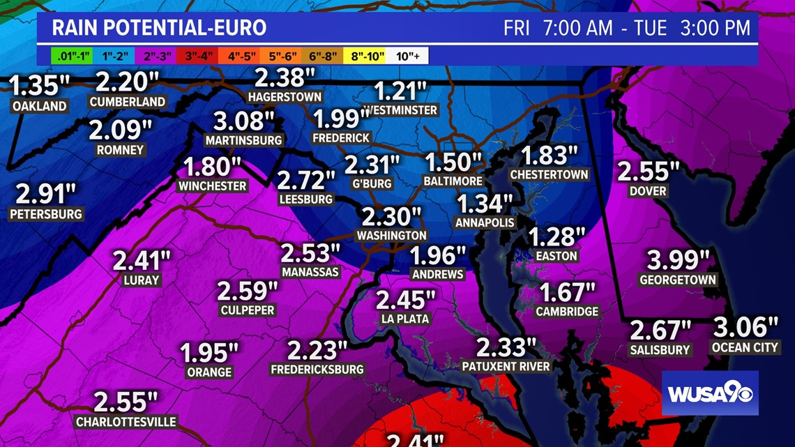
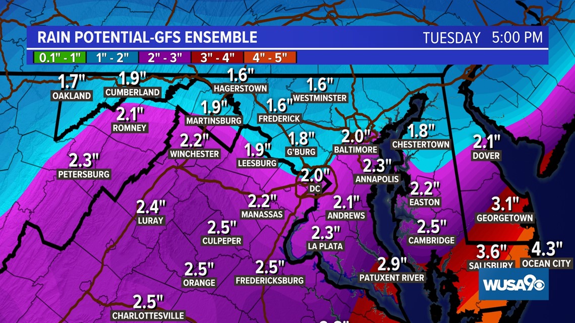
Some models indicate we could see 2" + across parts of the DMV with more rain southwest of DC and less rain northeast by Monday, but over a three day span, that's not enough to cause flooding concerns. The biggest threat would be to rivers and streams that may gradually rise over the weekend.
SATURDAY 3:00 PM

Saturday 8:00 PM

Sunday 8:00 AM

Sunday 3:00 PM

Sunday 8:00 PM

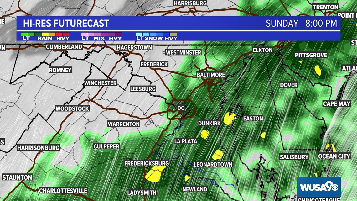
The models are slowly coming into agreement on brining 1 to 2 inches with an isolated 3 inches of rain to the region between Friday night and Tuesday morning.

