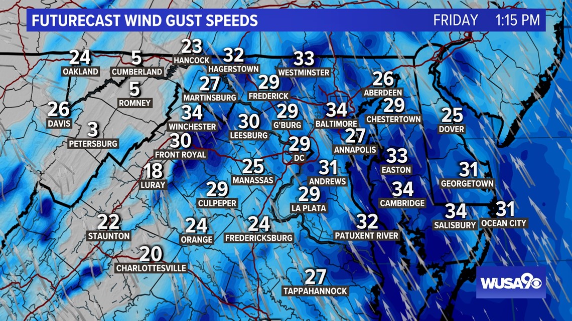
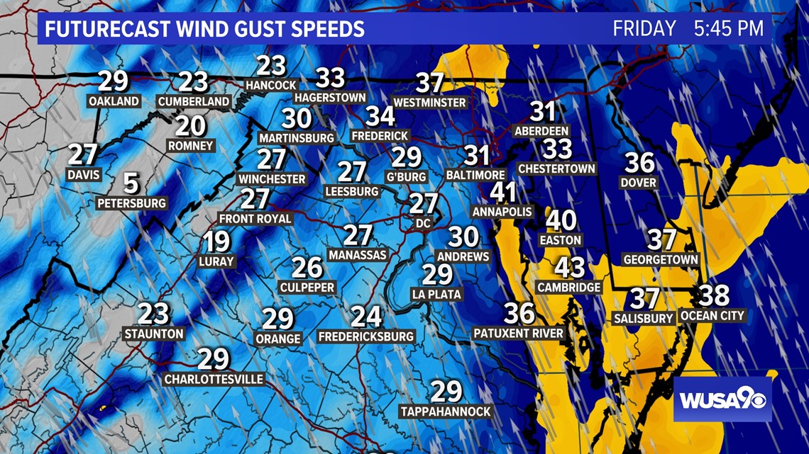
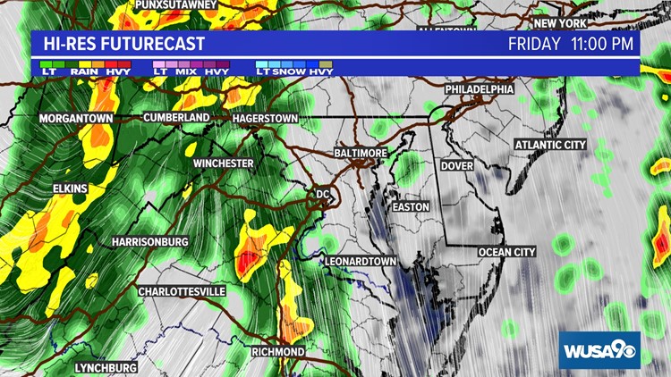
WASHINGTON — Showers will continue for the rest of the day and rain may be heavy at times. There will also be a few thunderstorms, some will be strong to severe. A few storms may produce damaging wind or an isolated tornado.
Right now: Mostly dry with isolated storms approaching from the south. Some of which have a history of rotating.
8 p.m. Last batch of rain spreading SW to NE.
10 p.m. Rain ramps up again, with pockets of heavy rain possible. Strong, damaging wind possible.
11 p.m. Rain, heavy at times. Strong, damaging wind possible.
After midnight- Rain continues until about 3 a.m. After 3 a.m., showers will gradually end.
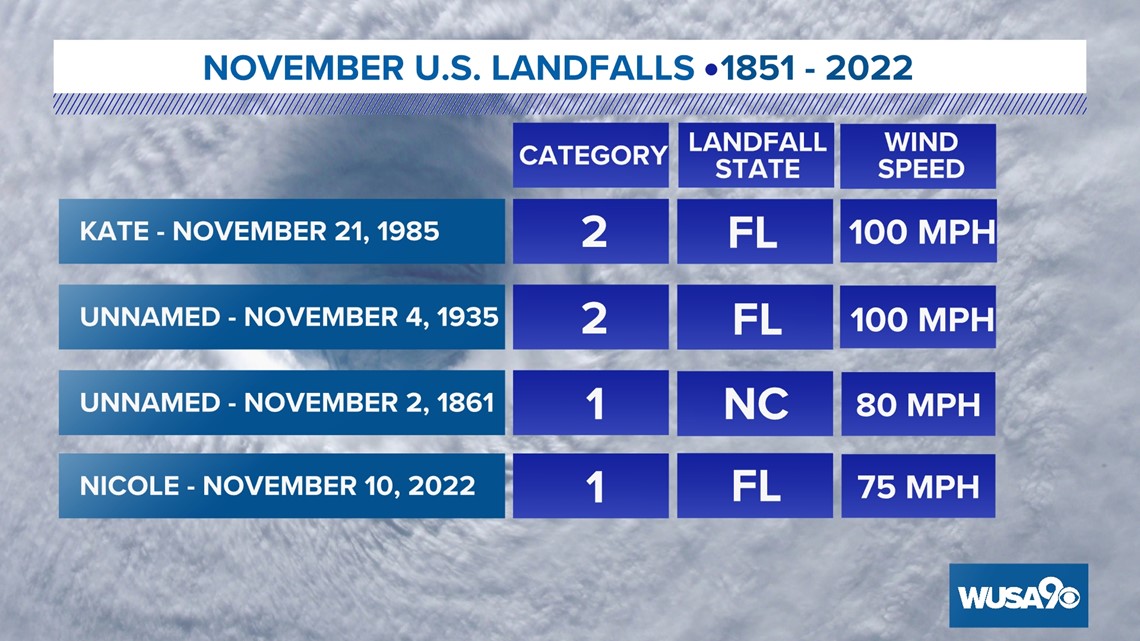
Hurricane Nicole made landfall near Vero Beach, Florida, early Thursday morning. The National Hurricane Center reported the storm had winds of 75 miles per hour.
Nicole is now the 4th strongest storm to ever make landfall in the United States during the month of November replacing Eta that made landfall in Florida as a tropical storm on November 9th, 2020.

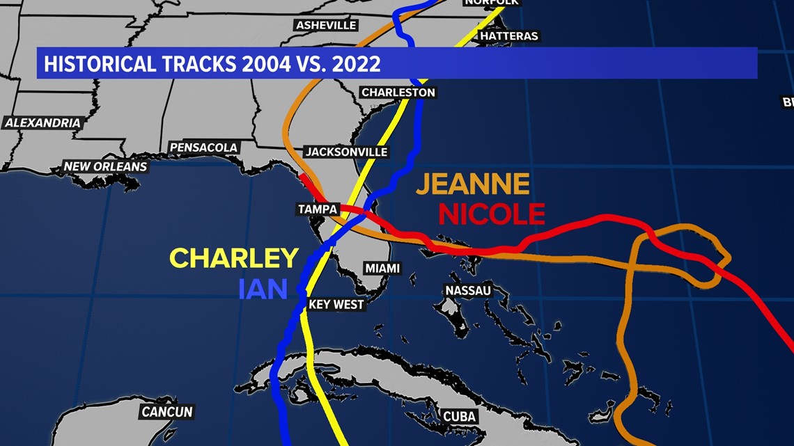
Now this...is kind of bizarre. Charley and Jeanne made landfall 43 days apart back in 2004. The tracks of Ian and Nicole from our current hurricane season are eerily similar. And get this, they ALSO made landfall 43 days apart.


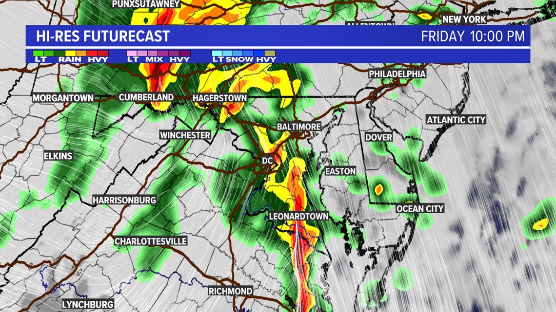
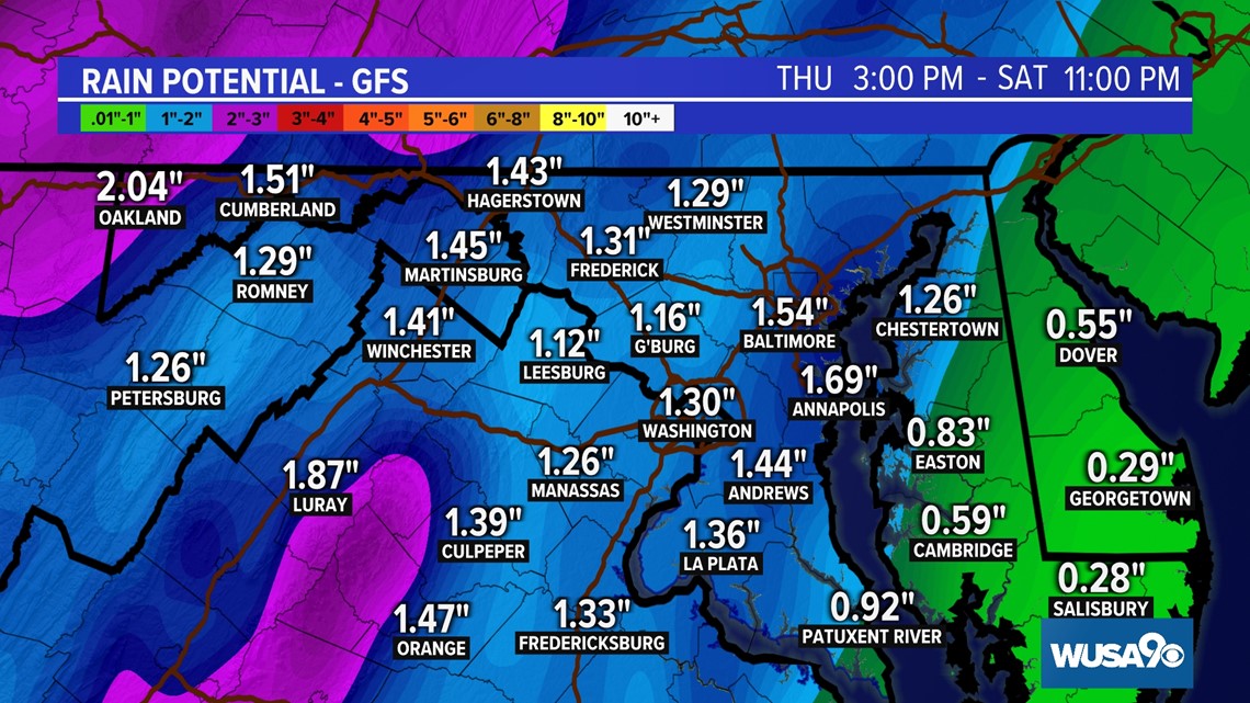
The expected rain isn't enough to cause widespread flooding issues, but pockets of heavier rain (especially in our western counties) could lead to minor flooding.

Gusty wind will start to kick up later this afternoon and last into the overnight hours. Localized gusts up to 30 - 35 mph may snap a few tree branches but widespread wind damage is not expected. Breezy conditions persist into the weekend.

