WASHINGTON — Before making plans this weekend, go ahead and check out our forecast.
Here's what you need to know:
KEY DETAILS:
- Heaviest rain now - 11 a.m. Saturday along I-95
- Flood Watch for most of the DMV until 2 p.m. Saturday afternoon
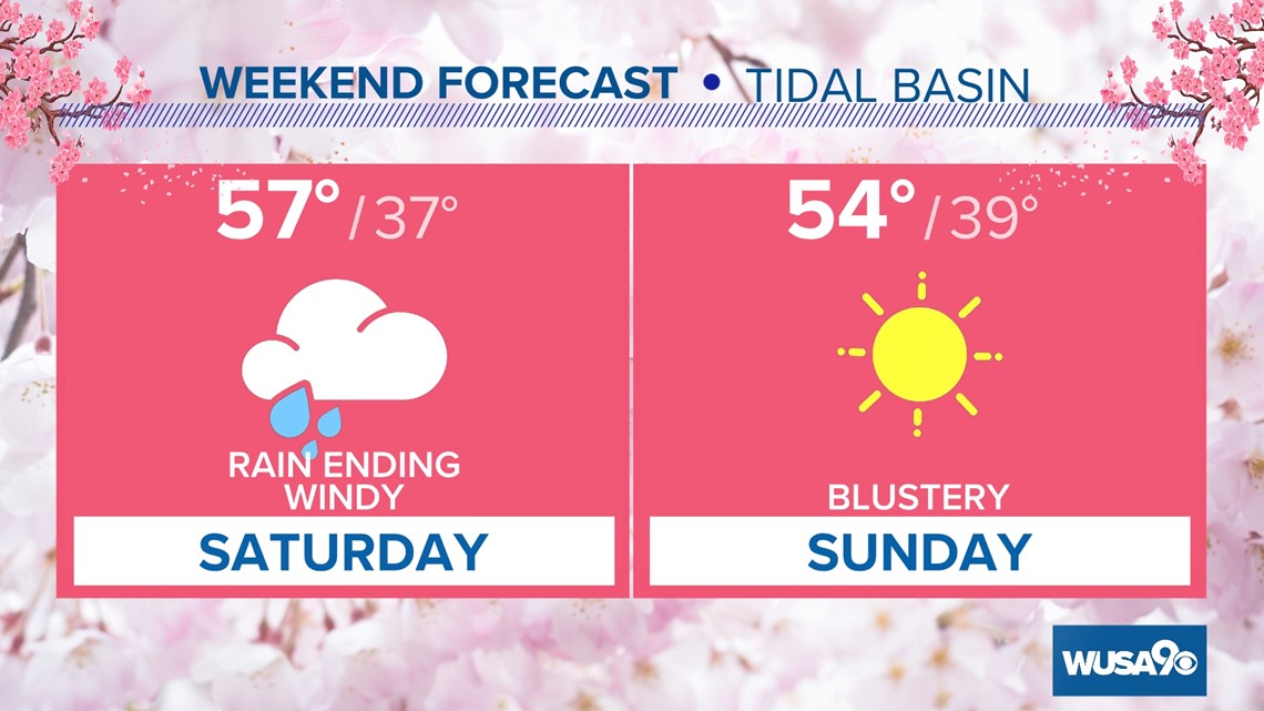
- Rain tapers off after 12 p.m.
- Winds pick up Saturday afternoon
- Gusts 25 - 35, with isolated 40 mph gusts
TIMELINE:
Right now, heavy rain is falling across the area. The heaviest rain will fall between now and 11 a.m. After 12 p.m. the heaviest rain moves away from the area. You may run into an isolated shower, but most of the area will start to dry up. Winds will start to pick up at around 2 p.m.
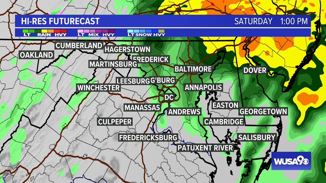
SATURDAY AT 1:00 P.M.
Rain will start to get lighter and end after 12 p.m.

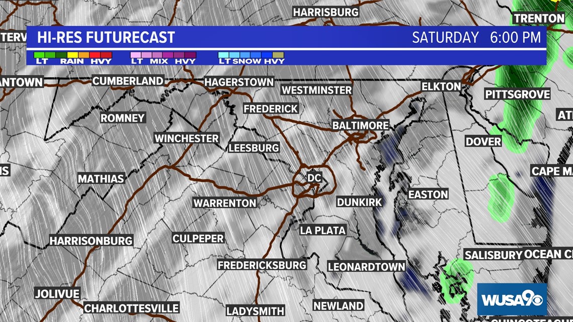
SATURDAY AT 6:00 P.M.
Most of the showers will clear out by 3:00 p.m. and by Saturday evening skies will be clearing as wind picks up.

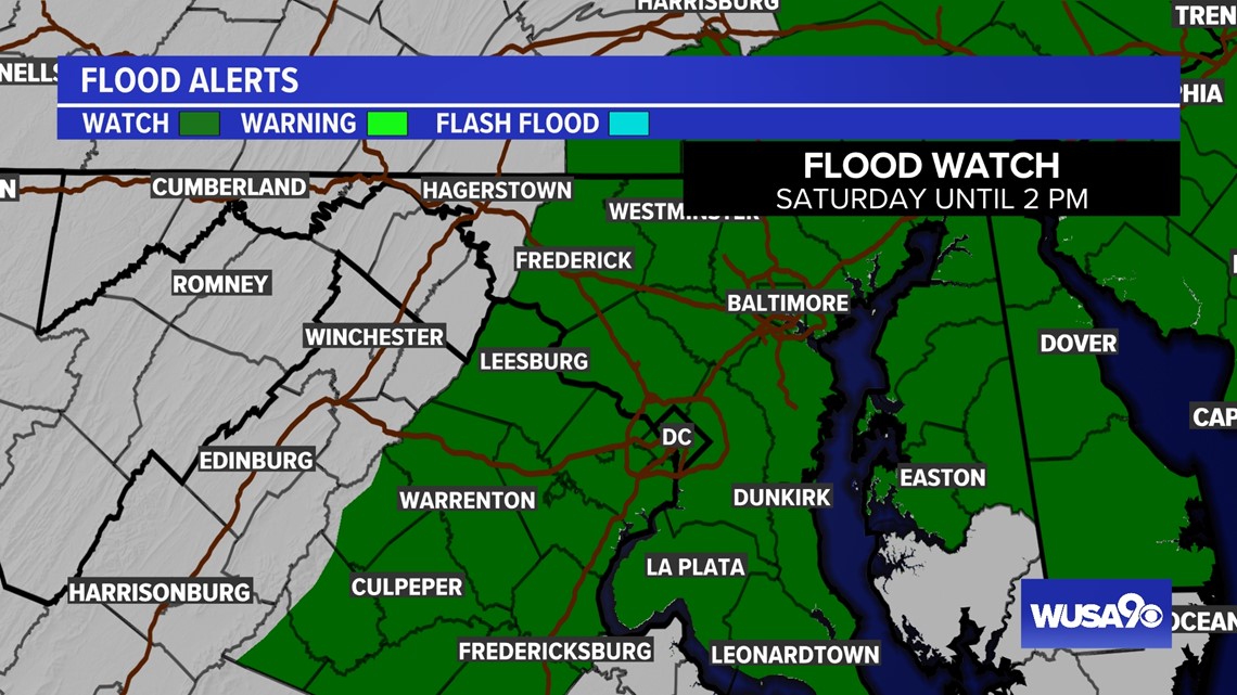
FLOOD ALERTS:
A Flood Watch has been issued for the majority of the DMV through Saturday afternoon.
Take a few minutes on Friday to clear out your gutters and any storm drains near your home to reduce the risk of any flooding.
By the time the rain is over Saturday, some daily rainfall records could be challenged.
March 23 daily rainfall records.
National Airport (DCA): 1.85" (2005)
Dulles Airport, Sterling, VA (IAD): 2.21" (1991)
BWI Airport, Maryland: 2.56" (2005)

HOW MUCH RAIN?
The heaviest rain will be centered around the I-95 corridor and points east. Plan on a widespread 1 - 2" of rain for areas east of I-81 with less rain closer to the mountains. Isolated totals over 2" are certainly possible, especially along I-95.


Try and check out the cherry blossoms along the Tidal Basin before Saturday if you can! Once the trees hit peak bloom, rain and wind are the enemy. The heavy rain and gusty wind will likely bring down quite a few petals over the weekend.
If you can't get out to the Tidal Basin before the weekend, shoot for early Sunday morning.

RELATED: FORECAST: Chilly and breezy Thursday
WATCH NEXT: