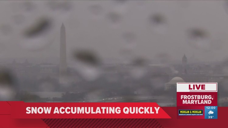
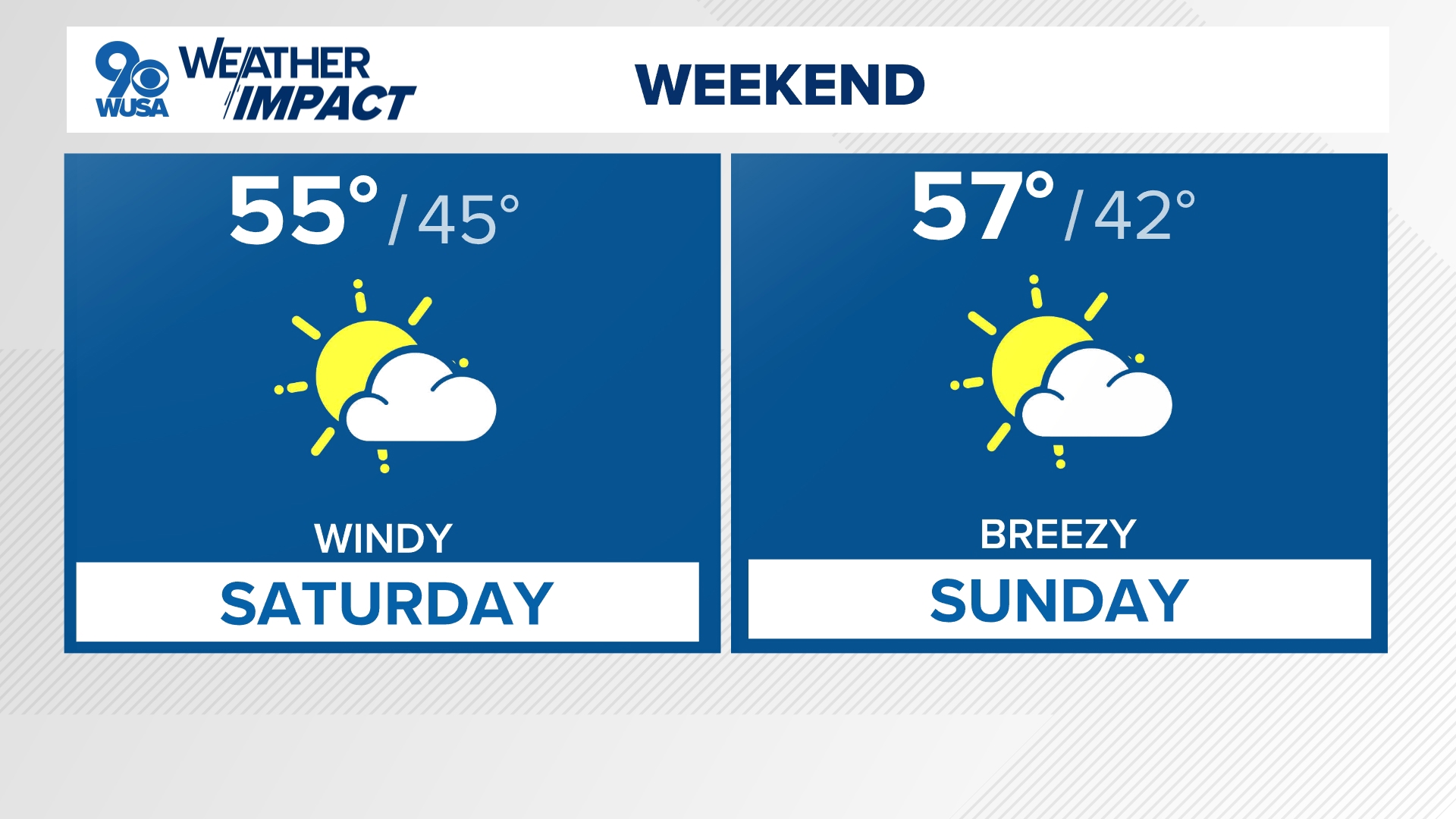
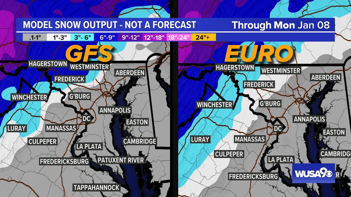
WASHINGTON — The heaviest snow stays well north and west of D.C. with mostly rain and some wintry mix for D.C./immediate suburbs and mainly rain south and east into Southern Maryland to the Bay. The key timing for the most active weather will be between through 5 p.m. on Saturday.
What We Know
- A winter storm impacts the DMV Saturday.
- This is far from a pure snow for the entire DMV, with mainly rain from I-95, points east.
- The heaviest snow will stay along and west of I-81 and north of I-70.
- Stay with WUSA9 and download our app to get the latest on computer model runs as they come in and to stay ahead of the storm.
Weekend Winter Weather Potential
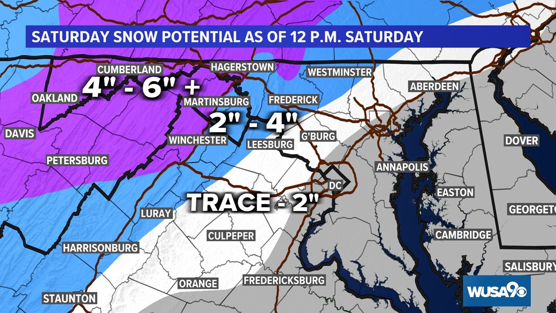
A winter storm continues Saturday, but fairly quickly exits the area by Saturday night. This storm is far from a pure snow in the entire DMV. The best chance for a pure and heavy snow is where it will be coldest, along and west of I-81 and north of I-70.
After about 1 p.m. our immediate northern and western suburbs will shift from accumulating snow to all rain. Surface temperatures will be at or even above freezing but roads could still become covered and slick due to the intense snowfall rate well north and west.
Timeline
Saturday Evening: 6 p.m. - Midnight
The rain and snow will begin to exit the area between 5 p.m. and 6 p.m. Only a stray, isolated shower will be left over after that.
SATURDAY EVENING - NIGHT

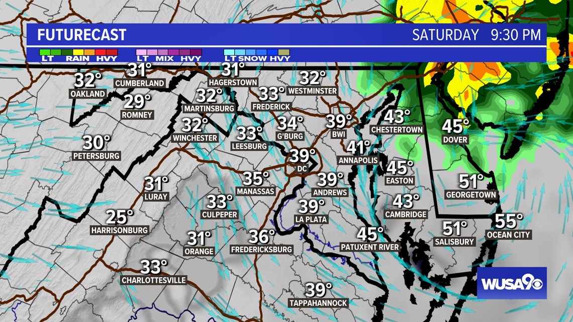
The most impact from significant snowfall is likely north and west over the higher elevations, with the prospect of even some slippery roads lasting into the Monday morning commute.


Winter Alerts
Winter Storm Warnings have been issued for areas below highlighted in white. This includes Martinsburg, Winchester, Hagerstown, Cumberland and Frederick. This is the region where heavy snow (5"+) and accumulating ice (up to .10' to .25") is most likely.
This forecast is evolving and unfolding, so check back in with us through the day for forecast updates.
Do you have a news tip on this story or any other story? We want to hear from you. Tell us about it by emailing newstips@wusa9.com.
MORE WAYS TO GET WUSA9
DOWNLOAD THE WUSA9 APP
Apple App Store: WUSA9 News on Apple
Google Play Store: WUSA9 News on Android
HOW TO ADD THE FREE WUSA9+ APP TO YOUR STREAMING DEVICE
ROKU: add the channel from the ROKU store or by searching for WUSA9.
For both Apple TV and Fire TV, search for "WUSA9" to find the free app to add to your account. Another option for Fire TV is to have the app delivered directly to your Fire TV through Amazon.
SIGN UP TO RECEIVE WUSA9 NEWSLETTER
Subscribe to our daily WUSA9 Newsletter for top stories from WUSA9 curated daily just for you. Get content and information right now for can’t-miss stories, Commanders content, weather, and more delivered right to your inbox.


