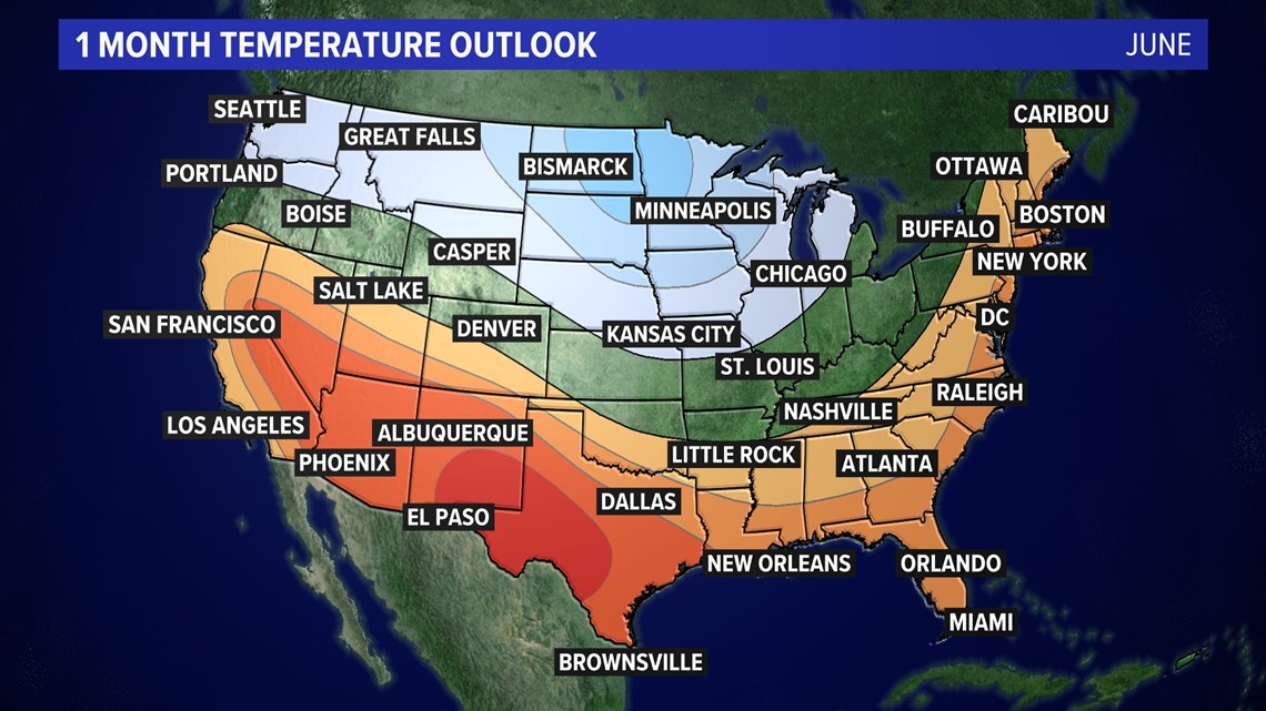
WASHINGTON — June marks the start of meteorological summer and we should expect a warmer-than-average month, according to NOAA’s Climate Prediction Center.
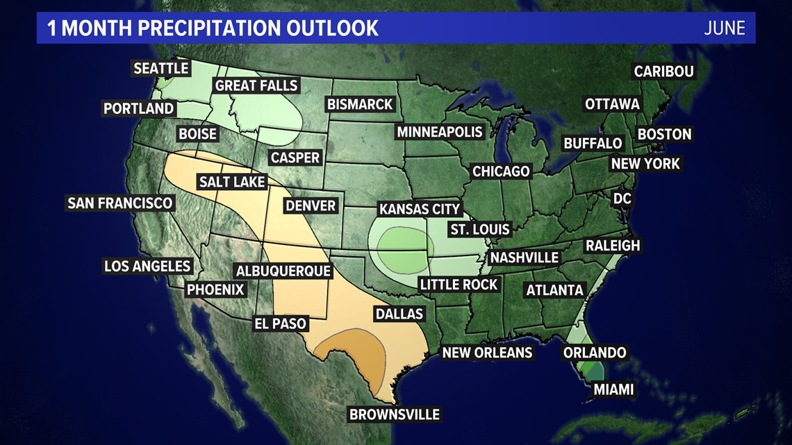
The latest from the climate forecasters at NOAA says June will be warm with near average rain.
The first few weeks of June will feature above normal rain. Meaning we’re in for an active weather pattern as areas of low pressure and the occasional cold front will move our way.
Temperatures for the first half of the month will run close to or just above average. This means a lot of 80-degree days and not too many 90s.
The back half of June, mainly after June 15th, looks hotter for the east coast, including here in metro Washington.
Last June we had near normal temperatures and slightly above normal rain.
June is the 3rd hottest month of the year, based on National Weather Service data. June typically sees high temperatures around 81 degrees at the start of the month, with an average high of 89 by the 30th day of the month.
Average rain for June is 4.20", most of which falls in the form of thunderstorms.


Summer outlook
Meteorologists define the summer period to be June 1st through August 31st. Once again, expect a hotter-than-average summer for the DC region. According to the Climate Prediction Center Summer 2022 is likely to be warmer than average..
In addition to the heat, the latest climate outlook from NOAA has our area (likely) above average in rain. So DC may be in for a wet summer too.

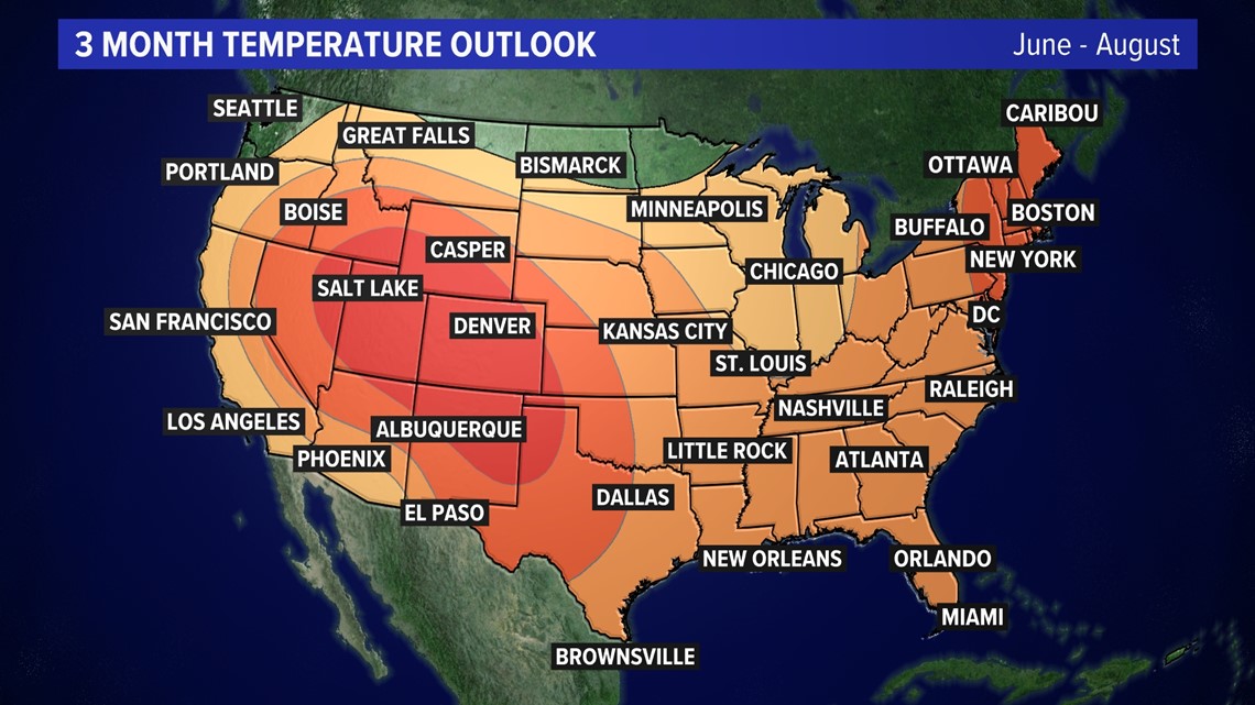

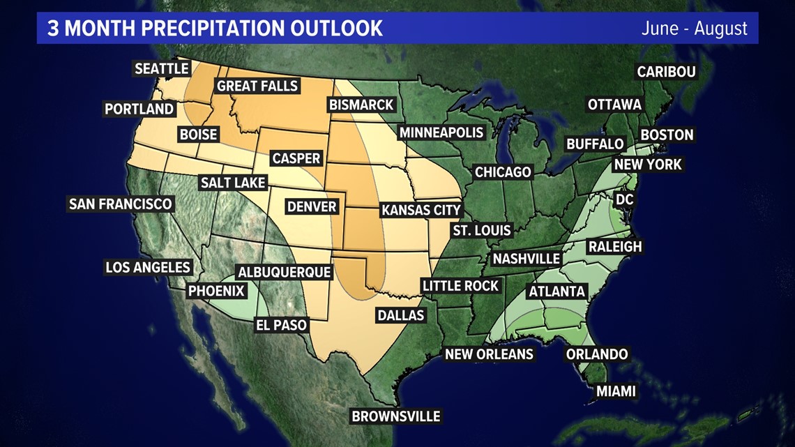
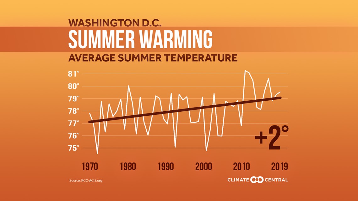
Summers in DC have been trending hotter. Of the top 10 hottest summers on record, eight have happened since 2010, including the hottest summer ever in 2010. Records date back to 1871.
According to Climate Central, summer temperatures have trended 2 degrees hotter since 1970.

