WASHINGTON — Ready for some more snow in D.C., Maryland and Virginia?
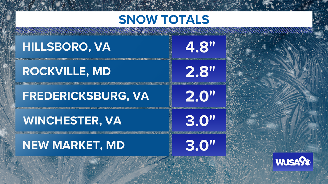
Most areas saw one to 4 inches of snow, with a few areas receiving as much as five inches. Rain and snow should end everywhere no later than 3 p.m.
While surface temperatures will be around freezing -- even a bit above -- the snow will fall faster than it can melt. Roads will become snow-covered and slippery but most of the accumulation will be on grassy surfaces.
The middle portion of the region -- leading from Charlottesville, Virginia through to Dover, Delaware -- may see most of the snow. Communities in this path include D.C., Gaithersburg, Culpeper, Manassas, Leesburg and Frederick.
The map below shows the middle section -- in blue -- where snow models show the most snow may accumulate in the region.
View the map below that gives snow projections for communities in the region:


Here is a look at the amount of snow that has fallen so far on Sunday Feb. 7th.:


Here's the timeline:
Sunday: Noon - 3 p.m. -- Rain/snow gradually end.
Sunday 3 p.m. - 6 p.m. -- A dry afternoon and evening, with wet roads.
Sunday 6 p.m. - Midnight -- Prepare for re-freezing with temps below freezing by 8 p.m. in the suburbs and around midnight downtown.
WUSA9 is the home of Super Bowl LV. You can track the snow with us Sunday morning then watch the game Sunday evening!


