WASHINGTON — If you have outdoor plans for Sunday afternoon, you may want to move them indoors. The WUSA9 Weather Team has issued a Weather Impact Alert for Sunday due to scattered showers and storms.
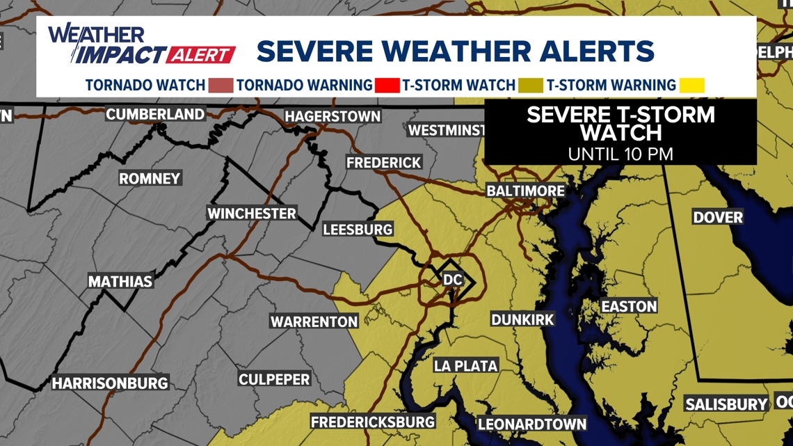
What: Weather Impact Alert for showers and storms. Severe Thunderstorm Watch for the DMV. Flood Watch for parts of the DMV.
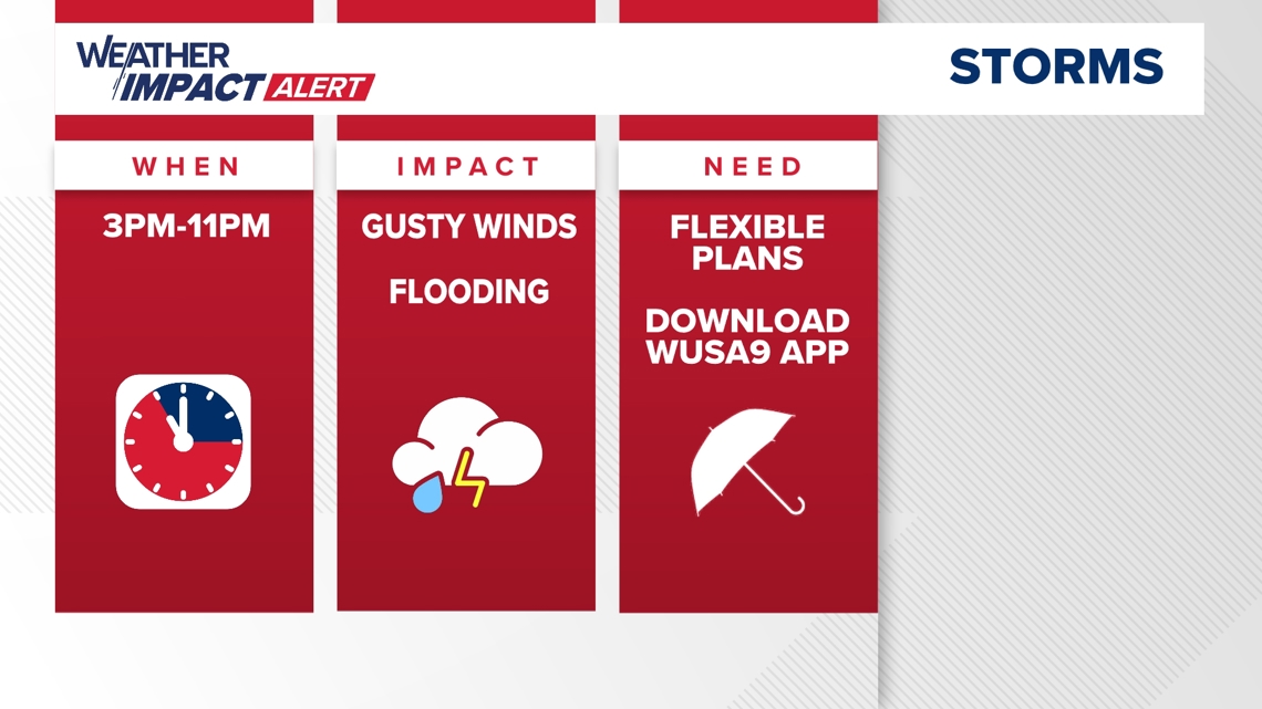
When: Sunday until 11 p.m.
Threats: Heavy rainfall, localized flooding, strong winds, frequent thunder, and lightning.
Impact: Heavy rain may lower visibility while driving, roads may become flooded, weak or unstable tree branches could break, isolated power outages may occur, and outdoor plans may have to move indoors.
Need To Know: Have a way to get weather information and have a plan to quickly get indoors when storms arrive. Avoid driving through flooded roads. Six inches of fast moving water is enough to knock an adult off of their feet; 12 inches of water is enough to float a car and small SUVs; and 18 inches of water is enough to carry away most vehicles.
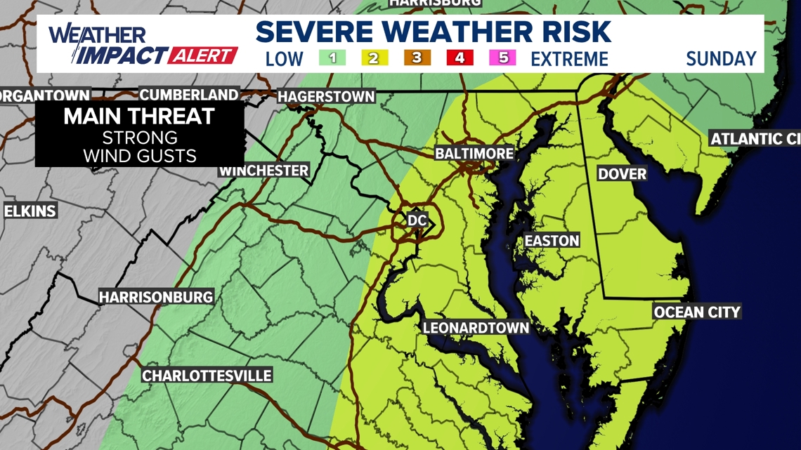
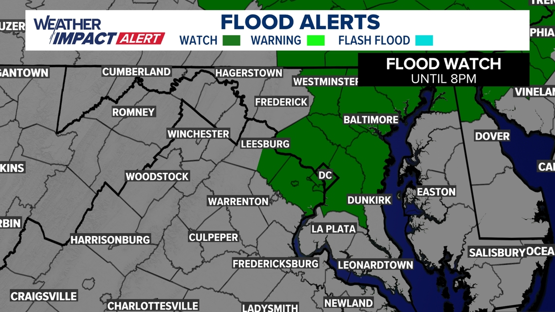
Showers and storms will become more numerous Sunday afternoon and evening. Some storms may become severe, so be sure you have a way to get weather information. Expect heavy rain that could cause flooding, frequent lightning, and strong, damaging winds. The Storm Prediction Center has placed us at a slight risk for severe weather in areas along and east of I-95. This is level 2 out of 5, so scattered severe storms are possible. A Severe Thunderstorm Watch and a Flood Watch have been issued for the DMV.
Areas included in the Flood Watch are: District of Columbia, Maryland, including the following areas: Anne Arundel,
Carroll, Cecil, Howard, Baltimore, Harford, Howard, Montgomery, Prince Georges, and northern Virginia, including the following areas: Arlington/Falls Church/Alexandria, Eastern Loudoun, and Fairfax.
TIMELINE:
Now–11 p.m.: Showers and storms move through the region. The heaviest rain and strongest winds will be in areas along and east of I-95. The D.C. area will see showers between 5 p.m. and 9 p.m.
SEVERE THUNDERSTORM WATCH

ALERT

SEVERE WEATHER RISK

FLOOD WATCH

Do you have a news tip on this story or any other story? We want to hear from you. Tell us about it by emailing newstips@wusa9.com.
MORE WAYS TO GET WUSA9
DOWNLOAD THE WUSA9 APP
Apple App Store: WUSA9 News on Apple
Google Play Store: WUSA9 News on Android
HOW TO ADD THE FREE WUSA9+ APP TO YOUR STREAMING DEVICE
ROKU: add the channel from the ROKU store or by searching for WUSA9.
For both Apple TV and Fire TV, search for "WUSA9" to find the free app to add to your account. Another option for Fire TV is to have the app delivered directly to your Fire TV through Amazon.
SIGN UP TO RECEIVE WUSA9 NEWSLETTER
Subscribe to our daily WUSA9 Newsletter for top stories from WUSA9 curated daily just for you. Get content and information right now for can’t-miss stories, Commanders content, weather, and more delivered right to your inbox.