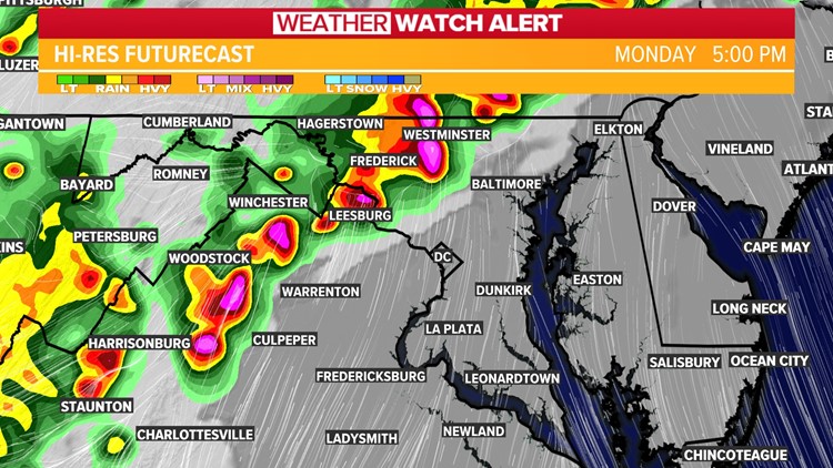
WASHINGTON — Prepare for severe storms Monday afternoon with damaging wind, hail and isolated tornadoes possible. The primary concern is damaging wind with widespread gusts between 60 and 70 mph with isolated gusts even higher possible.
WUSA9 will be watching for isolated tornadoes embedded in the line of storms. Large hail also can't be ruled out.
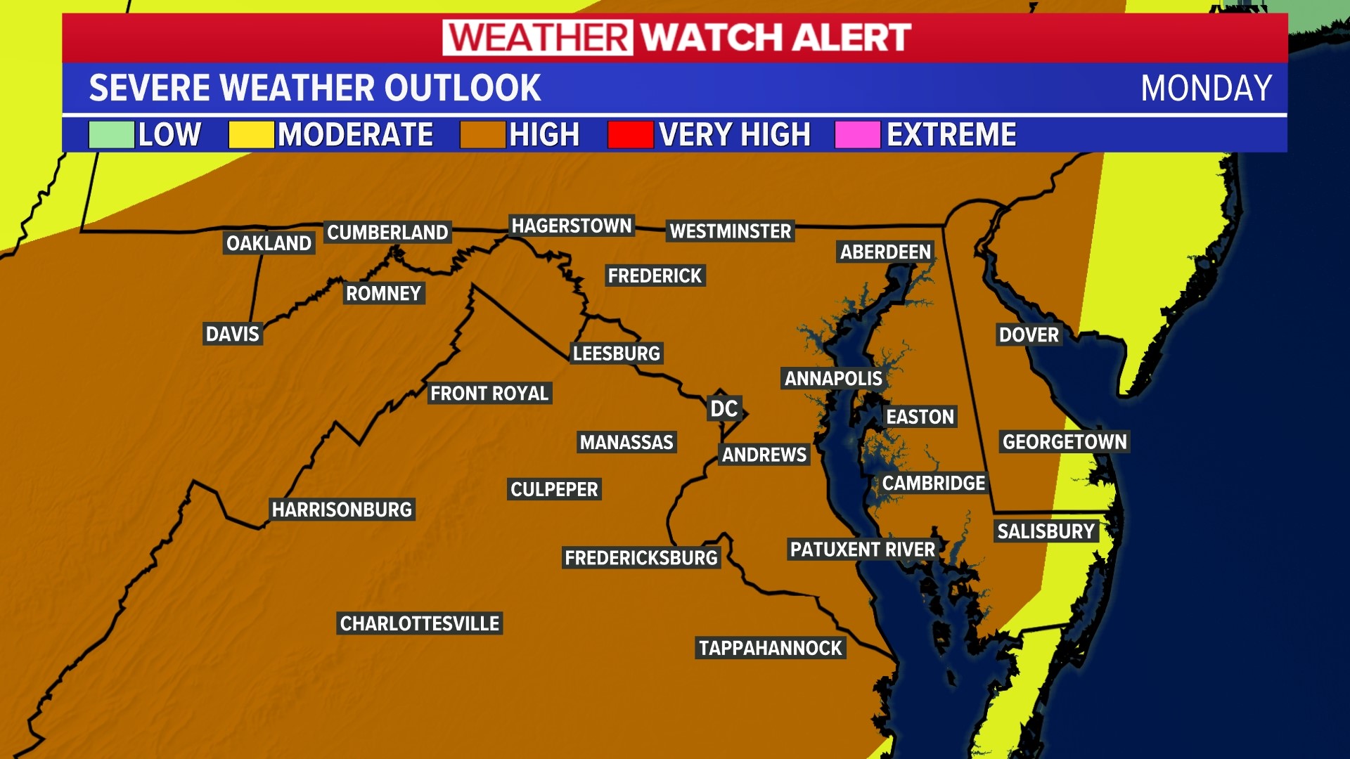
The Storm Prediction Center is telling people to take Monday's weather seriously. For the first time since June 2013, a level 4 out of 5 risk for severe weather in the DMV region has been issued. The Storm Prediction Center puts severe thunderstorms in five categories from 1 (Marginal) to 5 (High). A 4 means risk is Moderate. That means there will be widespread severe storms likely. Those storms are expected to be long-lived, widespread and intense.
A tornado watch was issued for the entire DMV until 9 p.m. Monday.
In addition to the heightened risk across the D.C. region, windy conditions from two weeks ago are another reason our meteorologists are concerned.
Destructive storms blew through D.C., Maryland and Virginia on July 29, uprooting trees, knocking out power lines and leaving many in the dark, both literally and figuratively. The gusty conditions were caused by downburst winds. Meteorologist Kaitlyn McGrath says conditions Monday could help amplify downbursts with gusts 70 to 80 mph.
Trees compromised from last month's winds could fall more easily, and, coming on the heels of wet weather on Sunday, saturated ground could lead to more easily uprooted trees.
The key timing for storms will be now through 10 p.m. with storms first developing along the I-81 corridor and pushing east.
Here's how to prepare:
Have a plan in place and know where you'll go: A small interior room or basement is the best place to go when dealing with strong winds.
Have a way to get alerts: Download the WUSA9 app for the latest weather information
Stay weather aware: We will update you throughout the day as weather develops.


