WASHINGTON — A rainstorm is moving across the Mid-Atlantic on Friday.
For DC, this means a cold, rainy Friday. However, with temperatures at or below freezing across Western Maryland, much of West Virginia, and parts of Virginia, freezing rain will continue to develop.
Temperatures will hold in the 30s and to around 40 in metro Washington during most of the day. Parts of Loudoun and Frederick Counties may see light ice accumulations, especially on untreated surfaces.
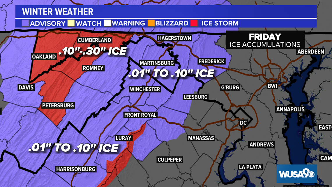
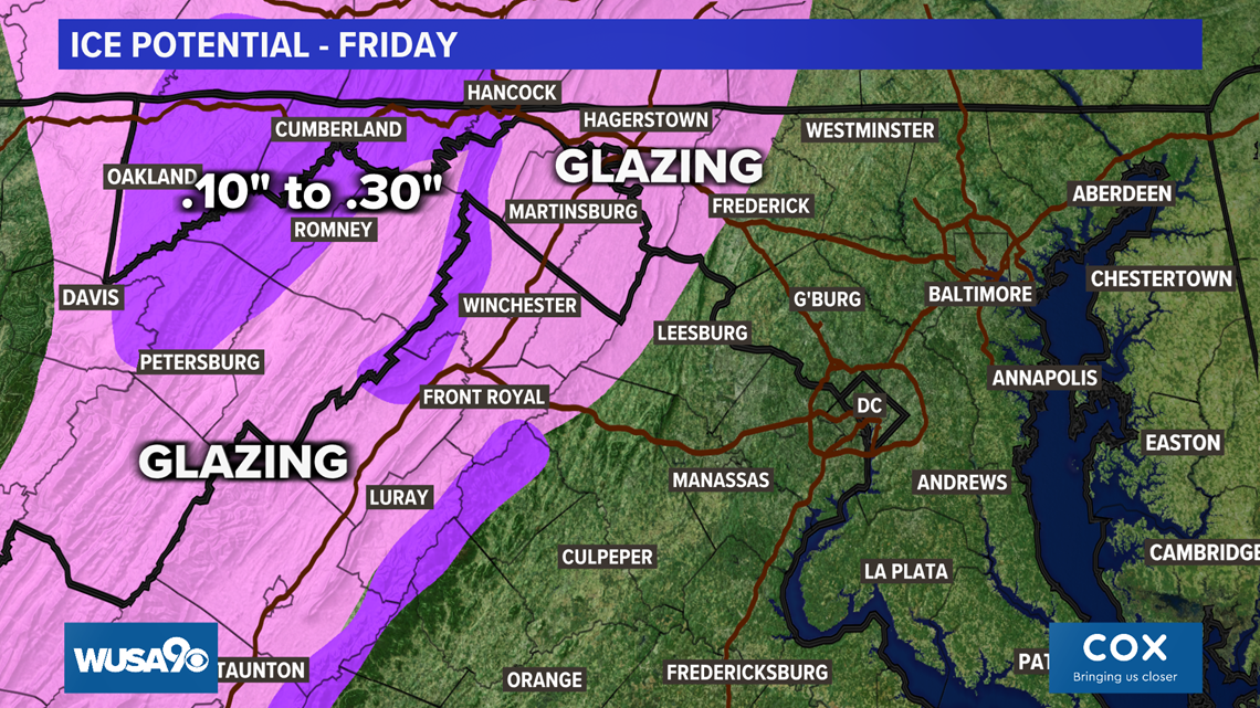
With temperatures near and below freezing north and west of metro DC, some freezing rain is likely throughout the day on Friday. An Ice Storm Warning covers far Western Maryland and portions of West Virginia and the Blue Ridge Mountain tops in Virginia. Up to a third of an inch of ice is possible there on Friday. Elsewhere, winter weather advisories are in in force for light ice amounts. See map below.

Storm timeline Friday:
By Friday evening, warmer air will push across the entire Mid-Atlantic. This will lead to freezing rain and/or areas of sleet to become all rain. All accumulating ice will end and some melting will begin in areas that saw ice. Rain will ease to showers during Friday evening and clear the region by dawn on Saturday.


For metro DC, rain will roll in by the afternoon, with temperatures in the upper 30s. By Friday evening, warmer air will push across the entire region, leading to a high temperature near 40 degrees in DC on Friday night. Rain showers will continue into the evening.
The highest ice amounts will be in far Western Maryland, especially over the Appalachian Mountains and nearby valleys. Up to a third of an inch of ice is possible. For areas between the Blue Ridge and the cities along I-81, a glaze of ice is most likely on untreated surfaces, with most places seeing less than a tenth of an inch of ice.

In areas where freezing rain is forecast, power outages and tree damage is likely. Travel will become hazardous and at times impossible. Prepare for possible power outages, charge up mobile devices, and avoid travel if possible.