Now that it's June, the Atlantic tropical season has officially begun. NOAA's National Hurricane Center issued its outlook for the tropical season last month, and their forecast leans toward a below-average year for storms. (You can see the full forecast here).So far, the Atlantic Basin has been quiet, as no tropical storms have formed. This is certainly good news; however, it only takes one major landfalling hurricane to make for a disastrous tropical season in the United States.
Most of the damage from tropical systems does not come from the wind, or even from all the heavy rain. Instead, storm surge is the biggest culprit. Surprisingly, even though storm surge causes the most death and damage, it is overlooked by many people when they're preparing for the arrival of a tropical system. Maybe this is because the strength of a tropical system is measured by its wind speed and central pressure? Whatever the reason, NOAA is looking at ways to mitigate the risk that can result when people underestimate the threat of an approaching tropical system.
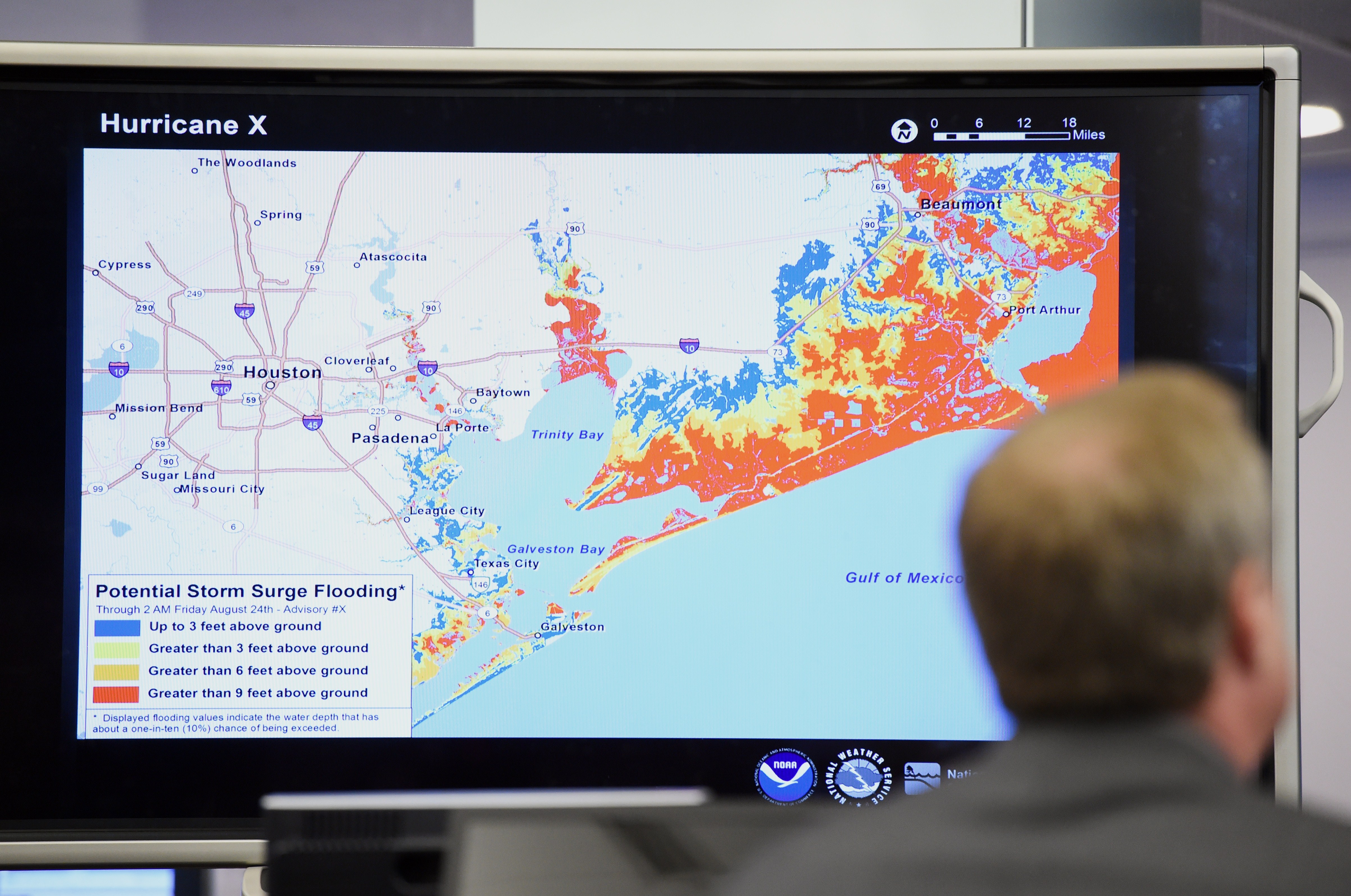
This year, the National Hurricane Center is implementing a new tool that they're hoping will make it easier for all of us to see how dangerous a storm could potentially be at landfall. It's called the Experimental Potential Storm Surge Flooding Map. You can take a look at the map here. http://www.nhc.noaa.gov/news/20140131_pa_stormSurgeGraphic.pdf
This map is the result of many years of research and collaboration. The map will be updated every 6 hours as a tropical storm or hurricane approaches land. This means that we'll get frequent updates in case the storm's path changes, or if the intensity of the storm varies. The map shows land areas that are expected to be impacted by storm surge, and the forecast of the storm surge height. Both of these pieces of information will be tremendously useful, especially for people who live in hurricane-prone areas.
The storm surge map does have limitations, however. The amount of flooding due to rainfall is not taken into account. This means that the storm surge map cannot be used as a "worst-case scenario" map for flooding at a person's coastal home, for example. The map doesn't account for wave height, either. So, the final water level will likely be higher than the storm surge prediction, especially in areas of high winds and heavy wave action. But since storm surge is a complete inundation of water, this tool has the potential to make a huge impact on how well people prepare for an approaching tropical system. That said, let's hope that the storm surge potential map doesn't have to get used too often during this tropical season!
). So far, the Atlantic Basin has been quiet, as no tropical storms have formed. This is certainly good news; however, it only takes one major landfalling hurricane to make for a disastrous tropical season in the United States.


