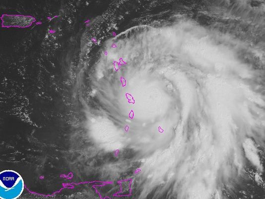
It has been a busy hurricane season with an unusual number of major hurricanes. Here's a look at a few terms that forecasters use in technical discussions when tracking the storms. Some of of these terms have been used when tracking Hurricanes Maria, Irma and Harvey.
Pinhole Eye - Forecasters at the National Hurricane Center, mentioned this feature as they track Hurricane Maria. Forecasters use this term to describe an unusually small eye of a hurricane. Some storms with a smaller eye can get stronger as storms around the eye spin more quickly.
Moat - A moat describes the area between the eye wall of a storm and an outer rainband. Usually relatively light rain is found between this region of the eye wall and the rainband.
Rapid Intensification - This is used to describe a situation when the maximum sustained winds in a tropical cyclone increase at least 30kts (roughly 35 mph) in a 24 hour period. Maria underwent rapid intensification.
Neutercane - This is used to describe a small system that has features of both a tropical cyclone and a mid-latitude cyclone. (Mid-latitude cyclones help drive our normal weather patterns and usually include a low pressure system with warm and cold fronts.) But you may not hear this coming out of forecasters mouths anytime soon. In the 1970s, government forecasters stopped using the term because of complaints that the term was sexist. They are now officially referred to as "sub-tropical cyclone".
Dvorak Technique - This is a technique that is used to estimate the intensity of a tropical cyclone. Satellite images are used help get these estimates.
Major Hurricane - You may have heard forecasters use this term. It describes a hurricane that is category 3 strength and above. Winds with these storms are 111 mph and stronger. Maria, Harvey, Irma, and Jose were all major hurricanes.


