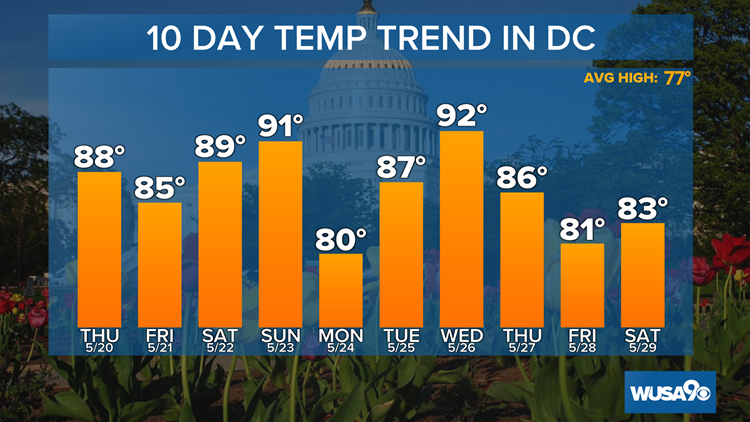
WASHINGTON — The last time that D.C. (National Airport) hit 90-degrees was on September 4, 2020, when we reached 91 degrees. That's more than 8 months. We could see that streak end before the week is out. We hit 93 degrees Thursday and more 90s are on the way this weekend.
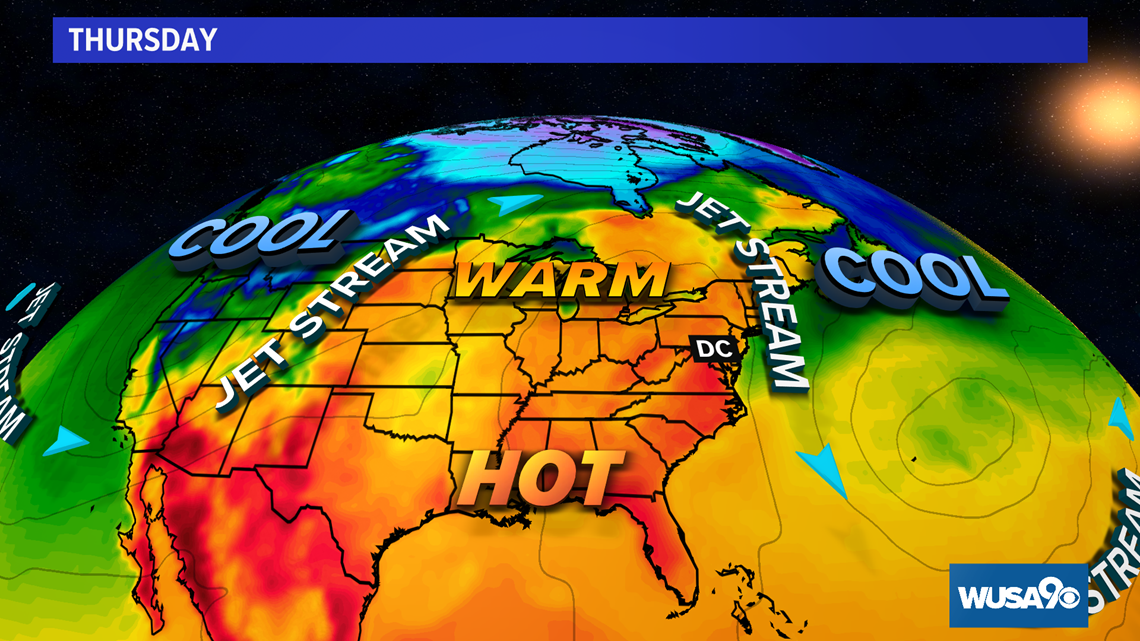
Friday the 'Jet Stream' (upper-level winds that push storms along) was still dropping across southeastern Canada, where the cooler temps are, but we are now getting into the warm/hot air.. As it becomes warm to hot the humidity stays in check through Friday, but creeps up over the weekend.

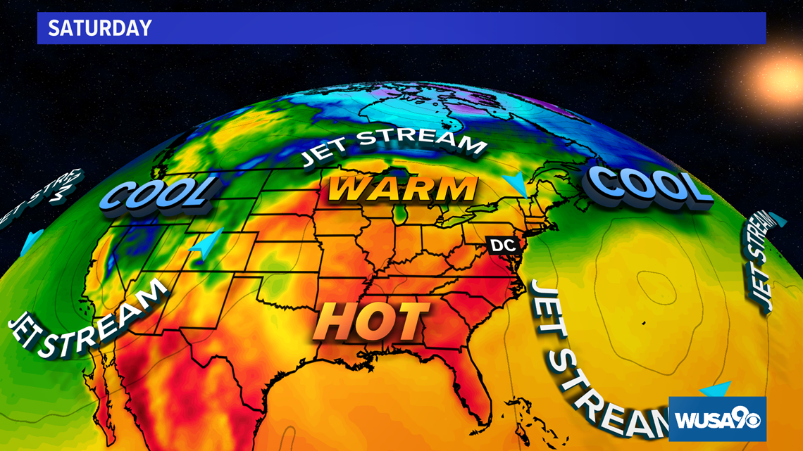
By the weekend, the 'Jet Stream' will rise more into Southern Canada and that will allow much warmer weather to move into much of the Eastern U.S. Rain chances around the DMV still remain rather low.

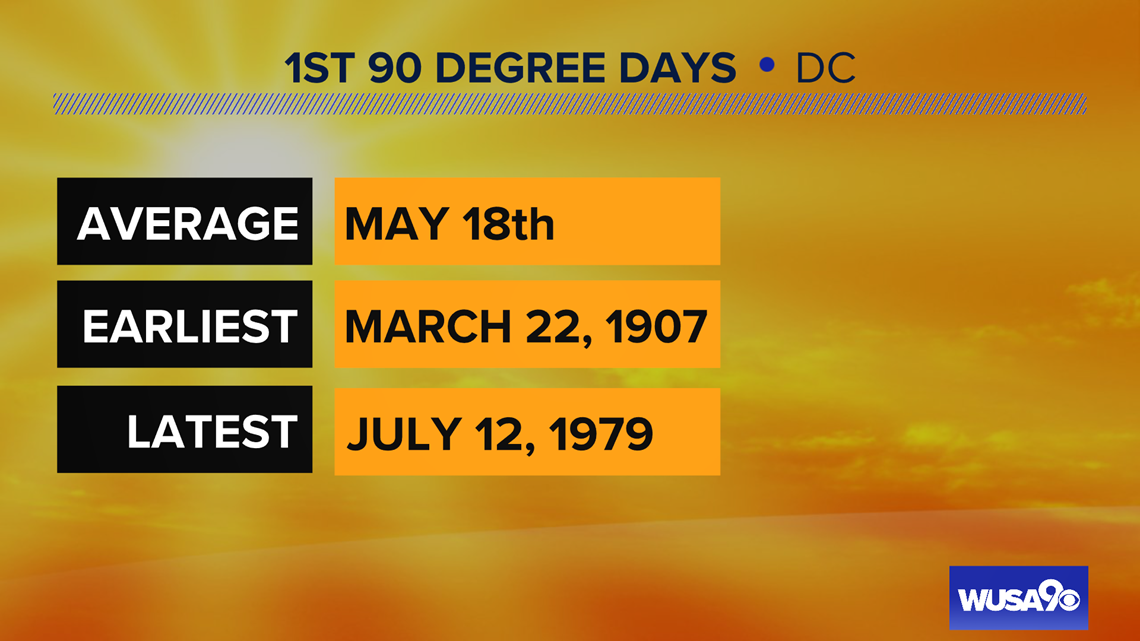
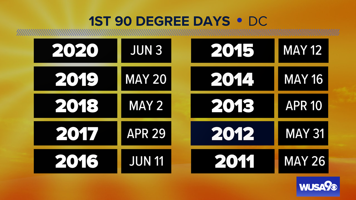
Reaching 90 degrees in mid May is not unusual. In fact, it is about average.


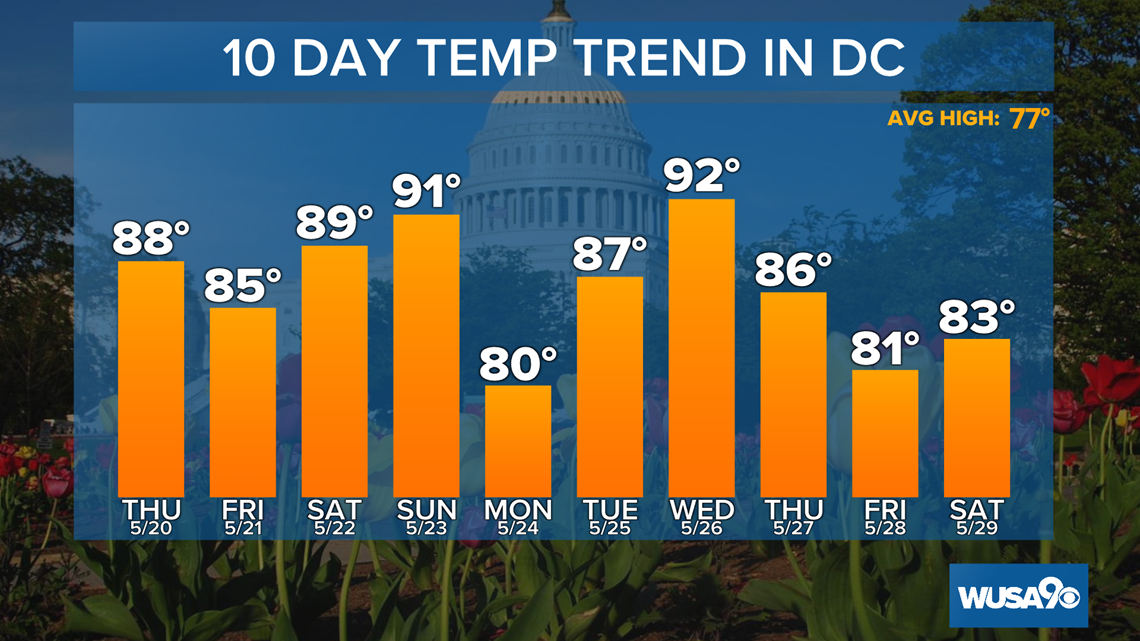
As of Wednesday night, forecast high temperatures for D.C. will be above average for the next 10 days with rain chances staying very low.

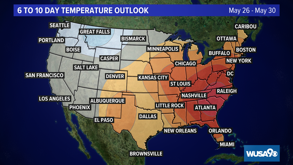
A look even farther into the future from the Climate Prediction Center shows the highest probabilities of above average temperatures centered just southwest of D.C. in the 6 to 10-day outlook with areas in the Northwestern U.S. with the highest chances of seeing below average temperatures.

One thing that does stay low is the threat of rain, and we really could use some. As of Thursday, Reagan National Airport was running a deficit of 2.42" since March 1.
Here's the latest Daily Climate Report for Washington, D.C.
Sign up for the Get Up DC newsletter: Your forecast. Your commute. Your news.
Sign up for the Capitol Breach email newsletter, delivering the latest breaking news and a roundup of the investigation into the Capitol Riots on January 6, 2021.

