WASHINGTON — The nation's capital will have its first heat wave of the summer starting Monday, June 17, with highs in the low 90s. A "heat wave" is loosely defined as three or more consecutive days with highs of at least 90 degrees. With highs in the 90s forecasted through the weekend, this could be one of D.C.'s most significant heat waves in recent memory, lasting at least seven consecutive days.
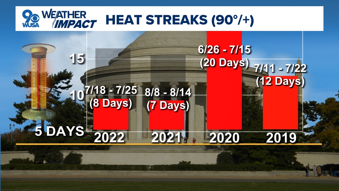
There hasn't been a heat wave of that magnitude in the nation's capital since an 8-day stretch from July 18 to July 25, 2022. That was the longest heat wave in Washington, D.C. since a 20-day stretch from June 26 to July 15, 2020. No triple-digit heat occurred during either of those heat waves.
The nation's capital hasn't actually experienced triple-digit heat in nearly eight years. D.C.'s hottest temperature during all of last year was 99 degrees on September 5.
June is D.C.'s third hottest month of the year on average, according to NOAA, narrowly behind July and August. Over the last 30 years, the nation's capital has averaged between 7 and 8 days in the 90s and one day of triple-digit heat roughly every six years.
Meanwhile, D.C. residents haven't seen triple-digit June heat since 2012, making the nation's capital overdue for it. That's important to remember as my colleagues and I on the WUSA9 Weather Team are watching the potential for high temperatures to reach the upper 90s by the end of the week and next weekend. That's just the air temperature, not accounting for humidity.
The combination of high temperatures in the 90s with an increasing amount of relatively humidity will produce heat index temperatures above the triple-digit mark. The "heat index" is summer's equivalent to wind chill and is what a person feels when the relative humidity is combined with the air temperature for an "apparent" or feels-like temperature.


Heat waves are not uncommon in the nation's capital during the summer months. That's when a semi-permanent area of high pressure sets up off the southeast coast of the United States. It's sometimes referred to as the "Bermuda High" since that's where they are often centered. The clockwise winds around this seasonal area of high pressure usher in hot and humid air northward from the deep south into the Mid-Atlantic Region.
WATCH NEXT:

