WASHINGTON — High heat continues through the start of the week as high pressure continues to build over our region.
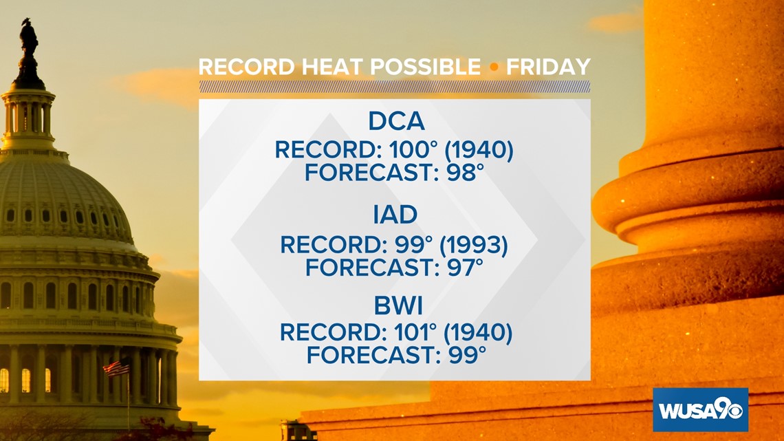
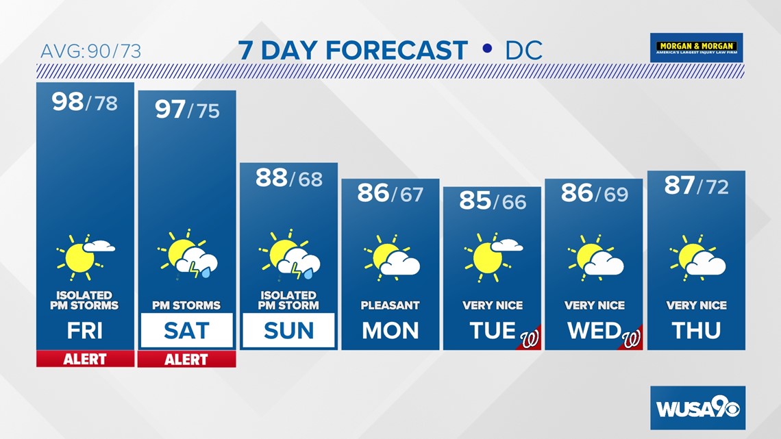
We will likely fall short of records Friday with high temperatures topping off in the upper 90s.

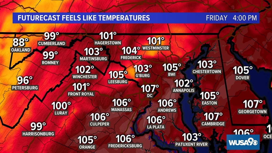
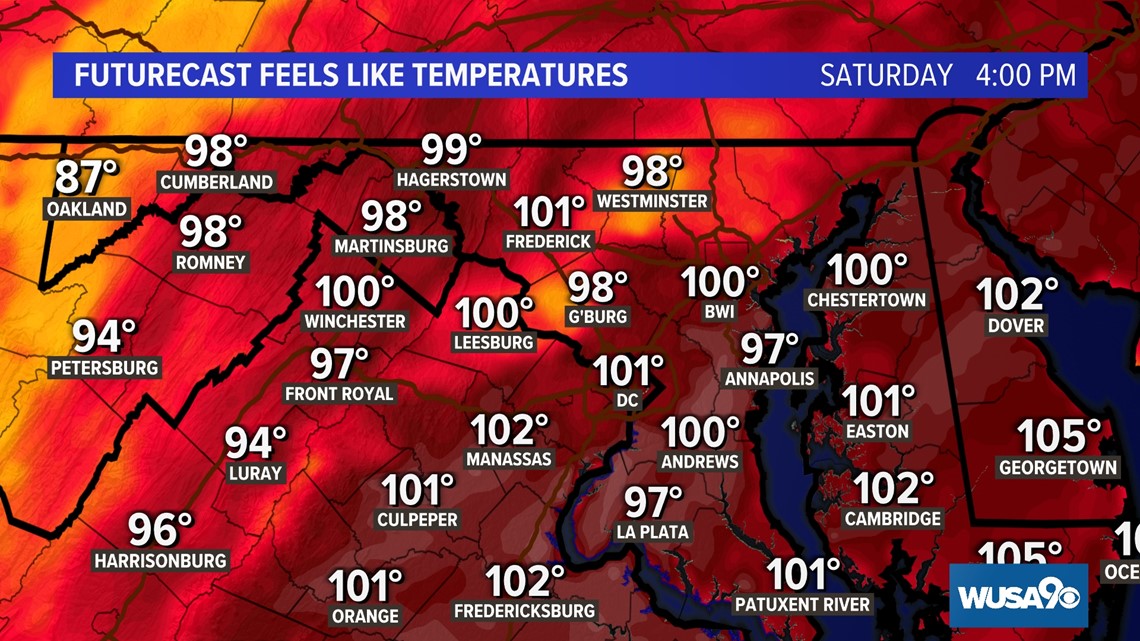
A Heat Advisory will continue until 8 p.m. this evening before an Excessive Heat Warning goes into effect for Friday. Areas highlighted under a Heat Advisory should plan on temperatures feel like 105 degrees. Regions under an Excessive Heat Warning could experience heat index values up to 110 degrees.

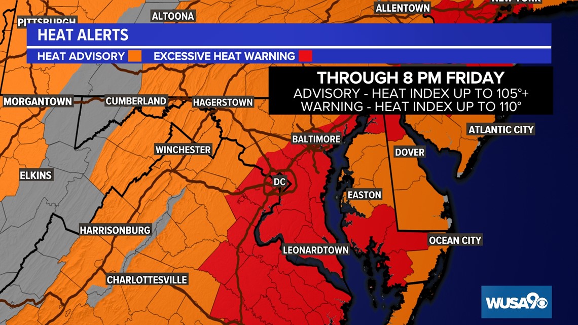
Friday Heat Index

Saturday Heat Index

This is the kind of heat where hot weather safety precautions should be taken. A few reminders:
- Check on elderly, children and pets
- Wear light-weight, light-colored, loose-fitted clothing
- Avoid high-energy activities midday
- Drink plenty of hydrating fluids
- Seek shade when possible
The high heat won't last long. A cold front over the weekend will usher in more seasonable temperatures in the low 90s and lower humidity. With that cold front comes the chance for thunderstorms both days. Be sure to check back in throughout the week as we fine tune the timing of wet weather.

RELATED: El Niño: VERIFY Fact Sheet


