WASHINGTON — Grab the jackets and hot drinks as fall marks the start of a cool down for the D.C. region.
While Sept. 22 marked the start of astronomical autumn, for meteorologists, fall began on Sept. 1.
Without getting into too many details on why the differences, the basic idea is the weather starts cooling off in early September with the months of June, July and August being the hottest months of the year on average.
Still, September is the fourth warmest month of the year in the D.C. region. So far, 2021 has lived up to the hype with temperatures running 1.4 degrees above average as of Sept. 23.
The latest weather model data and information from the Weather Prediction Center call for near-normal temperatures and precipitation chances to close out the month of September. The average high temperature this time of year is in the 70s, with typical nighttime temperatures in the low 60s to upper 50s. Not exactly jacket weather just yet, but a far cry from the pool-friendly 80s and 90s of the summer months
October Through December
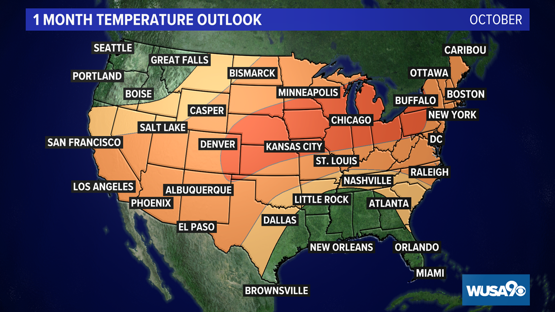
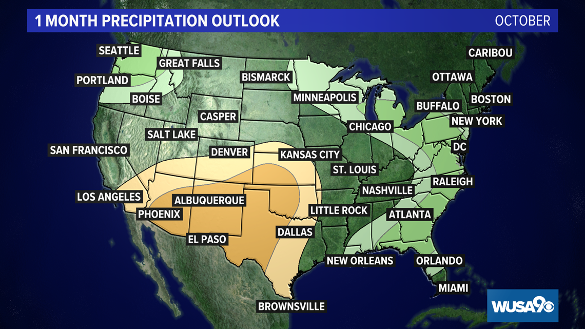
Looking ahead to October, the Climate Prediction Center is forecasting a warm and damp month for the D.C. region. We have a greater than 50% chance of above-average temperatures for the month, with a greater than 40% chance of above-average rain. While we’ll likely see plenty of dry and cool days, October looks mild for the D.C. region. This may have us holding off on the jackets and hot drinks a little longer than usual. Additionally, we may need to pull out the umbrella several times in October.
The average high temperature at the start of October is 74 degrees, with an average nighttime low of 56 degrees. The month leans to the drier side, with an average of 3.4 inches of rain.
What about snow in October? It’s incredibly rare.
Sticking snow has only happened a handful of October days in D.C. The last occasion was in 1979 when 0.3 inches of snow fell on Oct. 10. It came too early.


The outlook for the October to December period is overall warm, according to the Climate Prediction Center. Additionally, we’ll have about normal amounts of precipitation through December. November is usually our fifth coldest month of the year, with December being our third coldest. By Dec. 1, the average high is 52 degrees, with a chilly 37 degrees for the average low on that date.
What’s Driving Our Warm Weather?
The Climate Prediction Center said the fall weather across the U.S. will be influenced by a developing La Nina. According to the National Oceanic and Atmospheric Association (NOAA), the weather in the DMV region tends to be a little warmer than average during La Nina years.

