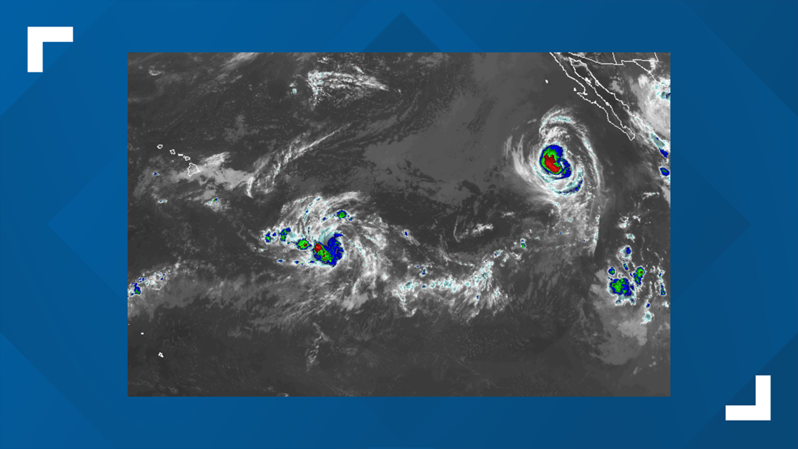
While there is significant attention focused on Hurricane Dorian in the Western Hemisphere, Tropical Depression 12-E in the Pacific is likely to strengthen and cause trouble in the Hawaiian Islands in the coming days.
The depression formed and immediately moved into the Central Pacific basin early Wednesday. As of 5 p.m. HST, the storm is located about 1,050 miles east-southeast of Hilo, Hawaii, and is moving west-southwest at around 7 mph. The depression's maximum sustained winds are currently 30 mph.
Hurricane Juliette will continue to spin well off the coast of Mexico into the end of this week, but it is the mass of clouds, showers and thunderstorms southeast of Hawaii that may be of concern for the islands this weekend to early next week.


"Waters are significantly warm and wind shear is low in this sector of the Pacific Ocean," AccuWeather Hurricane Expert Dan Kottlowski said.
It is possible the depression becomes a viable tropical storm a few hundred miles south of the Big Island later this week and needs to be watched closely, according to Kottlowski.
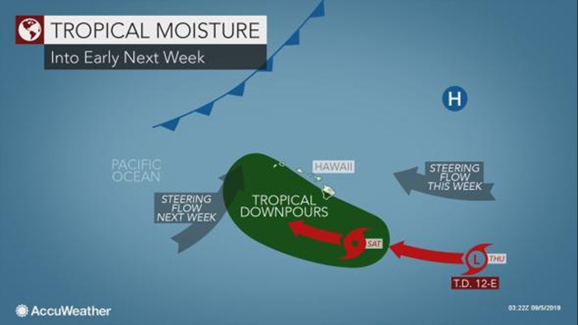
Steering winds are likely to allow this budding feature to track on a slightly north of west path into this weekend.
As the system organizes, an area of showers and thunderstorms may bulge to the north, which is likely to enhance the routine trade wind rainfall this weekend initially.
While most of these systems tend to behave in this manner, there is the potential for this one to do something a bit different, depending on feature over the northern Pacific Ocean.


There is some concern that as a non-tropical storm and trailing cold front approach from the northwest that the tropical feature could be pulled northward early next week.
Should this occur, conditions may worsen over Hawaii, in the form of more significant downpours, gusty thunderstorms and rough seas and surf conditions, especially the central and western islands of Hawaii next week.
How rough conditions get in this case or not would depend on the strength and exact track of the tropical system.
Should the system remain weak and miss the pickup by the approaching storm and cold front, the southward extension of the front may still bring some shower and thunderstorm activity to the western and southern shores of the islands in general.


