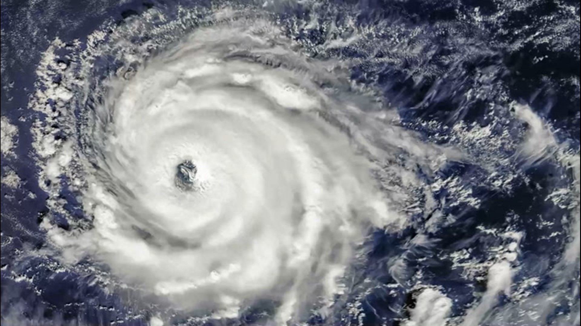
AccuWeather meteorologists warn that another round of tropical activity is likely to return in October, despite the current and brief break in tropical systems across the Atlantic Ocean Basin.
"After what has been a very busy stretch of tropical activity in the Atlantic, things have seemed to quiet down for the time being," said AccuWeather Senior Meteorologist Rob Miller.
There were no tropical cyclones spinning across the Atlantic on Thursday for the first time since Sept. 6, or the first time in 18 days. Additionally, the National Hurricane Center did not identify any areas that they were monitoring on Thursday for the first time since late August.
Miller explained further that a shift in the jet stream, which is normal at end of summer and start of autumn, is partially to thank for the current lull in activity across the basin.
"When the jet stream starts to shift, it changes the weather pattern across the globe. In this case, high pressure over the central Atlantic has become stronger, helping to limit if not outright suppress thunderstorm activity across the tropical Atlantic for now," Miller added.

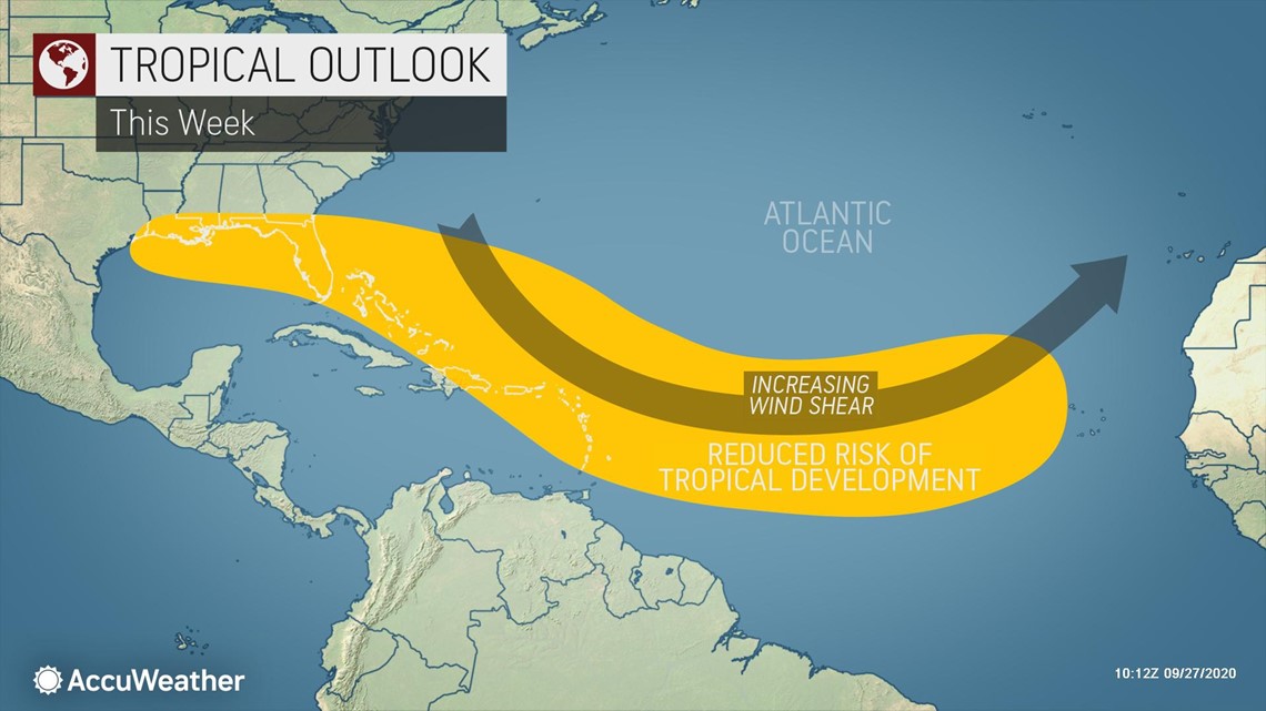
This high pressure is helping to hold an elongated area of stronger wind shear in place across the middle of the Atlantic Ocean through the week. Wind shear is the change in direction and wind speed at increasing heights in the atmosphere. As a result, this is a major factor in suppressing tropical activity through the end of September.
Tropical waves and disturbances, although typically less robust this time of year, will continue to push off the coast of Africa. But, the wind shear in place will squash most chances for those waves to become more organized.
There will still be some small pockets of low wind shear and moisture scattered about the Atlantic basin, which could be just enough to allow pop-up tropical systems to take shape. However, no area in particular looks concerning at this time.
The current pause in tropical activity across the entire Atlantic Basin won't last long, forecasters warn.
"We are not done with tropical season, and there are some indications that the Atlantic Basin could come back to life in the western Caribbean or the Gulf of Mexico the first week or two of October," said Miller.
Warm waters east of the Yucatan Peninsula to Jamaica combined with ample moisture could make this a breeding ground for tropical activity in October.

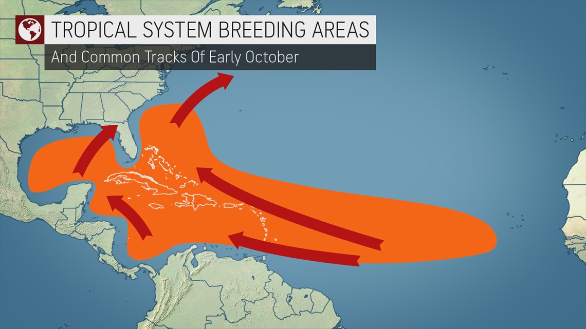
The absence of that strong wind shear across the Caribbean Sea is also part of the reason that tropical development will be possible.
The Caribbean, from the Leeward and Windward Islands to Central America and the Yucatan Peninsula of Mexico, climatologically speaking, is a favorable zone for tropical development in early autumn.
Should a gyre form in this zone, it will increase the chances for development in early October.
A gyre is a slow-spinning wind pattern that rotates counterclockwise. The spin from the gyre tends to create an area of low pressure. Sometimes the low pressure area can become more organized and grow into a tropical system, especially if a tropical disturbance from Africa is injected into it, or a non-tropical weather system happens to stall nearby.
Whether an organized tropical system develops in this zone or not, the tropical waves are likely to deliver rounds of heavy rainfall.
Moisture will come from two sources, one being a stalled front from the Yucatan Peninsula to southern Florida, and the other from incoming tropical waves from the eastern Caribbean.

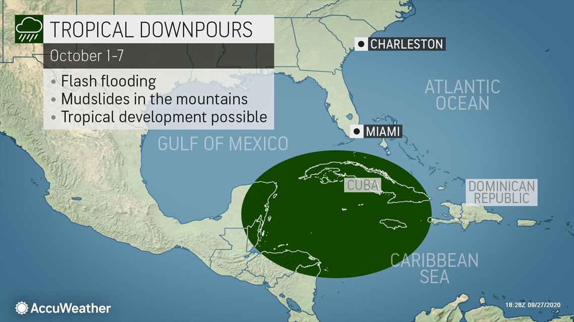
These two factors combing over the western Caribbean Sea are expected to result in rounds of tropical downpours for Jamaica and Cuba all the way to eastern Mexico, Belize and northern Honduras.
With more than one wave of heavy rain expected during the first week of October, enough rain could fall in some areas to prompt flash flooding and even mudslides in the higher elevations into the second week of October.
Interests, especially from Central America, northward to the Eastern Seaboard and Gulf Coast of the U.S. and Atlantic Canada, should not let their guard down. Forecasters urge those who live in hurricane-prone locations to have a plan in place and remain prepared should a system develop, especially during these uncertain times amid the pandemic, which has added challenges to storm preparations.
The 2020 Atlantic hurricane season has already been one for the record books, including the number of storms that have formed so early in the season and the number of landfalls that have occurred in the United States. Forecasters say even more records may be broken during the anticipated ramp up in early October.
Storms have been forming at a record pace this year, with Tropical Storm Cristobal as well as every named storm from Edouard through Beta beating previous early formation records in the Atlantic. Most of the records that have been knocked off the list had been set during the historic 2005 hurricane season, which generated a record-setting 28 named storms in one year. The 2005 season was the only other year in which Greek letters had to be used, with storms Alpha to Zeta being named.

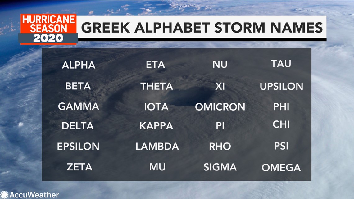
This season is on pace to tie or perhaps break the record number of storms to achieve tropical storm status or greater. Thus far, there have been 23 such storms this year. AccuWeather meteorologists predicted that 2020 will tie the previous seasonal record set with a total of 28 named storms now projected. More storms are likely to be given Greek letters for names in the coming weeks and perhaps even into December, beyond the official end of the Atlantic hurricane season on Nov. 30.
There is another troublesome record that the 2020 season has broken. The U.S. has already experienced nine landfalls from tropical systems so far this year, which ties 1916 for the most in one season.

