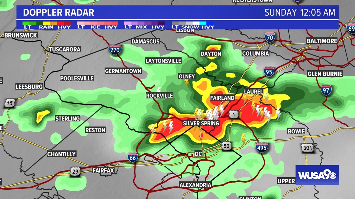
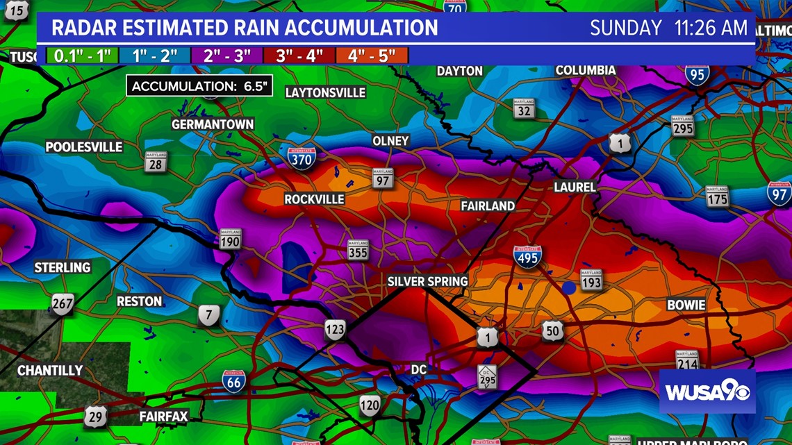
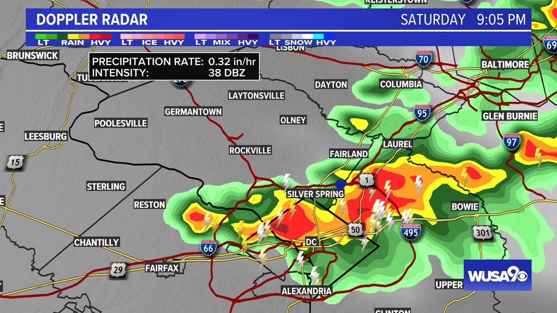
WASHINGTON — The skies opened Saturday night, and it poured across the region. Nearly 6 inches of rain fell across Prince George's County, Montgomery County and D.C. Radar estimates five to seven inches of rain, with some estimates as high as 8 inches. Rainfall rates reached as high as two to three inches per hour.
As the storms unleashed their wrath on the region, numerous flash flood warnings were issued. Emergency crews reported multiple water rescues in Montgomery County.
The storms were caused by a slow-moving cold front that tapped into moist air fueling and heavy rain. Other factors came together to create the heavy rain event, such as Convective Available Potential Energy (CAPE) and thunderstorms fueling other storms.
CAPE is the amount of energy the atmosphere has available to create storms.
You can think of it as money in a storm bank; the more you have, the stronger the storm. Usually, 1,000 (j/kg ) of CAPE is enough for a strong to severe storm.
Meteorologists at the National Weather Service working during the storms says the DMV had more than 2000 (j/kg) of CAPE. (j/kg) is short for joules per kilogram and is measure of heat capacity).
Outflows from thunderstorms also helped to jumpstart new storms that kept dumping rain over the same areas. This is known as thunderstorm training. The cooler air that flows out of the storm destabilizes the atmosphere allowing new storms to form.
Here's a look at rainfall totals throughout the region:

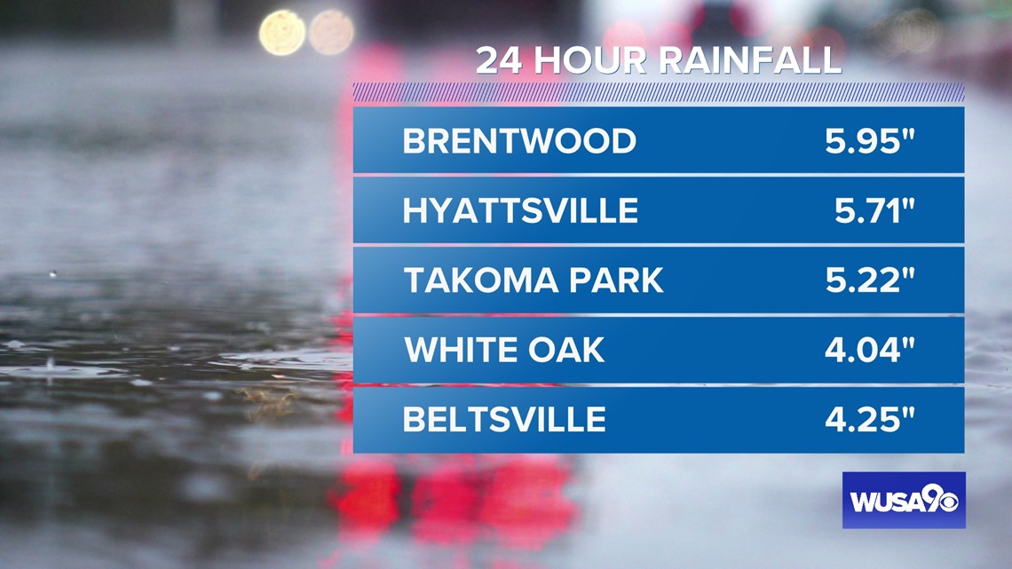

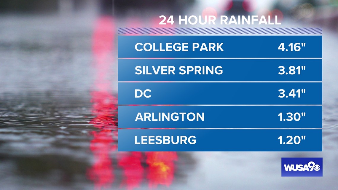
Sunday, July 3, 2022, 11:26 a.m.

Saturday, July 2, 2022, 9:05 p.m.

Sunday, July 3, 2022, 12:05 a.m.

