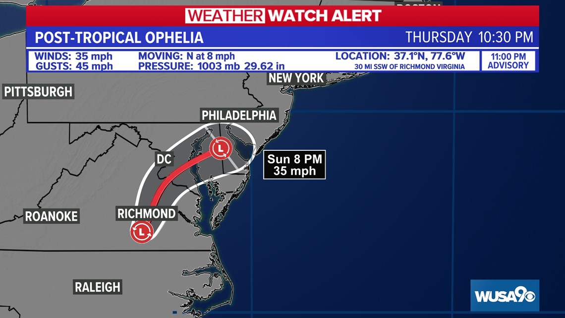
WASHINGTON — The Weather Watch team is monitoring a coastal storm that is bringing significant rain and wind to the DMV this weekend. The National Hurricane Center has named it Ophelia.
As of 11 p.m. Saturday, the maximum sustained winds remain at 35 mph. The storm made landfall as a tropical storm at 6:20 a.m. Saturday.
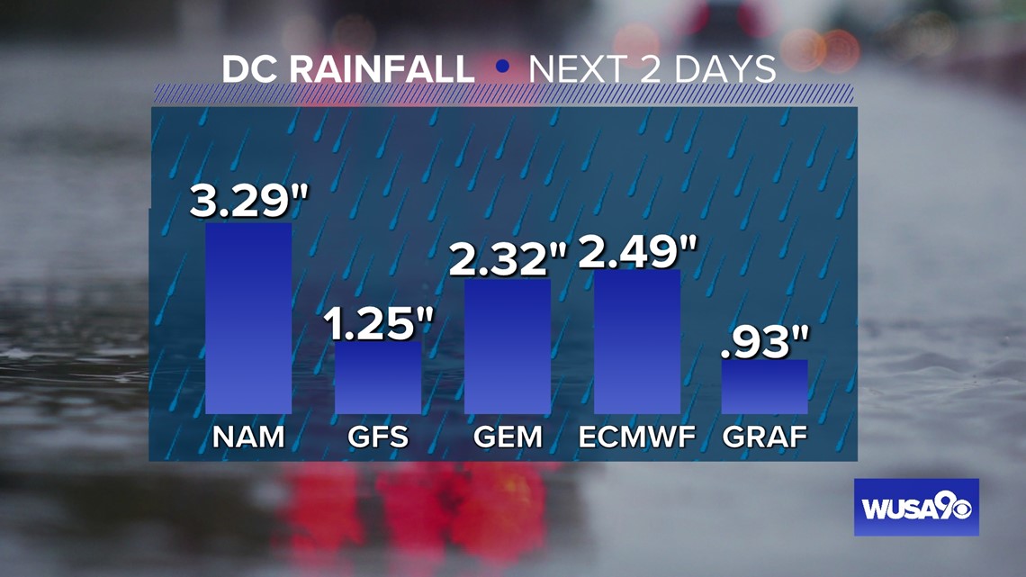
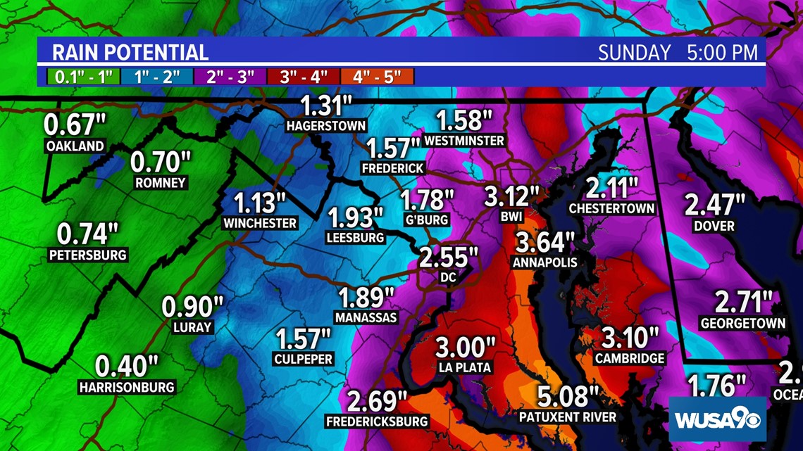
Most of the rain will fall between now and 12 p.m. Sunday.
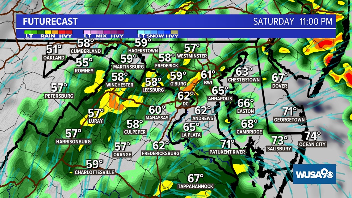
Widespread rain is falling across the area. Look for light rain at times with some pockets of heavy rain mixing. The bigger impacts will be along the Eastern Shore and southern Maryland such as Calvert and St. Mary's counties.
Where we see really locally heavy, tropical downpours set up, we could see minor flooding from rain.



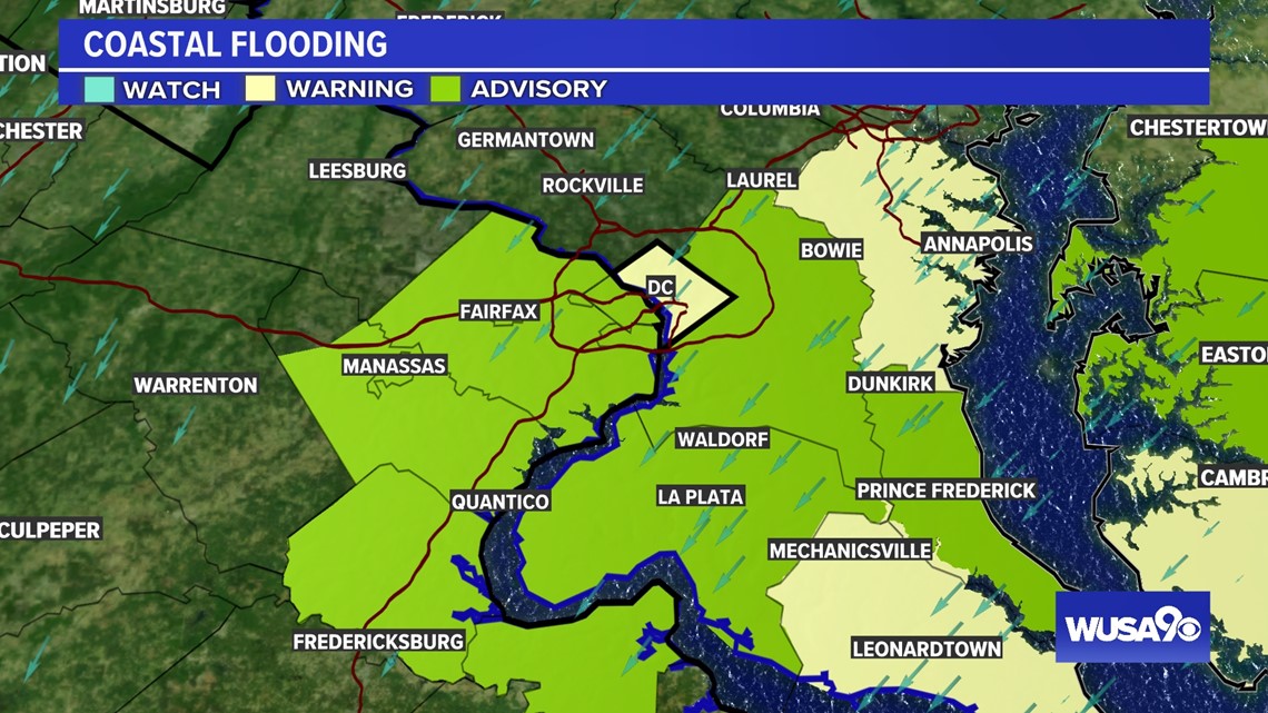
There is also a coastal flood threat. The worst coastal flooding is expected in far southern Maryland. SW DC may experience some minor coastal flooding during high tide Saturday night into Sunday morning.
Numerous Coastal Flood Warnings and Advisories are in effect.

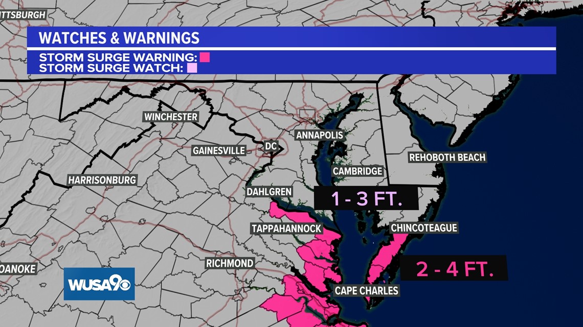
There is also a Storm Surge Watch for parts of the Northern Neck of Virginia where there could be 1 - 3 ft. of storm surge in the upper Chesapeake Bay.


Rain Timeline:
11:00 PM Saturday
Showers and rain will still linger, with pockets of moderate rain.


7:00 AM Sunday
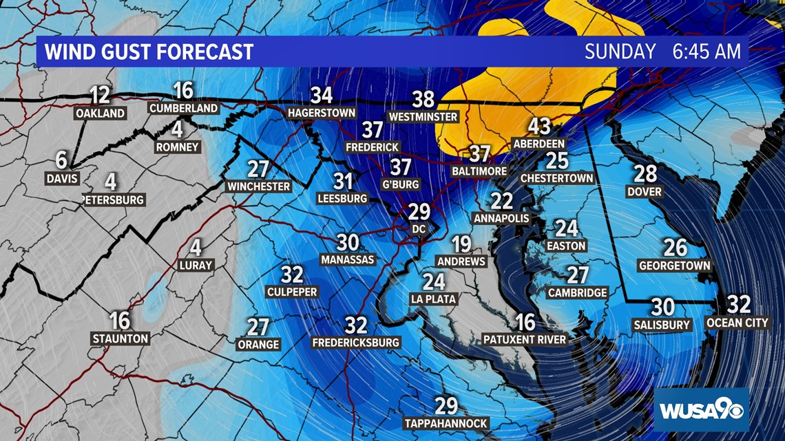
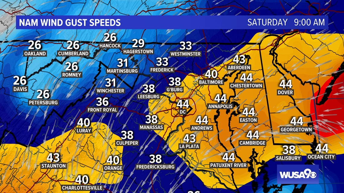
Breezy conditions will continue into Sunday, but the winds won't be nearly as strong as on Saturday.

