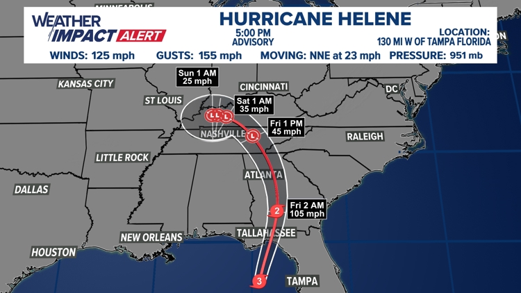
VIRGINIA, USA — Rain chances in the D.C. metro area will continue through this weekend as the remnants of Hurricane Helene are expected to move north toward the Tennessee Valley on Friday and Saturday.
Although Gov. Glenn Youngkin issued a state of emergency for Virginia on Wednesday, WUSA9 meteorologists say flooding from the remnants of Helene will likely impact only the southwestern parts of the state.
"Even though the largest impacts of Helene are predicted to the south and west of us, we can not ignore the fact that we have significant flooding events arise from precursory rain events and outer bands from tropical systems," Gov. Youngkin said Wednesday. "As high winds and heavy rains are predicted for parts of Virginia, we urge everyone to stay informed."
The Virginia Department of Emergency Management also warned of flooding on Friday.
"While the center of the storm is expected to track west of Virginia, impacts will be felt well outside of the forecast cone," VDOT said Thursday. "Heavy rainfall / flooding is expected through Friday especially in Southwest Virginia."
Southwestern Virginia may see about 2 to 3 inches of rain Friday and Saturday, with possible flood warnings. Northern Virginia may see an inch of rain on Friday.
WUSA9 meteorologist forecast less than an inch of rain for parts of the DMV, Thursday night. Although the rainfall is likely unrelated to Helene.
Nuisance tidal flooding in Northern Virginia and coastal Maryland could be impacted by Helene's remnants. Look out for advisories and warnings for places like Alexandria, Annapolis and Haines point through the weekend.
Thursday marked the seventh consecutive day of high tides and nuisance flooding in the DMV.
Hurricane Helene reached Category 3 levels as it barreled toward the Florida gulf coast on Thursday afternoon.
The D.C. power company Pepco has sent many of its workers further south to Georgia to help with potential storm impacts there. FEMA also activated the Maryland and Virginia Task Forces to help people in Hurricane Helene's path.


