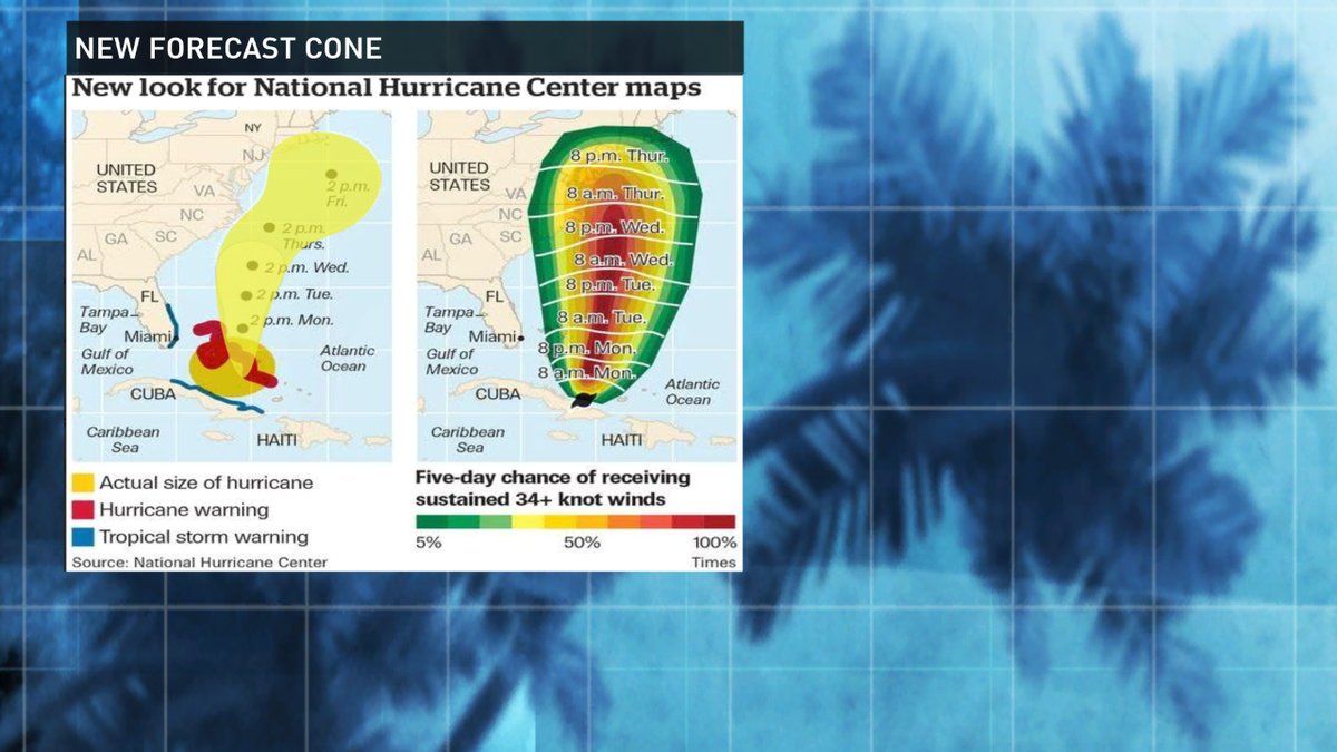
The National Hurricane Center is releasing a new product that will help you better understand the threat of a particular storm to where you live.
We've all followed closely the "cone of uncertainty" when hurricanes have threatened the Mid-Atlantic coast. The "center line" is what many of us have watched over the years when storms like Hurricane Matthew have threatened.
The new "cone" graphic will also take in to account the size of a hurricane. Past "cones" have only focused on the center or "eye" of a storm, not the potential impact area.
"This graphic is meant to show that even if you are not in the actual cone of uncertainty for a storm, you may be impacted by tropical storm or hurricane force winds," said Tim Deegan, a meteorologist in South Carolina.
FCNStorm Example of new cone to be used this hurricane season pic.twitter.com/LLv1nLgmRQ
— Tim Deegan (@fcntim) March 20, 2017
Deegan said Hurricane Matthew is a perfect example of why this new graphic will help you understand hurricane forecasts better. Tim says areas like the Space Coast in Florida, where the Kennedy Space Center is, were not in the "cone" as the storm approached because there was not a threat of the hurricane making landfall, yet the area was impacted by strong tropical storm and hurricane conditions.
"The new graphic will help you better understand how a storm is likely to impact you." Deegan said.


